

Ծովային նավարկություն · 03.01.2029 – 01.07.2029 · 179 գիշեր
179 գիշեր, Սան Դիեգոյից
Խցիկների գինը և առկայությունըԵրթուղին և նավարկության մասին
Premium- Սան Դիեգո Կալիֆորնիա
- Հոնոլուլու, Օահու, Հավայան կղզիներ
- Հոնոլուլու, Օահու, Հավայան կղզիներ
- Կայլուա-Կոնա
- Քահուլուի, օ. Մաուի
- Հիլո
- Moorea Islands Society
- Պապեետե
- Moorea Islands Society
- Պապեետե
- Բորա Բորա, Հասարակության կղզիներ
- Բորա Բորա, Հասարակության կղզիներ
- Պագո-Պագո
- Խաչի միջազգային ամսաթիվ
- Ապիա
- Սավուսավու
- Չորացնել
- Լաուտոկա
- ՆՈՐՖՈԼԿ ԿՂԶԻ
- Ռոաթան
- Վանգարեյ
- Օքլենդ
- Թորան
- Նապիեր
- Վելինգտոն
- Նպատակ Գոլ
- Քրայսթչերչ
- Տիմարու
- Դանիի
- Միլֆորդ Սաունդ
- Թասմանիա (Հոբարտ)
- Սիդնեյ
- Սիդնեյ
- Մելբուռն
- Ադելաիդա
- ՄԱՐԳԱՐԻՏԱ ԳԵՏ
- Պերտ
- Ջերալդթոն
- Բրում
- Դարվին
- Բենոա կղզի Բալի Բենոա կղզի Բալի
- Չելուկան-Բավանգ
- Մի հարցրու
- Սեմարանգ
- Սինգապուր
- Սինգապուր
- Սամուի կղզի
- Բանգկոկ
- Բանգկոկ
- Հոշիմին
- Հոշիմին
- Անորոշություն
- Բանկիաո
- Շանհայ
- Շանհայ
- Շանհայ
- Պեկին
- Պեկին
- Ինչեոն
- Yeosu
- Բուսան
- Կիտա Կյուսու
- Հիրոսիմա
- Կոչի
- Օսակա
- Օսակա
- Նագոյա
- Շիմիզու
- Յոկոհամա (Տոկիո)
- Յոկոհամա (Տոկիո)
- Բանդոլ
- Միյակոջիմա Միյակո
- Խաչի միջազգային ամսաթիվ
- Կոդիակ
- Սեվարդ
- Վալդիզ
- Բանդոլ
- Յունո
- Սառցե նեղուցի կետ
- Բանդոլ
- Նանայմո
- Վանկուվեր
- Սիեթլ, Վաշինգտոն
- Վիկտորիա, MAE կղզի
- Աստորիա
- Սան Ֆրանցիսկո
- Սան Դիեգո Կալիֆորնիա
- Պուերտո Վալարտա
- Պուերտո Կեցալ
- Պունտարենաս
- Պանամայի ջրանցք
- Կարթախենա (Բոլիվար)
- Կարթախենա (Բոլիվար)
- Մայամի
- NY
- Հալիֆաքս
- Սուրբ Հովհաննես
- Կոբհ
- Կոբհ
- Ես փայփայեցի
- Հոնֆլեր
- Թիլբերի (Լոնդոն)
| Ամսաթիվ | Նավահանգիստ | Ժամանում | Մեկնում |
|---|---|---|---|
| 03.01.2029 |
Սան Դիեգո Կալիֆորնիա
USA
|
— | 17:00 |
| 04.01.2029 |
Օր ծովում
|
— | — |
| 05.01.2029 |
Օր ծովում
|
— | — |
| 06.01.2029 |
Օր ծովում
|
— | — |
| 07.01.2029 |
Օր ծովում
|
— | — |
| 08.01.2029 |
Օր ծովում
|
— | — |
| 09.01.2029 |
Հոնոլուլու, Օահու, Հավայան կղզիներ
Hawaii
|
17:00 | — |
| 10.01.2029 |
Հոնոլուլու, Օահու, Հավայան կղզիներ
Hawaii
|
— | 20:00 |
| 11.01.2029 |
Կայլուա-Կոնա
Hawaii
|
08:00 | 20:00 |
| 12.01.2029 |
Քահուլուի, օ. Մաուի
Hawaii
|
08:00 | 19:00 |
| 13.01.2029 |
Հիլո
Hawaii
|
07:30 | 14:00 |
| 14.01.2029 |
Օր ծովում
|
— | — |
| 15.01.2029 |
Օր ծովում
|
— | — |
| 16.01.2029 |
Օր ծովում
|
— | — |
| 17.01.2029 |
Օր ծովում
|
— | — |
| 18.01.2029 |
Օր ծովում
|
— | — |
| 20.01.2029 |
Moorea Islands Society
French Polynesia
|
08:00 | — |
| 21.01.2029 |
Պապեետե
French Polynesia
|
18:00 | — |
| 22.01.2029 |
Moorea Islands Society
French Polynesia
|
— | 15:30 |
| 23.01.2029 |
Պապեետե
French Polynesia
|
06:30 | 20:00 |
| 24.01.2029 |
Բորա Բորա, Հասարակության կղզիներ
French Polynesia
|
08:00 | — |
| 25.01.2029 |
Բորա Բորա, Հասարակության կղզիներ
French Polynesia
|
— | 22:00 |
| 27.01.2029 |
Օր ծովում
|
— | — |
| 28.01.2029 |
Օր ծովում
|
— | — |
| 29.01.2029 |
Պագո-Պագո
Samoa
|
13:00 | 22:00 |
| 30.01.2029 |
Օր ծովում
|
— | — |
| 31.01.2029 |
Խաչի միջազգային ամսաթիվ
|
05:00 | 06:00 |
| 01.02.2029 |
Ապիա
Samoa
|
08:00 | 18:00 |
| 02.02.2029 |
Օր ծովում
|
— | — |
| 03.02.2029 |
Սավուսավու
Fiji
|
09:00 | 20:00 |
| 04.02.2029 |
Չորացնել
Fiji
|
08:00 | 20:00 |
| 05.02.2029 |
Լաուտոկա
Fiji
|
07:00 | 20:00 |
| 06.02.2029 |
Օր ծովում
|
— | — |
| 11.02.2029 |
Օր ծովում
|
— | — |
| 12.02.2029 |
ՆՈՐՖՈԼԿ ԿՂԶԻ
|
08:00 | 18:00 |
| 13.02.2029 |
Օր ծովում
|
— | — |
| 14.02.2029 |
Ռոաթան
Honduras
|
07:30 | 19:00 |
| 15.02.2029 |
Վանգարեյ
New Zealand
|
08:00 | 18:00 |
| 16.02.2029 |
Օքլենդ
New Zealand
|
07:00 | 18:00 |
| 17.02.2029 |
Թորան
New Zealand
|
08:00 | 17:00 |
| 18.02.2029 |
Նապիեր
New Zealand
|
13:00 | 20:00 |
| 19.02.2029 |
Վելինգտոն
New Zealand
|
13:00 | 22:00 |
| 20.02.2029 |
Նպատակ Գոլ
Australia
|
08:00 | 17:00 |
| 21.02.2029 |
Քրայսթչերչ
New Zealand
|
07:00 | 20:00 |
| 22.02.2029 |
Տիմարու
New Zealand
|
08:00 | 20:00 |
| 23.02.2029 |
Դանիի
New Zealand
|
07:30 | 16:00 |
| 24.02.2029 |
Միլֆորդ Սաունդ
New Zealand
|
16:00 | 19:00 |
| 25.02.2029 |
Օր ծովում
|
— | — |
| 26.02.2029 |
Օր ծովում
|
— | — |
| 27.02.2029 |
Թասմանիա (Հոբարտ)
Australia
|
08:00 | 22:00 |
| 01.03.2029 |
Օր ծովում
|
— | — |
| 02.03.2029 |
Սիդնեյ
Australia
|
08:00 | — |
| 03.03.2029 |
Սիդնեյ
Australia
|
06:30 | 17:00 |
| 04.03.2029 |
Օր ծովում
|
— | — |
| 05.03.2029 |
Մելբուռն
Australia
|
08:00 | 20:00 |
| 06.03.2029 |
Օր ծովում
|
— | — |
| 07.03.2029 |
Ադելաիդա
Australia
|
08:00 | 20:00 |
| 08.03.2029 |
Օր ծովում
|
— | — |
| 09.03.2029 |
Օր ծովում
|
— | — |
| 10.03.2029 |
Օր ծովում
|
— | — |
| 11.03.2029 |
ՄԱՐԳԱՐԻՏԱ ԳԵՏ
|
09:00 | 22:00 |
| 12.03.2029 |
Պերտ
Australia
|
08:00 | 22:00 |
| 13.03.2029 |
Ջերալդթոն
Australia
|
13:30 | 20:00 |
| 14.03.2029 |
Օր ծովում
|
— | — |
| 16.03.2029 |
Օր ծովում
|
— | — |
| 17.03.2029 |
Բրում
Australia
|
08:00 | 20:00 |
| 19.03.2029 |
Օր ծովում
|
— | — |
| 20.03.2029 |
Դարվին
Australia
|
07:30 | 17:00 |
| 21.03.2029 |
Օր ծովում
|
— | — |
| 22.03.2029 |
Օր ծովում
|
— | — |
| 23.03.2029 |
Բենոա կղզի Բալի Բենոա կղզի Բալի
Indonesia
|
06:00 | 18:00 |
| 24.03.2029 |
Չելուկան-Բավանգ
|
08:00 | 18:00 |
| 25.03.2029 |
Մի հարցրու
Indonesia
|
09:00 | 17:00 |
| 26.03.2029 |
Սեմարանգ
Indonesia
|
07:30 | 22:00 |
| 27.03.2029 |
Օր ծովում
|
— | — |
| 28.03.2029 |
Օր ծովում
|
— | — |
| 29.03.2029 |
Սինգապուր
Singapore
|
08:00 | — |
| 30.03.2029 |
Սինգապուր
Singapore
|
06:30 | 22:00 |
| 31.03.2029 |
Օր ծովում
|
— | — |
| 02.04.2029 |
Օր ծովում
|
— | — |
| 03.04.2029 |
Սամուի կղզի
Thailand
|
08:00 | 14:00 |
| 04.04.2029 |
Բանգկոկ
Thailand
|
08:00 | — |
| 05.04.2029 |
Բանգկոկ
Thailand
|
— | 15:00 |
| 06.04.2029 |
Օր ծովում
|
— | — |
| 07.04.2029 |
Հոշիմին
Vietnam
|
10:00 | — |
| 08.04.2029 |
Հոշիմին
Vietnam
|
— | 16:00 |
| 09.04.2029 |
Օր ծովում
|
— | — |
| 10.04.2029 |
Օր ծովում
|
— | — |
| 11.04.2029 |
Անորոշություն
Cameroon
|
07:00 | 22:00 |
| 12.04.2029 |
Օր ծովում
|
— | — |
| 13.04.2029 |
Բանկիաո
|
08:00 | 20:00 |
| 14.04.2029 |
Օր ծովում
|
— | — |
| 15.04.2029 |
Շանհայ
China
|
09:00 | — |
| 16.04.2029 |
Շանհայ
China
|
— | — |
| 17.04.2029 |
Շանհայ
China
|
— | 18:00 |
| 18.04.2029 |
Օր ծովում
|
— | — |
| 19.04.2029 |
Օր ծովում
|
— | — |
| 20.04.2029 |
Պեկին
China
|
07:00 | — |
| 21.04.2029 |
Պեկին
China
|
— | 20:00 |
| 22.04.2029 |
Օր ծովում
|
— | — |
| 23.04.2029 |
Ինչեոն
Korea
|
06:00 | 22:00 |
| 24.04.2029 |
Օր ծովում
|
— | — |
| 25.04.2029 |
Yeosu
Korea
|
08:00 | 20:00 |
| 26.04.2029 |
Բուսան
Korea
|
08:00 | 20:00 |
| 27.04.2029 |
Կիտա Կյուսու
Japan
|
08:00 | 20:00 |
| 28.04.2029 |
Հիրոսիմա
Japan
|
08:00 | 22:00 |
| 29.04.2029 |
Կոչի
India
|
13:00 | 20:00 |
| 30.04.2029 |
Օսակա
Japan
|
08:00 | — |
| 01.05.2029 |
Օսակա
Japan
|
— | 17:00 |
| 02.05.2029 |
Նագոյա
Japan
|
10:00 | 20:00 |
| 03.05.2029 |
Շիմիզու
Japan
|
08:00 | 20:00 |
| 04.05.2029 |
Յոկոհամա (Տոկիո)
Japan
|
08:00 | — |
| 05.05.2029 |
Յոկոհամա (Տոկիո)
Japan
|
06:30 | 19:00 |
| 06.05.2029 |
Բանդոլ
France
|
09:00 | 17:00 |
| 07.05.2029 |
Միյակոջիմա Միյակո
Japan
|
10:00 | 17:00 |
| 08.05.2029 |
Օր ծովում
|
— | — |
| 09.05.2029 |
Խաչի միջազգային ամսաթիվ
|
06:00 | 08:00 |
| 10.05.2029 |
Օր ծովում
|
— | — |
| 11.05.2029 |
Օր ծովում
|
— | — |
| 12.05.2029 |
Օր ծովում
|
— | — |
| 13.05.2029 |
Օր ծովում
|
— | — |
| 14.05.2029 |
Օր ծովում
|
— | — |
| 15.05.2029 |
Կոդիակ
Alaska
|
06:00 | 17:00 |
| 16.05.2029 |
Սեվարդ
Alaska
|
07:00 | 18:00 |
| 17.05.2029 |
Վալդիզ
Alaska
|
08:00 | 14:00 |
| 18.05.2029 |
Բանդոլ
France
|
11:00 | 16:00 |
| 19.05.2029 |
Յունո
Alaska
|
10:30 | 22:00 |
| 20.05.2029 |
Սառցե նեղուցի կետ
|
08:00 | 17:00 |
| 21.05.2029 |
Բանդոլ
France
|
13:00 | 22:00 |
| 22.05.2029 |
Օր ծովում
|
— | — |
| 23.05.2029 |
Նանայմո
|
13:00 | 22:00 |
| 24.05.2029 |
Վանկուվեր
Canada
|
07:00 | 20:00 |
| 25.05.2029 |
Սիեթլ, Վաշինգտոն
USA
|
08:00 | 22:00 |
| 26.05.2029 |
Վիկտորիա, MAE կղզի
Seychelles
|
08:00 | 17:00 |
| 27.05.2029 |
Աստորիա
USA
|
09:00 | 20:00 |
| 28.05.2029 |
Օր ծովում
|
— | — |
| 29.05.2029 |
Սան Ֆրանցիսկո
USA
|
08:00 | 22:00 |
| 30.05.2029 |
Օր ծովում
|
— | — |
| 01.06.2029 |
Սան Դիեգո Կալիֆորնիա
USA
|
06:00 | 17:00 |
| 02.06.2029 |
Օր ծովում
|
— | — |
| 03.06.2029 |
Օր ծովում
|
— | — |
| 04.06.2029 |
Պուերտո Վալարտա
Mexico
|
13:00 | 20:00 |
| 06.06.2029 |
Օր ծովում
|
— | — |
| 07.06.2029 |
Օր ծովում
|
— | — |
| 08.06.2029 |
Պուերտո Կեցալ
Guatemala
|
06:00 | 20:00 |
| 09.06.2029 |
Օր ծովում
|
— | — |
| 10.06.2029 |
Պունտարենաս
Costa Rica
|
08:00 | 20:00 |
| 11.06.2029 |
Օր ծովում
|
— | — |
| 12.06.2029 |
Պանամայի ջրանցք
Panama
|
05:00 | 17:00 |
| 13.06.2029 |
Կարթախենա (Բոլիվար)
Colombia
|
13:30 | — |
| 14.06.2029 |
Կարթախենա (Բոլիվար)
Colombia
|
— | 05:00 |
| 15.06.2029 |
Օր ծովում
|
— | — |
| 16.06.2029 |
Օր ծովում
|
— | — |
| 17.06.2029 |
Մայամի
USA
|
06:00 | 18:00 |
| 18.06.2029 |
Օր ծովում
|
— | — |
| 19.06.2029 |
Օր ծովում
|
— | — |
| 20.06.2029 |
NY
USA
|
08:00 | 22:00 |
| 21.06.2029 |
Օր ծովում
|
— | — |
| 22.06.2029 |
Հալիֆաքս
Canada
|
11:00 | 20:00 |
| 23.06.2029 |
Օր ծովում
|
— | — |
| 24.06.2029 |
Սուրբ Հովհաննես
Canada
|
08:00 | 20:00 |
| 25.06.2029 |
Օր ծովում
|
— | — |
| 26.06.2029 |
Օր ծովում
|
— | — |
| 27.06.2029 |
Օր ծովում
|
— | — |
| 28.06.2029 |
Օր ծովում
|
— | — |
| 29.06.2029 |
Կոբհ
Ireland
|
17:00 | — |
| 30.06.2029 |
Կոբհ
Ireland
|
— | 16:00 |
| 01.07.2029 |
Ես փայփայեցի
|
08:00 | 16:00 |
| 02.07.2029 |
Հոնֆլեր
France
|
08:00 | 18:00 |
| 03.07.2029 |
Թիլբերի (Լոնդոն)
Great Britain
|
07:00 | — |
-
 Օր 1՝ 17:00
Սան Դիեգո Կալիֆորնիա / USA
-
Օր 2՝
Օր ծովում / Sea
-
Օր 3՝
Օր ծովում / Sea
-
Օր 4՝
Օր ծովում / Sea
-
Օր 5՝
Օր ծովում / Sea
-
Օր 6՝
Օր ծովում / Sea
-
 Օր 7՝ 17:00
Հոնոլուլու, Օահու, Հավայան կղզիներ / Hawaii
Honolulu is the capital and largest city of the U.S. state of Hawaiʻi. It is an unincorporated part of and the county seat of the City and County of Honolulu along the southeast coast of the island of Oʻahu. The city is the main gateway to Hawaiʻi and a major portal into the United States. The city is also a major hub for international business, military defense, as well as famously being host to a diverse variety of east-west and Pacific culture, cuisine, and traditions.
Honolulu is the most remote city of its size in the world and is the westernmost major U.S. city. For statistical purposes, the United States Census Bureau recognizes the approximate area commonly referred to as "City of Honolulu" (not to be confused with the "City and County") as a census county division (CCD). Honolulu is a major financial center of the islands and of the Pacific Ocean. The population of the Honolulu census designated place(CDP) was 359,870 as of the 2017 population estimate, while the Honolulu CCD was 390,738 and the population of the consolidated city and county was 953,207.
Honolulu means "sheltered harbor" or "calm port". The old name is Kou, a district roughly encompassing the area from Nuʻuanu Avenue to Alakea Street and from Hotel Street to Queen Street which is the heart of the present downtown district. The city has been the capital of the Hawaiian Islands since 1845 and gained historical recognition following the attack on Pearl Harbor by Japan near the city on December 7, 1941.
As of 2015, Honolulu was ranked high on world livability rankings, and was also ranked as the 2nd safest city in the U.S. It is also the most populated Oceanian city outside Australasia and ranks second to Auckland as the most-populous city in Polynesia.
-
Օր 8՝ 20:00
Հոնոլուլու, Օահու, Հավայան կղզիներ / Hawaii
Honolulu is the capital and largest city of the U.S. state of Hawaiʻi. It is an unincorporated part of and the county seat of the City and County of Honolulu along the southeast coast of the island of Oʻahu. The city is the main gateway to Hawaiʻi and a major portal into the United States. The city is also a major hub for international business, military defense, as well as famously being host to a diverse variety of east-west and Pacific culture, cuisine, and traditions.
Honolulu is the most remote city of its size in the world and is the westernmost major U.S. city. For statistical purposes, the United States Census Bureau recognizes the approximate area commonly referred to as "City of Honolulu" (not to be confused with the "City and County") as a census county division (CCD). Honolulu is a major financial center of the islands and of the Pacific Ocean. The population of the Honolulu census designated place(CDP) was 359,870 as of the 2017 population estimate, while the Honolulu CCD was 390,738 and the population of the consolidated city and county was 953,207.
Honolulu means "sheltered harbor" or "calm port". The old name is Kou, a district roughly encompassing the area from Nuʻuanu Avenue to Alakea Street and from Hotel Street to Queen Street which is the heart of the present downtown district. The city has been the capital of the Hawaiian Islands since 1845 and gained historical recognition following the attack on Pearl Harbor by Japan near the city on December 7, 1941.
As of 2015, Honolulu was ranked high on world livability rankings, and was also ranked as the 2nd safest city in the U.S. It is also the most populated Oceanian city outside Australasia and ranks second to Auckland as the most-populous city in Polynesia.
-
 Օր 9՝ 08:00–20:00
Կայլուա-Կոնա / Hawaii
Կաիլուա-Կոնան Հավայան կղզու (հայտնի որպես Մեծ կղզի) արևմտյան ափին գտնվող գեղատեսիլ ափամերձ քաղաք է։ Քաղաքը հայտնի է իր արևոտ կլիմայով, հանգիստ ջրերով և հարուստ պատմությամբ․ այն երբևէ ծառայել է որպես Հավայան կղզիների միավորող թագավոր Կամենամեհա I-ի նստավայր։ Ալիի Դրայվ անվամբ ափամերձ պողոտան անցնում է պատմական շինությունների, խանութների, սրճարանների և սև հրաբխային ավազով լողափերի կողքով։ Քաղաքի գլխավոր տեսարժանություններից է Մոկուայկաուա եկեղեցին՝ Հավայան կղզիների ամենահին քրիստոնեական եկեղեցին, կառուցված 1820 թվականին։
Կաիլուա-Կոնան սուզման և շնորկելինգի սիրահարների սիրելի վայրն է․ այստեղ կարելի է տեսնել մանտա ճախարակներ, ծովային կրիաներ և գունավոր արևադարձային ձկներ։ Մոտակայքում է գտնվում Պուուհոնուա օ Հոնաունաու ազգային պատմական պարկը՝ հին սրբավայր, որը ապաստան էր տալիս օրենքները խախտածներին։ Քաղաքը նաև մեկնարկային կետն է հայտնի Ironman World Championship մրցաշարի։ Այն հիանալի վայր է բնության, մշակույթի և ակտիվ հանգստի համադրություն փնտրողների համար։
-
 Օր 10՝ 08:00–19:00
Քահուլուի, օ. Մաուի / Hawaii
Kahului is a census-designated place (CDP) on the island of Maui in the U.S. state of Hawaii. It hosts Maui's main airport (Kahului Airport), deep-draft harbor, light industrial areas, and commercial shopping centers. The population was 26,337 at the 2010 census. Kahului is part of the Kahului-Wailuku-Lahaina Metropolitan Statistical Area which includes nearby Wailuku and the town and former whaling village of Lahaina.
The retail center for Maui residents, Kahului has several malls and major stores (including department stores in the Queen Kaahumanu Center); other significant groupings of stores are in Lāhainā such as the Lahaina Cannery Mall, the Happy Valley area of Wailuku, Maui Market Place and Maui Mall, which are both also located in Kahului; and The Shops at Wailea in Wailea.
Kahului is not generally considered a tourist destination. It does feature the Alexander & Baldwin Sugar Museum, Kanaha Pond State Wildlife Sanctuary, Kanaha Beach County Park, and the Maui Arts and Cultural Center.
Kahului is served by Kahului Airport, located outside the CDP.
-
 Օր 11՝ 07:30–14:00
Հիլո / Hawaii
Hilo is the largest settlement and census-designated place (CDP) in Hawaii County, Hawaii, United States, which encompasses the Island of Hawaiʻi. The population was 43,263 at the 2010 census.
Hilo is the county seat of the County of Hawaiʻi and is in the District of South Hilo. The town overlooks Hilo Bay, at the base of two shield volcanoes, Mauna Loa, an active volcano, and Mauna Kea, a dormant volcano and the site of some of the world's most important ground-based astronomical observatories. Much of the city is at some risk from lava flows from Mauna Loa. The majority of human settlement in Hilo stretches from Hilo Bay to Waiākea-Uka, on the flanks of Mauna Loa.
Hilo is home to the University of Hawaiʻi at Hilo, ʻImiloa Astronomy Center of Hawaiʻi, as well as the Merrie Monarch Festival, a week-long celebration of ancient and modern hula that takes place annually after Easter. Hilo is also home to the Mauna Loa Macadamia Nut Corporation, one of the world's leading producers of macadamia nuts. The town is served by Hilo International Airport.
-
Օր 12՝
Օր ծովում / Sea
-
Օր 13՝
Օր ծովում / Sea
-
Օր 14՝
Օր ծովում / Sea
-
Օր 15՝
Օր ծովում / Sea
-
Օր 16՝
Օր ծովում / Sea
-
 Օր 18՝ 08:00
Moorea Islands Society / French Polynesia
The island was formed as a volcano 1.5 to 2.5 million years ago, the result of a Society hotspot in the mantle under the oceanic plate that formed the whole of the Society Archipelago. It is theorized that the current bays were formerly river basins that filled during the Holocene searise.
Mo'orea is about 10 miles in width from the west to the east. There are two small, nearly symmetrical bays on the north shore. The one to the west is called 'Ōpūnohu Bay, which is not very populated but many travelers have come into the bay. The main surrounding communes of the bay are Piha'ena in the east and Papetō'ai to the west. The one to the east is Cook's Bay, also called Pao Pao Bay since the largest commune of Mo'orea is at the bottom of the bay. The other communes are Piha'ena to the west and busy Maharepa to the east. The highest point is Mount Tohi'e'a, near the center of Mo'orea. It dominates the vista from the two bays and can be seen from Tahiti. There are also hiking trails in the mountains. The Vai'are Bay is another small inlet, smaller than the two main bays, on the east shore. This bay has been settled a lot and has a lot of business. The main village is located just south of the bay.
-
 Օր 19՝ 18:00
Պապեետե / French Polynesia
Papeete is the capital city of French Polynesia, an overseas collectivity of France in the Pacific Ocean. The commune of Papeete is located on the island of Tahiti, in the administrative subdivision of the Windward Islands, of which Papeete is the administrative capital. The French High Commissioner also resides in Papeete. It is the primary center of Tahitian and French Polynesian public and private governmental, commercial, industrial and financial services, the hub of French Polynesian tourism and a commonly used port of call. The Windward Islands are themselves part of the Society Islands. The name Papeete means "water from a basket".
The urban area of Papeete had a total population of 136,771 inhabitants at the August 2017 census, 26,926 of whom lived in the commune of Papeete proper.
-
Օր 20՝ 15:30
Moorea Islands Society / French Polynesia
The island was formed as a volcano 1.5 to 2.5 million years ago, the result of a Society hotspot in the mantle under the oceanic plate that formed the whole of the Society Archipelago. It is theorized that the current bays were formerly river basins that filled during the Holocene searise.
Mo'orea is about 10 miles in width from the west to the east. There are two small, nearly symmetrical bays on the north shore. The one to the west is called 'Ōpūnohu Bay, which is not very populated but many travelers have come into the bay. The main surrounding communes of the bay are Piha'ena in the east and Papetō'ai to the west. The one to the east is Cook's Bay, also called Pao Pao Bay since the largest commune of Mo'orea is at the bottom of the bay. The other communes are Piha'ena to the west and busy Maharepa to the east. The highest point is Mount Tohi'e'a, near the center of Mo'orea. It dominates the vista from the two bays and can be seen from Tahiti. There are also hiking trails in the mountains. The Vai'are Bay is another small inlet, smaller than the two main bays, on the east shore. This bay has been settled a lot and has a lot of business. The main village is located just south of the bay.
-
Օր 21՝ 06:30–20:00
Պապեետե / French Polynesia
Papeete is the capital city of French Polynesia, an overseas collectivity of France in the Pacific Ocean. The commune of Papeete is located on the island of Tahiti, in the administrative subdivision of the Windward Islands, of which Papeete is the administrative capital. The French High Commissioner also resides in Papeete. It is the primary center of Tahitian and French Polynesian public and private governmental, commercial, industrial and financial services, the hub of French Polynesian tourism and a commonly used port of call. The Windward Islands are themselves part of the Society Islands. The name Papeete means "water from a basket".
The urban area of Papeete had a total population of 136,771 inhabitants at the August 2017 census, 26,926 of whom lived in the commune of Papeete proper.
-
 Օր 22՝ 08:00
Բորա Բորա, Հասարակության կղզիներ / French Polynesia
-
Օր 23՝ 22:00
Բորա Բորա, Հասարակության կղզիներ / French Polynesia
-
Օր 25՝
Օր ծովում / Sea
-
Օր 26՝
Օր ծովում / Sea
-
 Օր 27՝ 13:00–22:00
Պագո-Պագո / Samoa
Pago Pago is the territorial capital of American Samoa. It is in Maoputasi County on the main island of American Samoa, Tutuila. It is home to one of the best and deepest natural deepwater harbors in the South Pacific Ocean, sheltered from wind and rough seas, and strategically located. The harbor is also one of the best protected in the South Pacific, which gives American Samoa a natural advantage with respect to landing fish for processing. Tourism, entertainment, food, and tunacanning are its main industries. Pago Pago was the world's 4th largest tuna processor as of 1993. It was home to two of the largest tuna companies in the world: Chicken of the Sea and StarKist, which exported an estimated $445 million in canned tuna to the U.S. mainland.
Pago Pago is the only modern urban center in American Samoa. The Greater Pago Pago Metropolitan Area encompasses several villages strung together along Pago Pago Harbor. One of the villages is itself named Pago Pago, and in 2010 had a population of 3,656. The constituent villages are, in order, Utulei, Fagatogo, Malaloa, Pago Pago, Satala and Atu'u. Fagatogo is the downtown area referred to as Town and is home to the legislature, while the executive is located in Utulei. In Fagatogo is the Fono, Police Department, Port of Pago Pago, many shops and hotels. The Greater Pago Pago Area was home to 8,000 residents in 2000.
Rainmaker Mountain (Mount Pioa) is located in Pago Pago, and gives the city the highest annual rainfall of any harbor in the world.
-
Օր 28՝
Օր ծովում / Sea
-
Օր 29՝ 05:00–06:00
Խաչի միջազգային ամսաթիվ
-
 Օր 30՝ 08:00–18:00
Ապիա / Samoa
Apia is the capital and the largest city of Samoa. From 1900 to 1919, it was the capital of German Samoa. The city is located on the central north coast of Upolu, Samoa's second largest island. Apia is the only city in Samoa and falls within the political district (itūmālō) of Tuamasaga.
The Apia Urban Area has a population of 36,735 (2011 census) and is generally referred to as the City of Apia. The geographic boundaries of Apia Urban Area is mainly from Letogo village to the new industrialized region of Apia known as Vaitele.
-
Օր 31՝
Օր ծովում / Sea
-
 Օր 32՝ 09:00–20:00
Սավուսավու / Fiji
Savusavu is a town in the Fijian Province of Cakaudrove. The town is located on the south coast of Vanua Levu Island and had a population of 3,372 in the 2007 census.
Savusavu is known as "the hidden paradise of Fiji."
-
 Օր 33՝ 08:00–20:00
Չորացնել / Fiji
Suva is the capital and largest metropolitan city in Fiji. It is located on the southeast coast of the island of Viti Levu, in the Rewa Province, Central Division.
In 1877, it was decided to make Suva the capital of Fiji, as the geography of former main European settlement at Levuka on the island of Ovalau, Lomaiviti province proved too restrictive. The administration of the colony was moved from Levuka to Suva in 1882.
At the 2007 census, the city of Suva had a population of 85,691. Including independent suburbs, the population of the Greater Suva urban area was 172,399 at the 2007 census. Suva, along with the bordering towns of Lami, Nasinu, and Nausori have a total urban population of around 330,000, over a third of the nation's population. This urban complex (not including Lami) is known also as the Suva-Nausori corridor.
Suva is the political, economic, and cultural centre of Fiji. It is also the economic and cultural capital of the Pacific, hosting the majority of regional headquarters of major corporations, as well as international agencies and diplomatic missions in the region. The city also has a thriving arts and performance scene, with a growing reputation as the region’s fashion capital.
-
 Օր 34՝ 07:00–20:00
Լաուտոկա / Fiji
-
Օր 35՝
Օր ծովում / Sea
-
Օր 40՝
Օր ծովում / Sea
-
Օր 41՝ 08:00–18:00
ՆՈՐՖՈԼԿ ԿՂԶԻ
-
Օր 42՝
Օր ծովում / Sea
-
 Օր 43՝ 07:30–19:00
Ռոաթան / Honduras
Roatán is an island in the Caribbean, about 65 kilometres (40 mi) off the northern coast of Honduras. It is located between the islands of Útila and Guanaja, and is the largest of the Bay Islands of Honduras.
The island was formerly known as Ruatan and Rattan. It is approximately 77 kilometres (48 mi) long, and less than 8 kilometres (5.0 mi) across at its widest point. The island consists of two municipalities: José Santos Guardiolain the east and Roatán, including the Cayos Cochinos, further south in the west.
-
Օր 44՝ 08:00–18:00
Վանգարեյ / New Zealand
-
 Օր 45՝ 07:00–18:00
Օքլենդ / New Zealand
-
 Օր 46՝ 08:00–17:00
Թորան / New Zealand
-
 Օր 47՝ 13:00–20:00
Նապիեր / New Zealand
Napier is a New Zealand city with a seaport, located in Hawke's Bay on the eastern coast of the North Island. The population of Napier is about 63,900 as of the June 2018. About 18 kilometres (11 mi) south of Napier is the inland city of Hastings. These two neighbouring cities are often called "The Bay Cities" or "The Twin Cities" of New Zealand. The total population of the Napier-Hastings Urban Area is 134,500 people, which makes it the sixth-largest urban area in New Zealand, closely followed by Dunedin (122,000), and trailing Tauranga(141,600).
Napier is about 320 kilometres (200 mi) northeast of the capital city of Wellington. Napier (63,900) has a smaller population than its neighbouring city of Hastings (70,600) but is seen as the main centre due to it being closer in distance to both the seaport and the main airport that service Hawke's Bay, and Hastings' population figure includes 13,000 people living in Havelock North, which is often considered a town in its own right. The City of Napier has a land area of 106 square kilometres (41 sq mi) and a population density of 540.0 per square kilometre.
Napier is the nexus of the largest wool centre in the Southern Hemisphere, and it has the primary export seaport for northeastern New Zealand – which is the largest producer of apples, pears, and stone fruit in New Zealand. Napier has also become an important grape and wine production area, with the grapes grown around Hastings and Napier being sent through the Port of Napier for export. Large amounts of sheep's wool, frozen meat, wood pulp, and timber also pass through Napier annually for export. Smaller amounts of these materials are shipped via road and railway to the large metropolitan areas of New Zealand itself, such as Auckland, Wellington and Hamilton.
Napier is a popular tourist city, with a unique concentration of 1930s Art Deco architecture, built after much of the city was razed in the 1931 Hawke's Bay earthquake. It also has one of the most photographed tourist attractions in the country, a statue on Marine Parade called Pania of the Reef. Thousands of people flock to Napier every February for the Tremains Art Deco Weekend event, a celebration of its Art Deco heritage and history. Other notable tourist events attracting many outsiders to the region annually include F.A.W.C! Food and Wine Classic events, and the Mission Estate Concert at Mission Estate and Winery in the suburb of Taradale.
-
 Օր 48՝ 13:00–22:00
Վելինգտոն / New Zealand
-
Օր 49՝ 08:00–17:00
Նպատակ Գոլ / Australia
-
 Օր 50՝ 07:00–20:00
Քրայսթչերչ / New Zealand
-
 Օր 51՝ 08:00–20:00
Տիմարու / New Zealand
-
 Օր 52՝ 07:30–16:00
Դանիի / New Zealand
-
 Օր 53՝ 16:00–19:00
Միլֆորդ Սաունդ / New Zealand
Դժվար է հավատալ, որ արևադարձային անտառների և վիթխարի ժայռերի միջև թաքնված է մշուշապատ գագաթների և փայլող ջրվեժների մի աշխարհ, որտեղ Միլֆորդ Սաունդ-ում Նոր Զելանդիայում ջրվեժները ավելի քան 150 մետր բարձրությունից ընկնում են դեպի ֆյորդի կապույտ ջրերը: Հարավային կղզու այս անկյունը զարմացնում է իր առեղծվածային մթնոլորտով․ այստեղ հաճախ են տեղումներ լինում, բայց հենց դրանք են ստեղծում տասնյակ ժամանակավոր ջրվեժներ, որոնք Միլֆորդ Սաունդ-ը վերածում են կենդանի բնության նկարների: Ֆյորդի ջրերում ապրում են դելֆիններ, կնիքներ և պինգվիններ, իսկ պարզ օրերին կարելի է տեսնել Միտրե գագաթի արտացոլանքը հանգիստ ջրի վրա:
Այս վայրը զգալու լավագույն ձևը նավարկություն կամ կայակով զբոսանք կատարելն է, անցնելով հայտնի Ստերլինգ ջրվեժի և հսկա ժայռերի կողքով, որոնք հարյուրավոր մետրերով բարձրանում են ջրից վեր: Ավելի առանձնացված փորձ ունենալու համար զբոսաշրջիկները կարող են քայլել Milford Track արահետով, որը աշխարհի ամենագեղեցիկ հետիոտն արահետներից է՝ անցնելով արևադարձային անտառներով և կախովի կամուրջներով՝ բացահայտելու շնչառությունը կտրող տեսարանները դեպի Միլֆորդ Սաունդ: Այստեղ յուրաքանչյուր անձրև դառնում է այդ կախարդանքի մի մասը, որը երկար ժամանակ կմնա ձեզ հետ այս ափերից հեռանալուց հետո:
-
Օր 54՝
Օր ծովում / Sea
-
Օր 55՝
Օր ծովում / Sea
-
 Օր 56՝ 08:00–22:00
Թասմանիա (Հոբարտ) / Australia
Այնտեղ, որտեղ լեռները և վայրի անտառները միանում են Խաղաղ օվկիանոսին, Հոբարթը Տասմանիա կղզում հրավիրում է ուսումնասիրելու քաղաք, որտեղ գաղութային ճարտարապետությունը համատեղվում է ժամանակակից արվեստի և խոհանոցի հետ։ Վելինգթոն լեռան ստորոտում բացվում է տեսարան դեպի ծովածոց, որտեղ յախտաները ճոճվում են ալիքների վրա, իսկ թարմ քամին բերում է օվկիանոսի հոտը։ Հոբարթի շուկաներում կարող եք համտեսել թարմ ծովամթերք և հայտնի տասմանական խեցիներ, իսկ քաղաքի փողոցները լցված են հարմարավետ սրճարաններով և տեղական արվեստագետների գործերով ցուցասրահներով։
Ակտիվ հանգստի սիրահարները կարող են քայլել Վելինգթոն լեռան արահետներով՝ տեսարաններով Դերվենտ ծովածոցի վրա և մասնակցել ծովային շրջագայությունների՝ փոկերի և ծովային թռչունների գաղութներ այցելելու համար։ Հոբարթում հեշտ է զգալ Տասմանիայի ռիթմը․ տեղական փառատոնները, քաղաքի մերձակայքում գտնվող գինեգործարանները և անձեռակերտ բնության մոտակայությունը այս քաղաքը դարձնում են իդեալական մեկնարկային կետ՝ այս յուրահատուկ կղզին ուսումնասիրելու համար, որտեղ ամեն օրը նոր տպավորություններ է բերում։
-
Օր 58՝
Օր ծովում / Sea
-
 Օր 59՝ 08:00
Սիդնեյ / Australia
Sydney is the state capital of New South Wales and the most populous city in Australiaand Oceania. Located on Australia's east coast, the metropolis surrounds Port Jackson and extends about 70 km (43.5 mi) on its periphery towards the Blue Mountains to the west, Hawkesbury to the north, and Macarthur to the south. Sydney is made up of 658 suburbs, 40 local government areas and 15 contiguous regions. Residents of the city are known as "Sydneysiders". As of June 2017, Sydney's estimated metropolitan population was 5,131,326, and is home to approximately 65% of the state's population.
-
Օր 60՝ 06:30–17:00
Սիդնեյ / Australia
Sydney is the state capital of New South Wales and the most populous city in Australiaand Oceania. Located on Australia's east coast, the metropolis surrounds Port Jackson and extends about 70 km (43.5 mi) on its periphery towards the Blue Mountains to the west, Hawkesbury to the north, and Macarthur to the south. Sydney is made up of 658 suburbs, 40 local government areas and 15 contiguous regions. Residents of the city are known as "Sydneysiders". As of June 2017, Sydney's estimated metropolitan population was 5,131,326, and is home to approximately 65% of the state's population.
-
Օր 61՝
Օր ծովում / Sea
-
 Օր 62՝ 08:00–20:00
Մելբուռն / Australia
Melbourne is the capital and most populous city of the Australian state of Victoria, and the second most populous city in Australia and Oceania. Its name refers to an urban agglomeration of 9,992.5 km2 (3,858.1 sq mi), comprising a metropolitan area with 31 municipalities, and is also the common name for its city centre. The city occupies much of the coastline of Port Phillip bay and spreads into the hinterlands towards the Dandenong and Macedon ranges, Mornington Peninsula and Yarra Valley. It has a population of approximately 4.9 million (19% of the population of Australia), and its inhabitants are referred to as "Melburnians".
The city was founded on 30 August 1835, in what was the British colony of New South Wales, by free settlers from the colony of Van Diemen’s Land. It was incorporated as a Crown settlement in 1837 and named in honour of the British Prime Minister, William Lamb, 2nd Viscount Melbourne. It was declared a city by Queen Victoria in 1847, after which it became the capital of the new colony of Victoria in 1851. In the wake of the 1850s Victorian gold rush, the city entered the "Marvellous Melbourne" boom period, transforming into one of the most important cities in the British Empire and one of the largest and wealthiest in the world. After the federation of Australia in 1901, it served as interim seat of government of the new nation until Canberra became the permanent capital in 1927. Today, it is a leading financial centre in the Asia-Pacific region and ranks 20th in the Global Financial Centres Index.
-
Օր 63՝
Օր ծովում / Sea
-
 Օր 64՝ 08:00–20:00
Ադելաիդա / Australia
Adelaide is the capital city of the state of South Australia, and the fifth-most populous city of Australia. In June 2017, Adelaide had an estimated resident population of 1,333,927. Adelaide is home to more than 75 percent of the South Australian population, making it the most centralised population of any state in Australia.
-
Օր 65՝
Օր ծովում / Sea
-
Օր 66՝
Օր ծովում / Sea
-
Օր 67՝
Օր ծովում / Sea
-
Օր 68՝ 09:00–22:00
ՄԱՐԳԱՐԻՏԱ ԳԵՏ
-
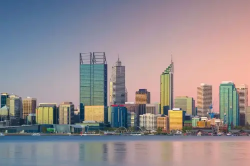 Օր 69՝ 08:00–22:00
Պերտ / Australia
Ավստրալիայի արևմտյան ափին, որտեղ փայլող Հնդկական օվկիանոսը միանում է ժամանակակից քաղաքային տեսարաններին, գտնվում է Պերտը՝ արևոտ, ոճային և անսպասելիորեն հանգիստ քաղաք։ Տարեկան ավելի քան 3000 արևոտ ժամերով այն համարվում է Ավստրալիայի ամենաարևոտ մայրաքաղաքը և առաջարկում է իդեալական հավասարակշռություն՝ ակտիվ քաղաքային կյանքի և բնության գեղեցկության միջև։
Պերտի հյուրերը կարող են զբոսնել գեղատեսիլ Քինգս Պարկում, այցելել արվեստի պատկերասրահներ ու նորաձև սրճարաններ կամ նավակով ուղևորվել դեպի մթնոլորտային Ֆրիմանթլ՝ պատմական նավահանգստային արվարձան։ Բնության սիրահարները կգնահատեն մոտակա Ռոտնեսթ կղզին, որտեղ ապրում են ժպտացող քուոկկաները։ Պերտը այն վայրն է, որտեղ հանգստությունը հանդիպում է էներգիային, իսկ բնությունն ու քաղաքային հարմարավետությունը ներդաշնակ համատեղվում են։
-
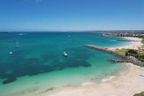 Օր 70՝ 13:30–20:00
Ջերալդթոն / Australia
Արևմտյան Ավստրալիայի անապատային լանդշաֆտները անակնկալորեն հանդիպում են Հնդկաստանի օվկիանոսի շողշողացող տուրկուազ ջրերին, որտեղ գտնվում է Ջերալդթոն` ջերմ կլիմայով և աշխույժ մթնոլորտով պատկերավոր ծովափնյա քաղաք։ Այս հանգստավայրը համարվում է երկրի լավագույն վայրերից մեկը սողազարկային և թռչող սայթաքման սիրահարների համար՝ շնորհիվ մշտական քամիների և մաքուր ջրերի։ Պատմության սիրահարները կգնահատեն HMAS Sydney II հուշարձանը, ինչպես նաև 1930-ականների պահպանված արտ-դեկո ճարտարապետությունը։
Ջերալդթոն-ը նաև հայտնի է իր մոտակայքում գտնվող Հաուտման Աբրոլոս կղզիների շնորհիվ` որը յուրահատուկ վայր է սնորխելինգի, դայվինգի և ծովային թռչունների դիտման համար։ Գարնանը քաղաքի շրջակայքը ծածկվում է վայրի ծաղիկների գորգով, որը տարածքը վերածում է բնության գունագեղ բացիկի։ Այս ուղղությունը հիանալի է նրանց համար, ովքեր փնտրում են ակտիվ հանգստի, բնության և փոքր ավստրալական քաղաքի հարմարավետության համադրություն։
-
Օր 71՝
Օր ծովում / Sea
-
Օր 73՝
Օր ծովում / Sea
-
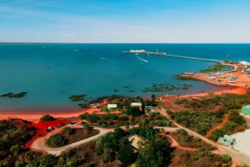 Օր 74՝ 08:00–20:00
Բրում / Australia
Ավստրալիայի Արեւմտյան մի ջեմ, Բռում քաղաքը հայտնի է իր յուրօրինակ մշակույթով եւ գեղեցիկ լողափերով: Այս քաղաքը Հնդկական օվկիանոսի ափին հայտնի է իր պատմական մարգարիտագործությամբ եւ ավանդույթների հարուստ խառնուրդով՝ աբորիգենների եւ ասիական ներգաղթյալների: Լողափով քայլելով՝ կարող եք վայելել Cable Beach լողափի 22 կիլոմետր երկարությունը եւ անտարբեր չթողնող, պայծառ արևամուտերը:
Բռում քաղաքում անց են կացվում հետաքրքիր փառատոններ, որոնք արտացոլում են տարածաշրջանի մշակութային միաձուլումն ու դարավոր պատմությունը: Քաղաքը դռներ է բացում դեպի բնության հրաշքներ, ինչպիսիք են Քիմբերլիի տարածաշրջանի եզակի երկրաբանական ձևավորումները եւ հնարավորություն դիտելու հին ծովային կրիաներ: Եթե ցանկանում եք զգալ Ավստրալիայի հյուսիս-արեւմուտքի մթնոլորտը, Բռում քաղաքը հիանալի ընտրություն է ձեր ճանապարհորդության համար:
-
Օր 76՝
Օր ծովում / Sea
-
 Օր 77՝ 07:30–17:00
Դարվին / Australia
Darwin is the capital city of the Northern Territory of Australia, situated on the Timor Sea. It is the largest city in the sparsely populated Northern Territory, with a population of 145,916. It is the smallest and most northerly of the Australian capital cities, and acts as the Top End's regional centre.
-
Օր 78՝
Օր ծովում / Sea
-
Օր 79՝
Օր ծովում / Sea
-
 Օր 80՝ 06:00–18:00
Բենոա կղզի Բալի Բենոա կղզի Բալի / Indonesia
-
Օր 81՝ 08:00–18:00
Չելուկան-Բավանգ
-
 Օր 82՝ 09:00–17:00
Մի հարցրու / Indonesia
-
 Օր 83՝ 07:30–22:00
Սեմարանգ / Indonesia
Semarang is the capital and largest city of Central Java province in Indonesia. It has an area of 373.78 square kilometres (144.32 sq mi) and a population of approximately 1.8 million people, making it Indonesia's seventh most populous city after Jakarta, Surabaya, Bandung, Bekasi, Medan, and Tangerang. The built-up (metro) area had 3,183,516 inhabitants at the 2010 census spread on 2 cities and 26 districts. Greater Semarang (a.k.a. Kedungsapur) has a population of close to 6 million (see Greater Semarang section), and is located at 6°58′S 110°25′E. A major port during the Dutch colonial era, and still an important regional center and port today, the city has a dominant Javanese population.
-
Օր 84՝
Օր ծովում / Sea
-
Օր 85՝
Օր ծովում / Sea
-
 Օր 86՝ 08:00
Սինգապուր / Singapore
Сингапур довольно необычный город Азии — это город-государство, которое расположилось на островах в Индийском океане. Его колониальные кварталы, храмы, музеи, великолепны парки, аттракционы, современные небоскребы и крупнейший морской порт, придают городу уникальный колорит и неповторимость. Город получил важное экономическое и политическое значение среди стран Восточной Азии. Все основные достопримечательности сосредоточены в четырех районах города. Основными из них являются: здание Импресс-Плейс-Билдинг, армянская церковь Св. Грегора-Святителя, Концертный зал и театр Виктории, англиканский собор Св. Андрея, католический собор Гуд-Шеферд, здания Парламента, а так же много других памятников архитектуры, дворцов, храмов и просто интересных улиц и кварталов.
-
Օր 87՝ 06:30–22:00
Սինգապուր / Singapore
Сингапур довольно необычный город Азии — это город-государство, которое расположилось на островах в Индийском океане. Его колониальные кварталы, храмы, музеи, великолепны парки, аттракционы, современные небоскребы и крупнейший морской порт, придают городу уникальный колорит и неповторимость. Город получил важное экономическое и политическое значение среди стран Восточной Азии. Все основные достопримечательности сосредоточены в четырех районах города. Основными из них являются: здание Импресс-Плейс-Билдинг, армянская церковь Св. Грегора-Святителя, Концертный зал и театр Виктории, англиканский собор Св. Андрея, католический собор Гуд-Шеферд, здания Парламента, а так же много других памятников архитектуры, дворцов, храмов и просто интересных улиц и кварталов.
-
Օր 88՝
Օր ծովում / Sea
-
Օր 90՝
Օր ծովում / Sea
-
 Օր 91՝ 08:00–14:00
Սամուի կղզի / Thailand
Թայվանդի արևադարձային կղզիների մեջ Կո Սամուի կղզին առանձնանում է իր յուրահատուկ բնությամբ և մթնոլորտով: Այս կղզին գրավում է ճամփորդներին ամբողջ աշխարհից իր սպիտակ ավազեชายափերով, գեղեցիկ ջրվեժներով և խիտ անտառներով: Սա իդեալական վայր է հանգստանալու համար՝ լինի դա ջրային սպորտով զբաղվելը, բնության ուսումնասիրությունը, թե պարզապես հանգիստն ու գեղեցկությունը վայելելը:
Բացի այդ, Կո Սամուի հայտնի է իր մշակութային ժառանգությամբ, այդ թվում բազմաթիվ բուդդայական տաճարներով և սրբավայրերով: Ամենահայտնիերից մեկը Մեծ Բուդդայի տաճարն է, որը ոչ միայն կրոնական կենտրոն է, այլ նաև կղզու գլխավոր տեսարժան վայրերից մեկը: Գործող տեղական խոհանոցը՝ բաղկացած թարմ ծովամթերքներից և էքզոտիկ պտուղներից, դարձնում է ճանապարհորդությունը դեռ ավելի հետաքրքիր ու համեղ:
-
 Օր 92՝ 08:00
Բանգկոկ / Thailand
Bangkok is the capital and most populous city of Thailand. It is known in Thai as Krung Thep Maha Nakhon or simply Krung Thep. The city occupies 1,568.7 square kilometres (605.7 sq mi) in the Chao Phraya River delta in central Thailand, and has a population of over eight million, or 12.6 percent of the country's population. Over fourteen million people (22.2 percent) lived within the surrounding Bangkok Metropolitan Region at the 2010 census, making Bangkok the nation's primate city, significantly dwarfing Thailand's other urban centres in terms of importance.
-
Օր 93՝ 15:00
Բանգկոկ / Thailand
Bangkok is the capital and most populous city of Thailand. It is known in Thai as Krung Thep Maha Nakhon or simply Krung Thep. The city occupies 1,568.7 square kilometres (605.7 sq mi) in the Chao Phraya River delta in central Thailand, and has a population of over eight million, or 12.6 percent of the country's population. Over fourteen million people (22.2 percent) lived within the surrounding Bangkok Metropolitan Region at the 2010 census, making Bangkok the nation's primate city, significantly dwarfing Thailand's other urban centres in terms of importance.
-
Օր 94՝
Օր ծովում / Sea
-
 Օր 95՝ 10:00
Հոշիմին / Vietnam
Ho Chi Minh City, also known by its former name of Saigon is the most populous city in Vietnam with a population of 8.4 million (13 million in the metropolitan area) as of 2017. Located in southeast Vietnam, the metropolis surrounds the Saigon River and covers about 2,061 square kilometres (796 square miles).
Under the name Saigon, it was the capital of French Indochina from 1887 to 1902 and again from 1945 to 1954. Saigon would later become the capital of South Vietnam from 1955 until its fall in 1975. On 2 July 1976, Saigon merged with the surrounding Gia Định Province and was officially renamed Ho Chi Minh City after revolutionary leader Hồ Chí Minh (although the name Sài Gòn is still widely used).
Ho Chi Minh City is the financial centre of Vietnam and is classifed as a Beta+ World City by Globalization and World Cities Research Network. It is home to the Ho Chi Minh City Stock Exchange, the largest stock exchange by total market capitalization in Vietnam and the headquarters of many national and international banks and companies.
Ho Chi Minh City is the most visited city in Vietnam, with 6.3 million visitors in 2017. Many of the city's landmarks which are well known to international visitors include the Bến Thành Market, Ho Chi Minh City Hall, Notre-Dame Cathedral Basilica of Saigon, Independence Palace and the Municipal Theatre. The main passenger airport serving the metropolitan area is Tan Son Nhat International Airport, it is the busiest airport in Vietnam handling 36 million passengers in 2017.
-
Օր 96՝ 16:00
Հոշիմին / Vietnam
Ho Chi Minh City, also known by its former name of Saigon is the most populous city in Vietnam with a population of 8.4 million (13 million in the metropolitan area) as of 2017. Located in southeast Vietnam, the metropolis surrounds the Saigon River and covers about 2,061 square kilometres (796 square miles).
Under the name Saigon, it was the capital of French Indochina from 1887 to 1902 and again from 1945 to 1954. Saigon would later become the capital of South Vietnam from 1955 until its fall in 1975. On 2 July 1976, Saigon merged with the surrounding Gia Định Province and was officially renamed Ho Chi Minh City after revolutionary leader Hồ Chí Minh (although the name Sài Gòn is still widely used).
Ho Chi Minh City is the financial centre of Vietnam and is classifed as a Beta+ World City by Globalization and World Cities Research Network. It is home to the Ho Chi Minh City Stock Exchange, the largest stock exchange by total market capitalization in Vietnam and the headquarters of many national and international banks and companies.
Ho Chi Minh City is the most visited city in Vietnam, with 6.3 million visitors in 2017. Many of the city's landmarks which are well known to international visitors include the Bến Thành Market, Ho Chi Minh City Hall, Notre-Dame Cathedral Basilica of Saigon, Independence Palace and the Municipal Theatre. The main passenger airport serving the metropolitan area is Tan Son Nhat International Airport, it is the busiest airport in Vietnam handling 36 million passengers in 2017.
-
Օր 97՝
Օր ծովում / Sea
-
Օր 98՝
Օր ծովում / Sea
-
 Օր 99՝ 07:00–22:00
Անորոշություն / Cameroon
-
Օր 100՝
Օր ծովում / Sea
-
Օր 101՝ 08:00–20:00
Բանկիաո
-
Օր 102՝
Օր ծովում / Sea
-
 Օր 103՝ 09:00
Շանհայ / China
Shanghai is one of the four municipalities under the direct administration of the central government of the Republic of China, the largest city in China by population, and the second most populous city proper in the world, with a population of 24.18 million as of 2017. It is a global financial centre and transport hub, with the world's busiest container port. Located in the Yangtze River Delta, it sits on the south edge of the estuary of the Yangtze in the middle portion of the East Chinacoast. The municipality borders the provinces of Jiangsu and Zhejiang to the north, south and west, and is bounded to the east by the East China Sea.
As a major administrative, shipping and trading city, Shanghai grew in importance in the 19th century due to trade and recognition of its favourable port location and economic potential. The city was one of five treaty ports forced open to foreign trade following the British victory over China in the First Opium War. The subsequent 1842 Treaty of Nankingand 1844 Treaty of Whampoa allowed the establishment of the Shanghai International Settlement and the French Concession. The city then flourished as a centre of commerce between China and other parts of the world (predominantly the Occident), and became the primary financial hub of the Asia-Pacific region in the 1930s. However, with the Communist Party takeover of the mainland in 1949, trade was limited to other socialist countries, and the city's global influence declined. In the 1990s, the economic reforms introduced by Deng Xiaoping resulted in an intense re-development of the city, aiding the return of finance and foreign investment to the city. It has since re-emerged as a hub for international trade and finance; it is the home of the Shanghai Stock Exchange, one of the world's largest by market capitalization.
Shanghai has been described as the "showpiece" of the booming economy of mainland China; renowned for its Lujiazui skyline, and museums and historic buildings, such as those along The Bund, as well as the City God Templeand the Yu Garden.
-
Օր 104՝
Շանհայ / China
Shanghai is one of the four municipalities under the direct administration of the central government of the Republic of China, the largest city in China by population, and the second most populous city proper in the world, with a population of 24.18 million as of 2017. It is a global financial centre and transport hub, with the world's busiest container port. Located in the Yangtze River Delta, it sits on the south edge of the estuary of the Yangtze in the middle portion of the East Chinacoast. The municipality borders the provinces of Jiangsu and Zhejiang to the north, south and west, and is bounded to the east by the East China Sea.
As a major administrative, shipping and trading city, Shanghai grew in importance in the 19th century due to trade and recognition of its favourable port location and economic potential. The city was one of five treaty ports forced open to foreign trade following the British victory over China in the First Opium War. The subsequent 1842 Treaty of Nankingand 1844 Treaty of Whampoa allowed the establishment of the Shanghai International Settlement and the French Concession. The city then flourished as a centre of commerce between China and other parts of the world (predominantly the Occident), and became the primary financial hub of the Asia-Pacific region in the 1930s. However, with the Communist Party takeover of the mainland in 1949, trade was limited to other socialist countries, and the city's global influence declined. In the 1990s, the economic reforms introduced by Deng Xiaoping resulted in an intense re-development of the city, aiding the return of finance and foreign investment to the city. It has since re-emerged as a hub for international trade and finance; it is the home of the Shanghai Stock Exchange, one of the world's largest by market capitalization.
Shanghai has been described as the "showpiece" of the booming economy of mainland China; renowned for its Lujiazui skyline, and museums and historic buildings, such as those along The Bund, as well as the City God Templeand the Yu Garden.
-
Օր 105՝ 18:00
Շանհայ / China
Shanghai is one of the four municipalities under the direct administration of the central government of the Republic of China, the largest city in China by population, and the second most populous city proper in the world, with a population of 24.18 million as of 2017. It is a global financial centre and transport hub, with the world's busiest container port. Located in the Yangtze River Delta, it sits on the south edge of the estuary of the Yangtze in the middle portion of the East Chinacoast. The municipality borders the provinces of Jiangsu and Zhejiang to the north, south and west, and is bounded to the east by the East China Sea.
As a major administrative, shipping and trading city, Shanghai grew in importance in the 19th century due to trade and recognition of its favourable port location and economic potential. The city was one of five treaty ports forced open to foreign trade following the British victory over China in the First Opium War. The subsequent 1842 Treaty of Nankingand 1844 Treaty of Whampoa allowed the establishment of the Shanghai International Settlement and the French Concession. The city then flourished as a centre of commerce between China and other parts of the world (predominantly the Occident), and became the primary financial hub of the Asia-Pacific region in the 1930s. However, with the Communist Party takeover of the mainland in 1949, trade was limited to other socialist countries, and the city's global influence declined. In the 1990s, the economic reforms introduced by Deng Xiaoping resulted in an intense re-development of the city, aiding the return of finance and foreign investment to the city. It has since re-emerged as a hub for international trade and finance; it is the home of the Shanghai Stock Exchange, one of the world's largest by market capitalization.
Shanghai has been described as the "showpiece" of the booming economy of mainland China; renowned for its Lujiazui skyline, and museums and historic buildings, such as those along The Bund, as well as the City God Templeand the Yu Garden.
-
Օր 106՝
Օր ծովում / Sea
-
Օր 107՝
Օր ծովում / Sea
-
 Օր 108՝ 07:00
Պեկին / China
Beijing, formerly romanized as Peking, is the capital of the People's Republic of China, the world's third most populous city proper, and most populous capital city. The city, located in northern China, is governed as a municipality under the direct administration of central government with 16 urban, suburban, and rural districts. Beijing Municipality is surrounded by HebeiProvince with the exception of neighboring Tianjin Municipality to the southeast; together the three divisions form the Jingjinji metropolitan region and the national capital region of China.
Beijing is an important world capital and global power city, and one of the world's leading centers for politics, economy and business, finance, education, culture, innovation and technology, architecture, language, and diplomacy. A megacity, Beijing is the second largest Chinese city by urban population after Shanghai and is the nation's political, cultural, and educational center. It is home to the headquarters of most of China's largest state-owned companiesand houses the largest number of Fortune Global 500 companies in the world, as well as the world's four biggest financial institutions. It is also a major hub for the national highway, expressway, railway, and high-speed railnetworks. The Beijing Capital International Airport has been the second busiest in the world by passenger traffic since 2010, and, as of 2016, the city's subway network is the busiest and second longest in the world.
Combining both modern and traditional architecture, Beijing is one of the oldest cities in the world, with a rich historydating back three millennia. As the last of the Four Great Ancient Capitals of China, Beijing has been the political center of the country for most of the past eight centuries, and was the largest city in the world by population for much of the second millennium A.D. Encyclopædia Britannica notes that "few cities in the world have served for so long as the political headquarters and cultural center of an area as immense as China." With mountains surrounding the inland city on three sides, in addition to the old inner and outer city walls, Beijing was strategically poised and developed to be the residence of the emperor and thus was the perfect location for the imperial capital. The city is renowned for its opulent palaces, temples, parks, gardens, tombs, walls and gates. It has seven UNESCO World Heritage Sites—the Forbidden City, Temple of Heaven, Summer Palace, Ming Tombs, Zhoukoudian, and parts of the Great Wall and the Grand Canal— all popular locations for tourism. Siheyuans, the city's traditional housing style, and hutongs, the narrow alleys between siheyuans, are major tourist attractions and are common in urban Beijing.
Many of Beijing's 91 universities consistently rank among the best in China, such as the Peking University and Tsinghua University. Beijing CBD is a center for Beijing's economic expansion, with the ongoing or recently completed construction of multiple skyscrapers. Beijing's Zhongguancun area is known as China's Silicon Valley and a center of innovation and technology entrepreneurship.
-
Օր 109՝ 20:00
Պեկին / China
Beijing, formerly romanized as Peking, is the capital of the People's Republic of China, the world's third most populous city proper, and most populous capital city. The city, located in northern China, is governed as a municipality under the direct administration of central government with 16 urban, suburban, and rural districts. Beijing Municipality is surrounded by HebeiProvince with the exception of neighboring Tianjin Municipality to the southeast; together the three divisions form the Jingjinji metropolitan region and the national capital region of China.
Beijing is an important world capital and global power city, and one of the world's leading centers for politics, economy and business, finance, education, culture, innovation and technology, architecture, language, and diplomacy. A megacity, Beijing is the second largest Chinese city by urban population after Shanghai and is the nation's political, cultural, and educational center. It is home to the headquarters of most of China's largest state-owned companiesand houses the largest number of Fortune Global 500 companies in the world, as well as the world's four biggest financial institutions. It is also a major hub for the national highway, expressway, railway, and high-speed railnetworks. The Beijing Capital International Airport has been the second busiest in the world by passenger traffic since 2010, and, as of 2016, the city's subway network is the busiest and second longest in the world.
Combining both modern and traditional architecture, Beijing is one of the oldest cities in the world, with a rich historydating back three millennia. As the last of the Four Great Ancient Capitals of China, Beijing has been the political center of the country for most of the past eight centuries, and was the largest city in the world by population for much of the second millennium A.D. Encyclopædia Britannica notes that "few cities in the world have served for so long as the political headquarters and cultural center of an area as immense as China." With mountains surrounding the inland city on three sides, in addition to the old inner and outer city walls, Beijing was strategically poised and developed to be the residence of the emperor and thus was the perfect location for the imperial capital. The city is renowned for its opulent palaces, temples, parks, gardens, tombs, walls and gates. It has seven UNESCO World Heritage Sites—the Forbidden City, Temple of Heaven, Summer Palace, Ming Tombs, Zhoukoudian, and parts of the Great Wall and the Grand Canal— all popular locations for tourism. Siheyuans, the city's traditional housing style, and hutongs, the narrow alleys between siheyuans, are major tourist attractions and are common in urban Beijing.
Many of Beijing's 91 universities consistently rank among the best in China, such as the Peking University and Tsinghua University. Beijing CBD is a center for Beijing's economic expansion, with the ongoing or recently completed construction of multiple skyscrapers. Beijing's Zhongguancun area is known as China's Silicon Valley and a center of innovation and technology entrepreneurship.
-
Օր 110՝
Օր ծովում / Sea
-
 Օր 111՝ 06:00–22:00
Ինչեոն / Korea
Ինչհոնը նավահանգստային քաղաք է, որը գտնվում է Հարավային Կորեայի արևմտյան ափին, Սեուլից ընդամենը 40 կմ հեռավորության վրա: Ինչոնն կարևոր տրանսպորտային հանգույց է, որտեղ գտնվում է միջազգային օդանավակայան, որը Ասիայի ամենամեծերից մեկն է և կարևոր հանգույց է ճանապարհորդների համար, ովքեր ժամանում են Հարավային Կորեա: Քաղաքը հայտնի է նաև իր գեղատեսիլ նավահանգիստներով, գեղեցիկ ավազափնջերով և կղզիներով, որոնք идеально համապատասխանում են հանգիստ զբոսանքների համար: Այս քաղաքում ամենահայտնի զբոսաշրջային վայրերից մեկն է Ինչհոնի ծովափնյա փողոցը՝ իր յուրահատուկ կամրջով, որը ներկայացնում է տպավորիչ տեսարաններ ծոցից և հարևան կղզիներից:
Բացի այդ, Ինչհոնը ունի հարուստ մշակութային պատմություն, հատկապես Մունսու կղզու շրջանում, որտեղ այցելուները կարող են տեսնել հնագույն տաճարներ և ավանդական կորեական գյուղեր: Քաղաքը հայտնի է դարձել 1950 թվականին՝ Ինչհոնի օպերացիայի շնորհիվ, որը եղել է Կորեայի պատերազմի կարևոր մարտերից մեկը: Մոդեռն մշակույթի սիրահարների համար այստեղ նույնպես անցկացվում են ցուցահանդեսներ և փառատոններ, իսկ տեղական ռեստորանները առաջարկում են լավագույն կորեական խոհանոցը՝ հատկապես ծովամթերք, որը շատ հանրաճանաչ է քաղաքի ծովափի մոտակա գտնվելու շնորհիվ:
-
Օր 112՝
Օր ծովում / Sea
-
 Օր 113՝ 08:00–20:00
Yeosu / Korea
-
 Օր 114՝ 08:00–20:00
Բուսան / Korea
Busan, formerly known as Pusan and now officially Busan Metropolitan City, is South Korea's second most-populous city after Seoul, with a population of over 3.5 million inhabitants. It is the economic, cultural and educational center of southeastern Korea, with its port—Korea's busiest and the 9th-busiest in the world—only about 120 miles (190 km) from the Japanese islands of Kyushu and Honshu. The surrounding "Southeast Economic Zone" (including Ulsan and South Gyeongsang) is now South Korea's largest industrial area.
-
Օր 115՝ 08:00–20:00
Կիտա Կյուսու / Japan
-
 Օր 116՝ 08:00–22:00
Հիրոսիմա / Japan
a city in southwestern Japan, on the southern coast of the island of Honshu; population 1,144,572 (2007). It was the target of the first atom bomb, which was dropped by the US on August 6, 1945, and resulted in the deaths of about one third of the city's population of 300,000. This, with a second attack on Nagasaki three days later, led to Japan's surrender and to the end of World War II.
-
 Օր 117՝ 13:00–20:00
Կոչի / India
a seaport and naval base on the Malabar Coast of southwestern India, in the state of Kerala; population 254,500 (est. 2009).
-
 Օր 118՝ 08:00
Օսակա / Japan
Osaka is a designated city in the Kansai regionof Japan. It is the capital city of Osaka Prefecture and the largest component of the Keihanshin Metropolitan Area, the second largest metropolitan area in Japan and among the largest in the world with over 19 million inhabitants. Osaka will host Expo 2025. The current mayor of Osaka is Hirohumi Yoshimura.
-
Օր 119՝ 17:00
Օսակա / Japan
Osaka is a designated city in the Kansai regionof Japan. It is the capital city of Osaka Prefecture and the largest component of the Keihanshin Metropolitan Area, the second largest metropolitan area in Japan and among the largest in the world with over 19 million inhabitants. Osaka will host Expo 2025. The current mayor of Osaka is Hirohumi Yoshimura.
-
 Օր 120՝ 10:00–20:00
Նագոյա / Japan
Nagoya is the largest city in the Chūbu region of Japan. It is Japan's fourth-largest incorporated city and the third-most-populous urban area. It is located on the Pacific coast on central Honshu. It is the capital of Aichi Prefectureand is one of Japan's major ports along with those of Tokyo, Osaka, Kobe, Yokohama, Chiba, and Kitakyushu. It is also the center of Japan's third-largest metropolitan region, known as the Chūkyō metropolitan area. As of 2015, 2.28 million people lived in the city, part of Chūkyō Metropolitan Area's 10.11 million people. It is also one of the 50 largest urban areas in the world.
-
 Օր 121՝ 08:00–20:00
Շիմիզու / Japan
-
 Օր 122՝ 08:00
Յոկոհամա (Տոկիո) / Japan
Tokyo, officially Tokyo Metropolis, one of the 47 prefectures of Japan, has served as the Japanese capital since 1869. As of 2014, the Greater Tokyo Arearanked as the most populous metropolitan area in the world. The urban area houses the seat of the Emperor of Japan, of the Japanese government and of the National Diet. Tokyo forms part of the Kantō region on the southeastern side of Japan's main island, Honshu, and includes the Izu Islands and Ogasawara Islands. Tokyo was formerly named Edo when Shōgun Tokugawa Ieyasu made the city his headquarters in 1603. It became the capital after Emperor Meiji moved his seat to the city from Kyoto in 1868; at that time Edo was renamed Tokyo. Tokyo Metropolis formed in 1943 from the merger of the former Tokyo Prefecture and the city of Tokyo. Tokyo is often referred to as a city but is officially known and governed as a "metropolitan prefecture", which differs from and combines elements of a city and a prefecture, a characteristic unique to Tokyo.
The 23 Special Wards of Tokyo were formerly Tokyo City. On July 1, 1943, it merged with Tokyo Prefecture and became Tokyo Metropolis with an additional 26 municipalities in the western part of the prefecture, and the Izu islandsand Ogasawara islands south of Tokyo. The population of the special wards is over 9 million people, with the total population of Tokyo Metropolis exceeding 13.8 million. The prefecture is part of the world's most populous metropolitan area called the Greater Tokyo Area with over 38 million people and the world's largest urban agglomeration economy. As of 2011, Tokyo hosted 51 of the Fortune Global 500 companies, the highest number of any city in the world at that time. Tokyo ranked third (twice) in the International Financial Centres Development Index. The city is home to various television networks such as Fuji TV, Tokyo MX, TV Tokyo, TV Asahi, Nippon Television, NHK and the Tokyo Broadcasting System.
-
Օր 123՝ 06:30–19:00
Յոկոհամա (Տոկիո) / Japan
Tokyo, officially Tokyo Metropolis, one of the 47 prefectures of Japan, has served as the Japanese capital since 1869. As of 2014, the Greater Tokyo Arearanked as the most populous metropolitan area in the world. The urban area houses the seat of the Emperor of Japan, of the Japanese government and of the National Diet. Tokyo forms part of the Kantō region on the southeastern side of Japan's main island, Honshu, and includes the Izu Islands and Ogasawara Islands. Tokyo was formerly named Edo when Shōgun Tokugawa Ieyasu made the city his headquarters in 1603. It became the capital after Emperor Meiji moved his seat to the city from Kyoto in 1868; at that time Edo was renamed Tokyo. Tokyo Metropolis formed in 1943 from the merger of the former Tokyo Prefecture and the city of Tokyo. Tokyo is often referred to as a city but is officially known and governed as a "metropolitan prefecture", which differs from and combines elements of a city and a prefecture, a characteristic unique to Tokyo.
The 23 Special Wards of Tokyo were formerly Tokyo City. On July 1, 1943, it merged with Tokyo Prefecture and became Tokyo Metropolis with an additional 26 municipalities in the western part of the prefecture, and the Izu islandsand Ogasawara islands south of Tokyo. The population of the special wards is over 9 million people, with the total population of Tokyo Metropolis exceeding 13.8 million. The prefecture is part of the world's most populous metropolitan area called the Greater Tokyo Area with over 38 million people and the world's largest urban agglomeration economy. As of 2011, Tokyo hosted 51 of the Fortune Global 500 companies, the highest number of any city in the world at that time. Tokyo ranked third (twice) in the International Financial Centres Development Index. The city is home to various television networks such as Fuji TV, Tokyo MX, TV Tokyo, TV Asahi, Nippon Television, NHK and the Tokyo Broadcasting System.
-
 Օր 124՝ 09:00–17:00
Բանդոլ / France
Bandol is a commune in Var department, Provence-Alpes-Côte d'Azur region, southeastern France. Bandol and the seat of its eponymous commune, was founded in 1595 and built around a small military fort.
The Bandol wine region, located near the coast east of Marseille and Cassis, is one of Provence’s most internationally recognized wine regions. Built around the village of Bandol, west of Toulon, the Bandol AOC covers the production of 8 communes with silicon & limestone soils. Those soils and the warm, coastal climate are ideally suited for the late ripening Mourvèdre grape which is the major variety of the region. For both the red and rosé wines, Mourvèdre must account for at least 50% of the blend, though most producers will use significantly more, with Grenache & Cinsaut usually filling out the rest of the wine’s composition.
-
 Օր 125՝ 10:00–17:00
Միյակոջիմա Միյակո / Japan
-
Օր 126՝
Օր ծովում / Sea
-
Օր 127՝ 06:00–08:00
Խաչի միջազգային ամսաթիվ
-
Օր 128՝
Օր ծովում / Sea
-
Օր 129՝
Օր ծովում / Sea
-
Օր 130՝
Օր ծովում / Sea
-
Օր 131՝
Օր ծովում / Sea
-
Օր 132՝
Օր ծովում / Sea
-
 Օր 133՝ 06:00–17:00
Կոդիակ / Alaska
Kodiak is one of seven communities and the main city on Kodiak Island, Kodiak Island Borough, in the U.S. state of Alaska. All commercial transportation between the entire island and the outside world goes through this city either via ferryboat or airline. The population was 6,130 as of the 2010 census. 2014 estimates put the population at 6,304.
Originally inhabited by Alutiiq natives for over 7,000 years, the city was settled in the 18th century by the subjects of the Russian crown and became the capital of Russian Alaska.
Harvesting of the area's sea otter pelts led to the near extinction of the animal in the following century and led to wars with and enslavement of the natives for over 150 years.
After the Alaska Purchase by the United States in 1867, Kodiak became a commercial fishing center which continues to be the mainstay of its economy. A lesser economic influence includes tourism, mainly by those seeking outdoor adventure trips. Salmon, halibut, the unique Kodiak bear, elk, Sitka deer (black tail), and mountain goats attract hunting tourists as well as fishermen to the Kodiak Archipelago. The Alaska Department of Fish and Game maintains an office in the city and a website to help hunters and fishermen obtain the proper permits and learn about the laws specific to the Kodiak area.
-
 Օր 134՝ 07:00–18:00
Սեվարդ / Alaska
Seward is an incorporated home rule city in Alaska, United States. Located on Resurrection Bay, a fjord of the Gulf of Alaska on the Kenai Peninsula, Seward is situated on Alaska's southern coast, approximately 120 miles by road from Alaska's largest city, Anchorage, and nearly 1,300 miles from the closest point in the contiguous United States at Cape Flattery, Washington.
With an estimated permanent population of 2,831 people as of 2017, Seward is the fourth-largest city in the Kenai Peninsula Borough, behind Kenai, Homer, and the borough seat of Soldotna. The city is named for former U.S. Secretary of State William H. Seward, who orchestrated the United States' purchase of Alaska from the Russian Empire in 1867 while serving in this position as part of President Andrew Johnson's administration.
Seward is the southern terminus of the Alaska Railroad and the historic starting point of the original Iditarod Trail to the Alaskan interior, with Mile 0 of the trail marked on the shoreline at the southern end of town.
-
Օր 135՝ 08:00–14:00
Վալդիզ / Alaska
-
Օր 136՝ 11:00–16:00
Բանդոլ / France
Bandol is a commune in Var department, Provence-Alpes-Côte d'Azur region, southeastern France. Bandol and the seat of its eponymous commune, was founded in 1595 and built around a small military fort.
The Bandol wine region, located near the coast east of Marseille and Cassis, is one of Provence’s most internationally recognized wine regions. Built around the village of Bandol, west of Toulon, the Bandol AOC covers the production of 8 communes with silicon & limestone soils. Those soils and the warm, coastal climate are ideally suited for the late ripening Mourvèdre grape which is the major variety of the region. For both the red and rosé wines, Mourvèdre must account for at least 50% of the blend, though most producers will use significantly more, with Grenache & Cinsaut usually filling out the rest of the wine’s composition.
-
 Օր 137՝ 10:30–22:00
Յունո / Alaska
Столица штата Аляска — город Джуно, был основан в 1881 году, после открытия месторождения золота и назван в честь золотоискателя Джозефа Джуно. В городе развиты рыболовство и туризм. В список достопримечательностей этого очаровательного городка входят Музей истории Аляски и церковь Святого Николая. Это русская православная церковь, но поскольку среди ее прихожан русских нет, то служба идет на английском языке. Также интересным для туристов будет и Tongass National Forest (национальный парк), и Фьорд Трейси-Арм. Поразит своей красотой и прилегающая к Джуно территория. Здесь расположились живописные ледники, высочайшие горы, интригующие ущелья, что ежегодно привлекает сюда тысячи туристов, любящих пешеходные прогулки.
-
 Օր 138՝ 08:00–17:00
Սառցե նեղուցի կետ
-
Օր 139՝ 13:00–22:00
Բանդոլ / France
Bandol is a commune in Var department, Provence-Alpes-Côte d'Azur region, southeastern France. Bandol and the seat of its eponymous commune, was founded in 1595 and built around a small military fort.
The Bandol wine region, located near the coast east of Marseille and Cassis, is one of Provence’s most internationally recognized wine regions. Built around the village of Bandol, west of Toulon, the Bandol AOC covers the production of 8 communes with silicon & limestone soils. Those soils and the warm, coastal climate are ideally suited for the late ripening Mourvèdre grape which is the major variety of the region. For both the red and rosé wines, Mourvèdre must account for at least 50% of the blend, though most producers will use significantly more, with Grenache & Cinsaut usually filling out the rest of the wine’s composition.
-
Օր 140՝
Օր ծովում / Sea
-
Օր 141՝ 13:00–22:00
Նանայմո
-
 Օր 142՝ 07:00–20:00
Վանկուվեր / Canada
Vancouver is a coastal seaport city in western Canada, located in the Lower Mainland region of British Columbia. As the most populous city in the province, the 2016 census recorded 631,486 people in the city, up from 603,502 in 2011. The Greater Vancouver area had a population of 2,463,431 in 2016, making it the third-largest metropolitan area in Canada. Vancouver has the highest population density in Canada with over 5,400 people per square kilometre, which makes it the fifth-most densely populated city with over 250,000 residents in North America behind New York City, Guadalajara, San Francisco, and Mexico City according to the 2011 census. Vancouver is one of the most ethnically and linguistically diverse cities in Canada according to that census; 52% of its residents have a first language other than English.[8][9] Roughly 30% of the city's inhabitants are of Chineseheritage. Vancouver is classed as a Beta global city.
Vancouver is consistently named as one of the top five worldwide cities for livability and quality of life, and the Economist Intelligence Unit acknowledged it as the first city ranked among the top-ten of the world's most well-living cities for five consecutive years. Vancouver has hosted many international conferences and events, including the 1954 British Empire and Commonwealth Games, UN Habitat I, Expo 86, the World Police and Fire Games in 1989 and 2009; and the 2010 Winter Olympics and Paralympics which were held in Vancouver and Whistler, a resort community 125 km (78 mi) north of the city. In 2014, following thirty years in California, the TED conference made Vancouver its indefinite home. Several matches of the 2015 FIFA Women's World Cup were played in Vancouver, including the final at BC Place.
-
 Օր 143՝ 08:00–22:00
Սիեթլ, Վաշինգտոն / USA
На Тихоокеанском побережье США расположился замечательный, современный город Сиэтл, символом которого является Спейс-Нидл, башня, находящаяся на территории выставочного комплекса Seattle Center.
Эта узнаваемая достопримечательность представляет собой башню высотой почти 184 метра, более 40 метров шириной, а также она построена так, что выдержит ураганы с порывами ветра до 320 км/ч. Особенность этого величайшего сооружения в его обзорной площадке, расположенной на высоте 159 метров, где находится ресторан Sky City и магазин подарков. Каждый гость города просто обязан побывать в Керри Парке, пейзажи которого не оставляют равнодушными даже жителей Сиэтла. И эта не единственный знаменитый парк города. Также стоит посетить Гэзуоркс Парк, с великолепным видам на прибрежный Даунтаун. А еще в городе есть множество, интересных для посещения, рынков, в числе которых и Майк маркет-рынок морепродуктов, который также может похвастаться своеобразной сценой для уличных артистов, что, несомненно, делает его очень популярным для туристов, а также Пайк-Плейс-маркет — популярный среди туристов общественный рынок.
-
 Օր 144՝ 08:00–17:00
Վիկտորիա, MAE կղզի / Seychelles
Փիրուզագույն ջրերը և խիտ ջունգլիները շրջապատում են Վիկտորիան Մաե կղզում՝ Սեյշելների մայրաքաղաքը և աշխարհի ամենափոքր մայրաքաղաքներից մեկը։ Այստեղ գունեղ շուկաները էկզոտիկ մրգերով և համեմունքներով համադրվում են գաղութային դարաշրջանի ճարտարապետության հետ, իսկ քաղաքի կենտրոնում կանգնած է Լոնդոնի Բիգ Բենի փոքր տարբերակը՝ Վիկտորիայի խորհրդանիշներից մեկը։ Մոտակայքում այցելուները կարող են այցելել Բուսաբանական այգի, որտեղ աճում են հազվագյուտ արմավենիներ և խոլորձներ, ինչպես նաև տեսնել հսկա կրիաներին իրենց բնական միջավայրում։
Վիկտորիա ուղևորությունը հնարավորություն է զգալու Սեյշելների դանդաղ և հանգիստ կենսակերպը և վայելելու իսկական արևադարձային մթնոլորտ։ Նավահանգստի ափերով զբոսնելը, Ազգային արվեստի պատկերասրահ այցելելը կամ տեղական սրճարաններում թարմ որսացված ձուկ համտեսելը կօգնեն ավելի լավ հասկանալ կղզաբնակների մշակույթը և առօրյան։ Քաղաքի կենտրոնից ընդամենը մի քանի րոպե հեռու սկսվում են սպիտակ ավազով և կապտավուն ջրերով լողափերը, որոնք հրավիրում են Մաեի մարջանային խութերի մոտ ջրասուզակային արկածների։
-
 Օր 145՝ 09:00–20:00
Աստորիա / USA
Պատմական նավահանգիստը, որը գտնվում է Կոլումբիա գետի ափին, բացում է դռներ արկածների և գեղեցիկ լանդշաֆտների աշխարհ, որտեղ հարուստ մշակութային ժառանգությունը համատեղվում է բնական գեղեցկության հետ։ Այս տարածաշրջանում ճանապարհորդները կարող են վայելել XIX դարի մթնոլորտը՝ քայլելով հին շինությունների և թանգարանների միջով, ինչպես նաև համտեսել թարմ ծովամթերք հարմարավետ նավամատույցի ռեստորաններում։ Աստորյա հայտնի է ոչ միայն որպես ԱՄՆ արևմտյան ափի առաջին մշտական եվրոպական բնակավայր, այլ նաև որպես հայտնի վայր ձկնորսության և թռչունների դիտման սիրահարների համար։
Աստորյայի շուրջ տարածված բնական գեղեցկությունը զարմանալի բազմազանություն է ներկայացնում՝ սկսած հարազատ լողափերից մինչև Forest Grove ազգային պարկի խիտ անտառները։ Ակտիվ հանգստի սիրահարները կգտնեն հիանալի հնարավորություններ ոտքով զբոսնելու, հեծանվավազքի և կայակինգի համար, իսկ Կոլումբիա գետի հանգիստ ջրերը և գրավիչ շրջակայքը ապահովում են հարմարավետ մթնոլորտ հանգստի և ոգեշնչման համար։ Այս Խաղաղ օվկիանոսի ափամերձ քաղաքը խոստանում է յուրօրինակ փորձ, որտեղ պատմությունն ու բնությունը ներդաշնակորեն խառնվում են ամեն անկյունում։
-
Օր 146՝
Օր ծովում / Sea
-
 Օր 147՝ 08:00–22:00
Սան Ֆրանցիսկո / USA
San Francisco , officially the City and County of San Francisco, is the cultural, commercial, and financial center of Northern California. San Francisco is the 13th-most populous city in the United States, and the fourth-most populous in California, with 884,363 residents as of 2017. It covers an area of about 46.89 square miles (121.4 km2), mostly at the north end of the San Francisco Peninsula in the San Francisco Bay Area, making it the second-most densely populated large US city, and the fifth-most densely populated U.S. county, behind only four of the five New York City boroughs. San Francisco is also part of the fifth-most populous primary statistical area in the United States, the San Jose–San Francisco–Oakland, CA Combined Statistical Area (9.7 million residents).
-
Օր 148՝
Օր ծովում / Sea
-
Օր 150՝ 06:00–17:00
Սան Դիեգո Կալիֆորնիա / USA
-
Օր 151՝
Օր ծովում / Sea
-
Օր 152՝
Օր ծովում / Sea
-
 Օր 153՝ 13:00–20:00
Պուերտո Վալարտա / Mexico
Ջերմ օվկիանոսային քամին ողջունում է զբոսաշրջիկներին Puerto Vallarta քաղաքում՝ Պասիֆիկի ափին գտնվող գեղատեսիլ հանգստավայրում, որտեղ Սիեռա Մադրե լեռները հանդիպում են ոսկեգույն լողափերին։ Քաղաքը հայտնի է իր հարմարավետ մթնոլորտով, հին կենտրոնի նեղ քարաշեն փողոցներով և հայտնի Մալեկոն նավահանգստով, որը զարդարված է ժամանակակից արձաններով և փողոցային արվեստով։ Այստեղ կարելի է ոչ միայն արևից վայելել, այլև դիտել կետերին Բանդերաս ծոցում տեղափոխման սեզոնի ժամանակ։
Զբոսաշրջիկների համար Puerto Vallarta առաջարկում է մշակութային և գաստրոնոմիական հարուստ փորձառություն՝ սկսած ավանդական տակոյից և թարմ ծովամթերքներից մինչև արվեստի ցուցասրահներ և մեքսիկական երաժշտական փառատոններ։ Քաղաքը հայտնի է նաև սուզման և սնորքլինգի սիրահարների շրջանում՝ իր մարջանային խութերով և բյուրեղյա մաքուր ջրով։ Սա այն վայրն է, որտեղ հնարավոր է համատեղել հանգիստը օվկիանոսի ափին Մեքսիկայի բնությունն ու մշակութային կյանքը ուսումնասիրելու հետ։
-
Օր 155՝
Օր ծովում / Sea
-
Օր 156՝
Օր ծովում / Sea
-
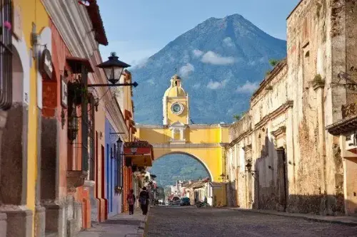 Օր 157՝ 06:00–20:00
Պուերտո Կեցալ / Guatemala
Պուերտո Կետսալը Գվատեմալայի ափամերձ կարևոր նավահանգիստ քաղաք է, որը գտնվում է Խաղաղ օվկիանոսի շրջանում: Այն ամենահայտնի վայրերից է ճանապարհորդական նավերի համար, ինչը դարձնում է այն կարևոր տրանսպորտային հանգույց և երկրի ներսում զբոսաշրջիկների համար գլխավոր մուտքը: Պուերտո Կետսալը նաև հանդիսանում է Գվատեմալայի բնական հրաշքներով զբոսաշրջիկների համար մեկնարկային կետ, ներառյալ հայտնի հրաբուխները և գեղեցիկ ծովափները: Մոտակայքում գտնվում են այնպիսի տեսարժան վայրեր, ինչպիսիք են Ակատենանգոյի հրաբուխը և Մոնտերրիկոյի ազգային պարկը, որը հայտնի է իր էկոհամակարգով և ալիքների վրա սերֆինգ անելու համար իդեալական ծովափերով:
Բացի իր բնական գեղեցկությունից, Պուերտո Կետսալը նաև առաջարկում է զբոսաշրջիկներին յուրահատուկ մթնոլորտ: Քաղաքը պահպանել է Խաղաղ օվկիանոսի ափի հմայքը՝ уютելի ձկնորսական գյուղերով և ռեստորաններով, որտեղ կարելի է համտեսել թարմ ծովամթերք: Այն իր ռազմավարական տեղադրվածությամբ և զարգացած ենթակառուցվածքներով դարձնում է Պուերտո Կետսալը հարմարավետ մեկնարկային կետ Գվատեմալայում ճանապարհորդելու համար՝ լինի այն նրանք, ովքեր ցանկանում են բացահայտել մայիական հին ավերակները, ինչպիսիք են Տիկալը, կամ նրանք, ովքեր փնտրում են հանգիստ հանգստություն ծովափին:
-
Օր 158՝
Օր ծովում / Sea
-
 Օր 159՝ 08:00–20:00
Պունտարենաս / Costa Rica
Puntarenas is the capital and largest city in the Province of Puntarenas, on the Pacific coast of Costa Rica.
-
Օր 160՝
Օր ծովում / Sea
-
 Օր 161՝ 05:00–17:00
Պանամայի ջրանցք / Panama
The Panama Canal is an artificial 82 km (51 mi) waterway in Panama that connects the Atlantic Ocean with the Pacific Ocean. The canal cuts across the Isthmus of Panama and is a conduit for maritime trade. Canal locks are at each end to lift ships up to Gatun Lake, an artificial lake created to reduce the amount of excavation work required for the canal, 26 m (85 ft) above sea level, and then lower the ships at the other end. The original locks are 34 m (110 ft) wide. A third, wider lane of locks was constructed between September 2007 and May 2016. The expanded canal began commercial operation on June 26, 2016. The new locks allow transit of larger, post-Panamax ships, capable of handling more cargo.
France began work on the canal in 1881, but stopped due to engineering problems and a high worker mortality rate. The United States took over the project in 1904 and opened the canal on August 15, 1914. One of the largest and most difficult engineering projects ever undertaken, the Panama Canal shortcut greatly reduced the time for ships to travel between the Atlantic and Pacific Oceans, enabling them to avoid the lengthy, hazardous Cape Horn route around the southernmost tip of South America via the Drake Passage or Strait of Magellan.
Colombia, France, and later the United States controlled the territory surrounding the canal during construction. The US continued to control the canal and surrounding Panama Canal Zone until the 1977 Torrijos–Carter Treatiesprovided for handover to Panama. After a period of joint American–Panamanian control, in 1999, the canal was taken over by the Panamanian government. It is now managed and operated by the government-owned Panama Canal Authority.
-
 Օր 162՝ 13:30
Կարթախենա (Բոլիվար) / Colombia
Հին ամրոցի պատերը, փողոցի երաժիշտները և Կարիբյան արևը ստեղծում են անզուգական մթնոլորտ Կարթախենայում (Բոլիվար)՝ Կոլումբիայի ափի մարգարիտում։ Այս քաղաքը, որը ներառված է ՅՈՒՆԵՍԿՕ-ի Համաշխարհային ժառանգության ցանկում, հմայում է այցելուներին իր գաղութային ճարտարապետությամբ, հարմարավետ բակերով և թարմ սուրճի բույրով, որը տարածվում է անթիվ սրճարաններից։
Ներծծվեք Կարթախենայի կենդանի ռիթմի մեջ՝ զբոսնելով Հին քաղաքի քարե փողոցներով, որտեղ յուրաքանչյուր անկյունը կրում է ծովահենների ու իսպանացի նվաճողների պատմությունները։ Միջնադարյան Castillo San Felipe de Barajas ամրոցի մոտ արևամուտը իդեալական ավարտ է լի մշակույթով, պատմությամբ և արևադարձային ռոմանտիկայով օրվա։
-
Օր 163՝ 05:00
Կարթախենա (Բոլիվար) / Colombia
Հին ամրոցի պատերը, փողոցի երաժիշտները և Կարիբյան արևը ստեղծում են անզուգական մթնոլորտ Կարթախենայում (Բոլիվար)՝ Կոլումբիայի ափի մարգարիտում։ Այս քաղաքը, որը ներառված է ՅՈՒՆԵՍԿՕ-ի Համաշխարհային ժառանգության ցանկում, հմայում է այցելուներին իր գաղութային ճարտարապետությամբ, հարմարավետ բակերով և թարմ սուրճի բույրով, որը տարածվում է անթիվ սրճարաններից։
Ներծծվեք Կարթախենայի կենդանի ռիթմի մեջ՝ զբոսնելով Հին քաղաքի քարե փողոցներով, որտեղ յուրաքանչյուր անկյունը կրում է ծովահենների ու իսպանացի նվաճողների պատմությունները։ Միջնադարյան Castillo San Felipe de Barajas ամրոցի մոտ արևամուտը իդեալական ավարտ է լի մշակույթով, պատմությամբ և արևադարձային ռոմանտիկայով օրվա։
-
Օր 164՝
Օր ծովում / Sea
-
Օր 165՝
Օր ծովում / Sea
-
 Օր 166՝ 06:00–18:00
Մայամի / USA
Miami, officially the City of Miami, is the cultural, economic and financial center of South Florida. Miami is the seat of Miami-Dade County, the most populous county in Florida. The city covers an area of about 56.6 square miles (147 km2), between the Everglades to the west and Biscayne Bay on the east; with a 2017 estimated population of 463,347, Miami is the sixth most densely populated major city in the United States. The Miami metropolitan area is home to 6.1 million people and the seventh-largest metropolitan area in the nation. Miami's metro area is the second-most populous metropolis in the southeastern United States and fourth-largest urban area in the U.S.
Miami is a major center, and a leader in finance, commerce, culture, media, entertainment, the arts, and international trade. The Miami Metropolitan Area is by far the largest urban economy in Florida and the 12th largest in the United States with a GDP of $344.9 billion as of 2017. In 2012, Miami was classified as an "Alpha−" level world city in the World Cities Study Group's inventory. In 2010, Miami ranked seventh in the United States and 33rd among global cities in terms of business activity, human capital, information exchange, cultural experience, and political engagement. In 2008, Forbes magazine ranked Miami "America's Cleanest City", for its year-round good air quality, vast green spaces, clean drinking water, clean streets, and citywide recycling programs. According to a 2009 UBS study of 73 world cities, Miami was ranked as the richest city in the United States, and the world's seventh-richest city in terms of purchasing power. Miami is nicknamed the "Capital of Latin America" and is the largest city with a Cuban-American plurality.
Greater Downtown Miami has one of the largest concentrations of international banks in the United States, and is home to many large national and international companies. The Civic Center is a major center for hospitals, research institutes, medical centers, and biotechnology industries. For more than two decades, the Port of Miami, known as the "Cruise Capital of the World", has been the number one cruise passenger port in the world. It accommodates some of the world's largest cruise ships and operations, and is the busiest port in both passenger traffic and cruise lines. Metropolitan Miami is also a major tourism hub in the southeastern U.S. for international visitors, ranking number two in the country after New York City.
-
Օր 167՝
Օր ծովում / Sea
-
Օր 168՝
Օր ծովում / Sea
-
 Օր 169՝ 08:00–22:00
NY / USA
The world famous city of New York , the largest city in the United States, with a population of 8.5 million people, and with suburbs - 20.6 million. New York is the largest economic, political, scientific, and cultural center of the United States. It is rightly called the "Main Gate" in the United States, and the world's largest John F. Kennedy Airport is located here. One of the distinguishing features of the city is the variegated national composition of the population, also called the United States in Miniature.
New York gathered in itself the whole essence of this country: fashion, religion, goods, pace and rhythm of American life. The UN headquarters is located here. There are also many universities in New York, the Academy of Sciences, and many other scientific institutions. Like any other metropolis in the world, New York invites you to visit numerous museums in the city, theaters and concert halls, including the Metropolitan Opera and Carnegie Hall. A great place to relax in New York is Central Park, where you can feed hand-held squirrels, which, to everyone's surprise, are not afraid of people. You can also appreciate the beauty of the famous Empire State Building, with a height of 102 floors, it is an example of skyscrapers, although it was built in 1829-1831. "Must see" in New York, of course, the Statue of Liberty ("Lady Liberty"), located at the mouth of the Hudson River, on the small island of Liberty. And of course, don't forget to stroll along Broadway.
-
Օր 170՝
Օր ծովում / Sea
-
 Օր 171՝ 11:00–20:00
Հալիֆաքս / Canada
Halifax, also known as the Halifax Regional Municipality (HRM), is the capital of the Canadian province of Nova Scotia. The municipality had a population of 403,131 in 2016, with 316,701 in the urban area centred on Halifax Harbour. The regional municipality consists of four former municipalities that were amalgamated in 1996: Halifax, Dartmouth, Bedford, and Halifax County.
Halifax is a major economic centre in Atlantic Canada with a large concentration of government services and private sector companies. Major employers and economic generators include the Department of National Defence, Dalhousie University, Saint Mary's University, the Halifax Shipyard, various levels of government, and the Port of Halifax. Agriculture, fishing, mining, forestry and natural gas extraction are major resource industries found in the rural areas of the municipality.
-
Օր 172՝
Օր ծովում / Sea
-
 Օր 173՝ 08:00–20:00
Սուրբ Հովհաննես / Canada
St. John's is the capital and largest city of the Canadian province of Newfoundland and Labrador. It is on the eastern tip of the Avalon Peninsula on the large Canadian island, Newfoundland. The city spans 446.04 square kilometres (172.22 sq mi) and is North America's easternmost city.
Its name has been attributed to the Nativity of John the Baptist, when John Cabot was believed to have sailed into the harbour in 1497 and to a Basque fishing town with the same name. Existing on maps as early as 1519, it is the oldest city in North America. It was officially incorporated as a city in 1888. With a metropolitan population of approximately 219,207 (as of July 1, 2017), the St. John's Metropolitan Area is Canada's 20th largest metropolitan area and the second largest Census Metropolitan Area (CMA) in Atlantic Canada, after Halifax.
The city has a rich history, having played a role in the French and Indian War, the American Revolutionary War, and the War of 1812. Italian inventor Guglielmo Marconi received the first transatlantic wireless signal in St. John's. Its history and culture have made it into an important tourist destination.
-
Օր 174՝
Օր ծովում / Sea
-
Օր 175՝
Օր ծովում / Sea
-
Օր 176՝
Օր ծովում / Sea
-
Օր 177՝
Օր ծովում / Sea
-
 Օր 178՝ 17:00
Կոբհ / Ireland
-
Օր 179՝ 16:00
Կոբհ / Ireland
-
Օր 180՝ 08:00–16:00
Ես փայփայեցի
-
 Օր 181՝ 08:00–18:00
Հոնֆլեր / France
Honfleur is a commune in the Calvados department in northwestern France. It is located on the southern bank of the estuary of the Seine across from le Havre and very close to the exit of the Pont de Normandie. Its inhabitants are called Honfleurais.
It is especially known for its old, beautiful picturesque port, characterized by its houses with slate-covered frontages, painted many times by artists, including in particular Gustave Courbet, Eugène Boudin, Claude Monet and Johan Jongkind, forming the école de Honfleur (Honfleur school) which contributed to the appearance of the Impressionistmovement. The Sainte-Catherine church, which has a bell tower separate from the principal building, is the largest church made out of wood in France.
-
 Օր 182՝ 07:00
Թիլբերի (Լոնդոն) / Great Britain
Թիլբերին ծովափնյա քաղաք է Էսեքս կոմսության արևելյան հատվածում, որը հանդիսանում է Լոնդոնի նավահանգստային համալիրի մաս։ Այն տեղակայված է Թեմզա գետի հյուսիսային ափին՝ մոտավորապես 40 կիլոմետր բրիտանական մայրաքաղաքի կենտրոնից։ Քաղաքի գլխավոր տեսարժան վայրը Թիլբերիի ամրոցն է, կառուցված 16-րդ դարում՝ Հենրի VIII-ի հրամանով՝ Լոնդոնը ծովային հարձակումներից պաշտպանելու նպատակով։ Այստեղ է, որ 1588 թվականին թագուհի Եղիսաբեթ I-ը իր հայտնի ելույթը ունեցավ զորքի առաջ՝ Իսպանական արմադայի դեմ կռվելուց առաջ։
Այսօր Թիլբերին հայտնի է որպես կարևոր բեռնափոխադրական և ծովային զբոսաշրջային նավահանգիստ, որտեղ պարբերաբար հասնում են ուղևորատար նավեր։ Այստեղից հարմար է սկսել ծովային ճանապարհորդություն Եվրոպայով կամ ուղևորվել Լոնդոն՝ լավ տրանսպորտային կապերի շնորհիվ։ Քաղաքը գրավում է զբոսաշրջիկներին իր պատմական մթնոլորտով, գետի մերձակա դիրքով և Թեմզայի ջրային տարածքների տեսարաններով։ Տեղական ափամերձ զբոսուղիներն ու պատմական շինությունները ստեղծում են բրիտանական գավառական հմայքի յուրահատուկ զգացողություն՝ խոր պատմական արմատներով։
Խնդրում ենք սպասել…
Հաճախակի հարցեր
Խորհուրդ ենք տալիս ժամանել նավարկության մեկնարկից մեկ օր առաջ։
- Նավահանգիստ պետք է ներկայանալ մեկնումից 2–3 ժամ առաջ։
- Օդանավակայան–նավահանգիստ տրանսֆեր պատվիրելիս նախատեսեք առնվազն 5 ժամ վայրէջքի և նախատեսված մեկնման միջև։
Հարցեր մնացե՞լ են
Կօգնենք ընտրել կրուիզը և կպատասխանենք ձեր հարցերին։