| Cruise Region : Caribbean, Panama Canal |
| Company : Azamara Cruises |
| Ship : Azamara Onward |
| Journey Start : Wed 05 Jan 2028 |
| Journey End : Tue 15 Feb 2028 |
| Count Nights : 41 night |
| Day | Date | Port | Arrival | Departure |
|---|---|---|---|---|
| 1 | 5.01 Wed | Miami / USA | 18:00 | |
| 2 | 6.01 Thu | Day at sea / Sea | ||
| 3 | 7.01 Fri | Day at sea / Sea | ||
| 4 | 8.01 Sat | Aruba (Oranjestad) / Aruba | 13:30 | 22:00 |
| 5 | 9.01 Sun | Curaçao / Curacao | 08:00 | 22:00 |
| 6 | 10.01 Mon | Day at sea / Sea | 15:00 | |
| 7 | 11.01 Tue | Cartagena (Bolívar) / Colombia | 08:00 | |
| 8 | 12.01 Wed | Cartagena (Bolívar) / Colombia | 13:00 | |
| 9 | 13.01 Thu | Column / Panama | 08:00 | 16:00 |
| 10 | 14.01 Fri | Panama Canal / Panama | 16:05 | 23:59 |
| 11 | 15.01 Sat | Panama City, Florida / USA | 02:00 | 17:00 |
| 12 | 16.01 Sun | Day at sea / Sea | ||
| 13 | 17.01 Mon | Manta rays / Ecuador | 08:00 | 13:30 |
| 14 | 18.01 Tue | Day at sea / Sea | ||
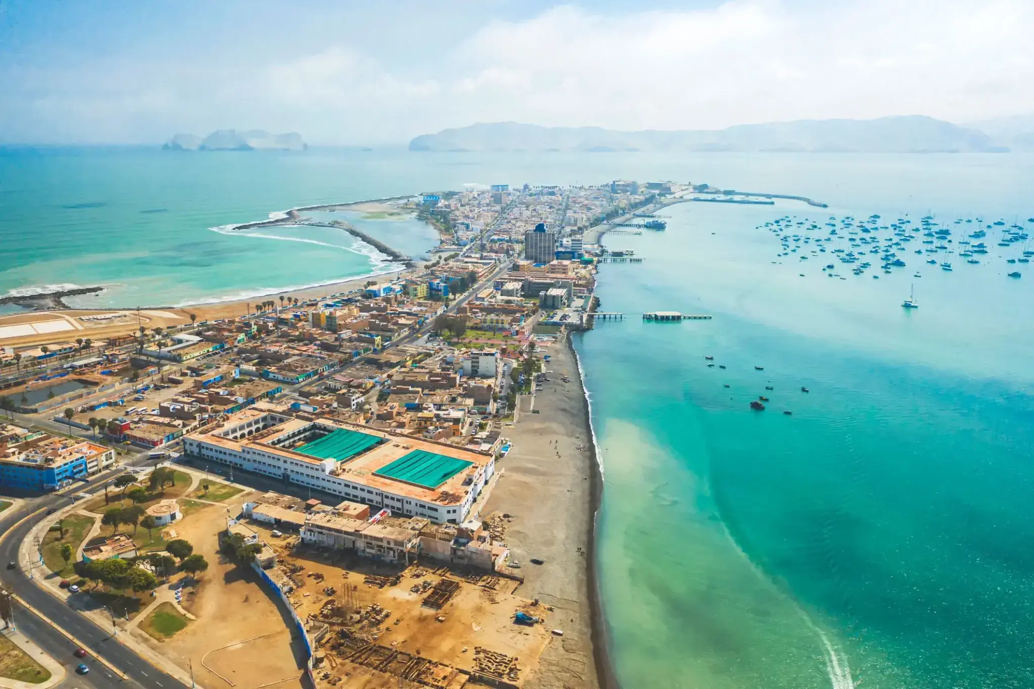
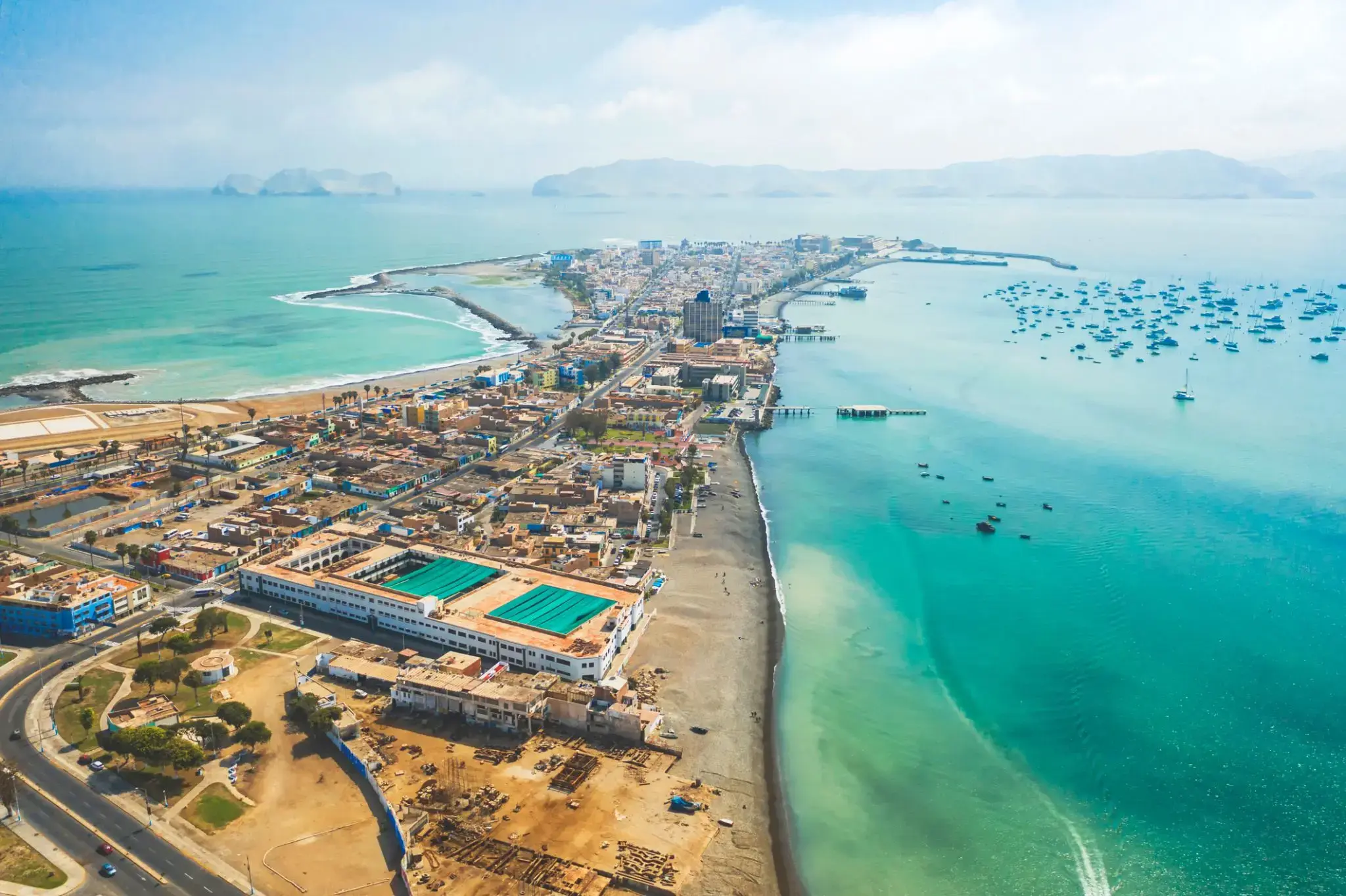
| 15 | 19.01 Wed | Callao / Peru | 13:00 | |
| 16 | 20.01 Thu | Callao / Peru | 09:00 | 17:00 |
| 17 | 21.01 Fri | Day at sea / Sea | ||
| 18 | 22.01 Sat | Day at sea / Sea | ||
| 19 | 23.01 Sun | Day at sea / Sea | ||
| 20 | 24.01 Mon | Day at sea / Sea | ||
| 21 | 25.01 Tue | Day at sea / Sea | ||
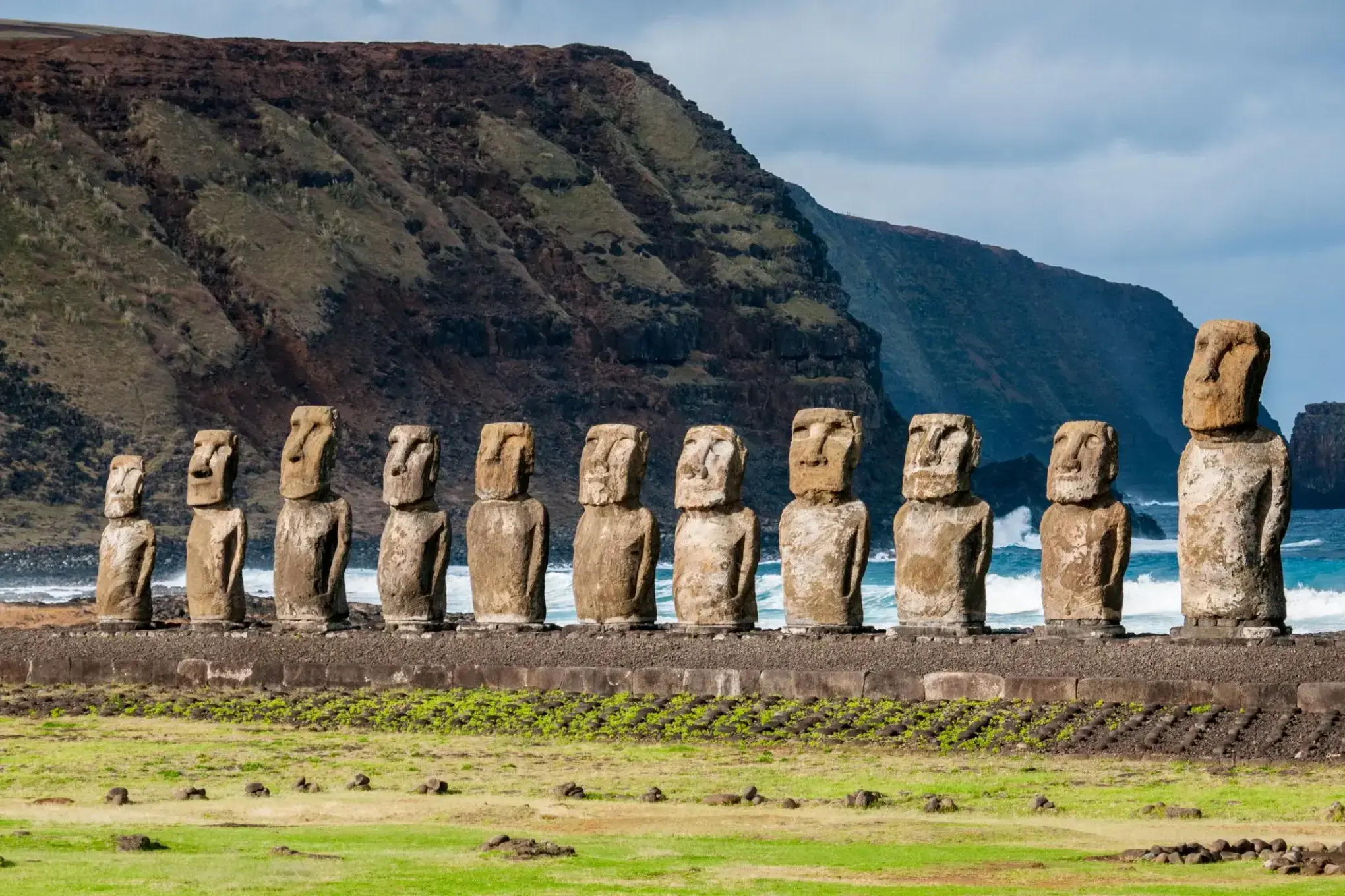
| 22 | 26.01 Wed | Easter Island / Chile | 08:00 | |
| 23 | 27.01 Thu | Easter Island / Chile | 13:00 | |
| 24 | 28.01 Fri | Day at sea / Sea | ||
| 25 | 29.01 Sat | Day at sea / Sea | ||
| 26 | 30.01 Sun | oh. Pitcairn | 09:00 | 17:00 |
| 27 | 31.01 Mon | Day at sea / Sea | 15:00 | |
| 28 | 1.02 Tue | Day at sea / Sea | ||
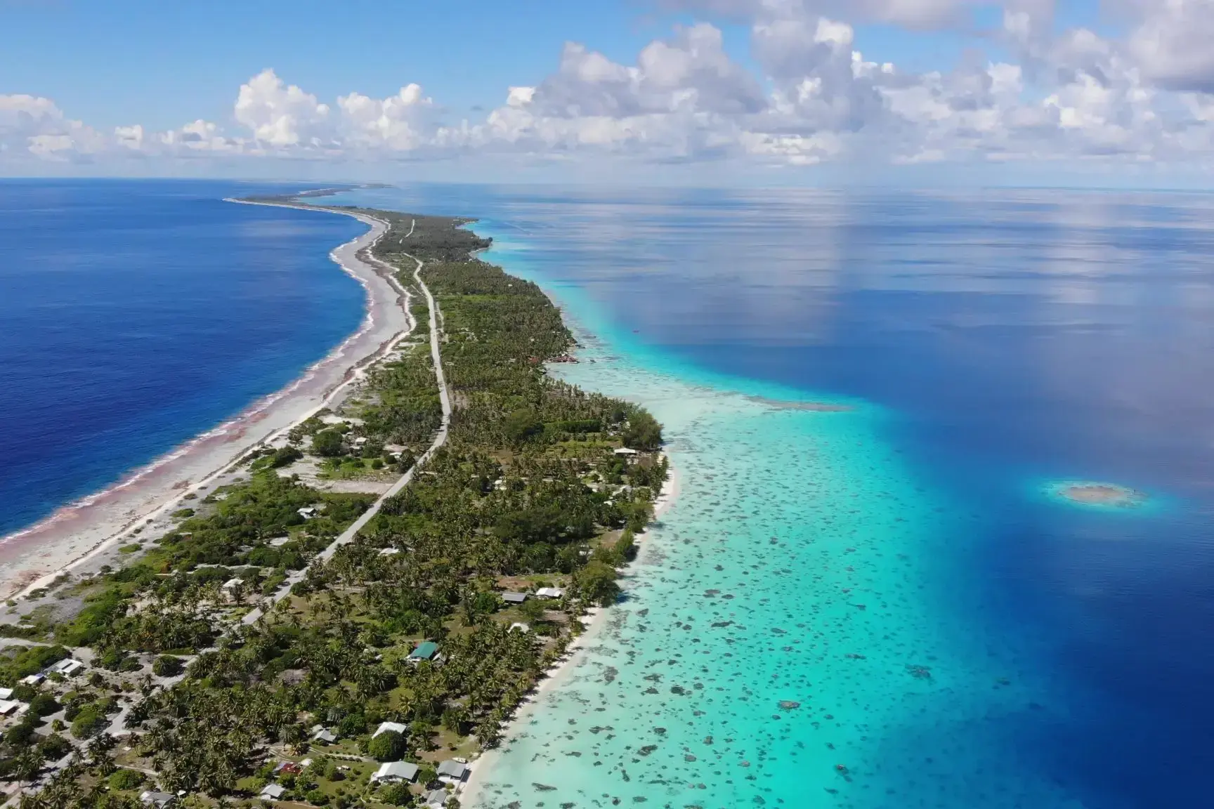
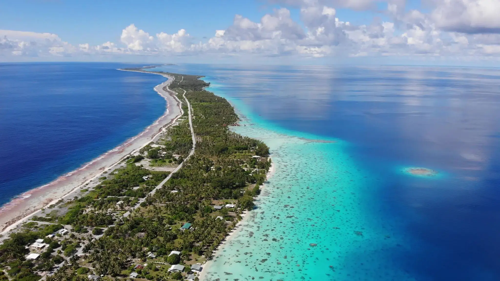
| 29 | 2.02 Wed | Fakarava / French Polynesia | 09:00 | 14:00 |
| 30 | 3.02 Thu | Moorea Islands Society / French Polynesia | 09:00 | |
| 31 | 4.02 Fri | Papeete / French Polynesia | 18:00 | |
| 32 | 5.02 Sat | Moorea Islands Society / French Polynesia | 15:30 | |
| 33 | 6.02 Sun | Papeete / French Polynesia | 09:00 | 18:00 |
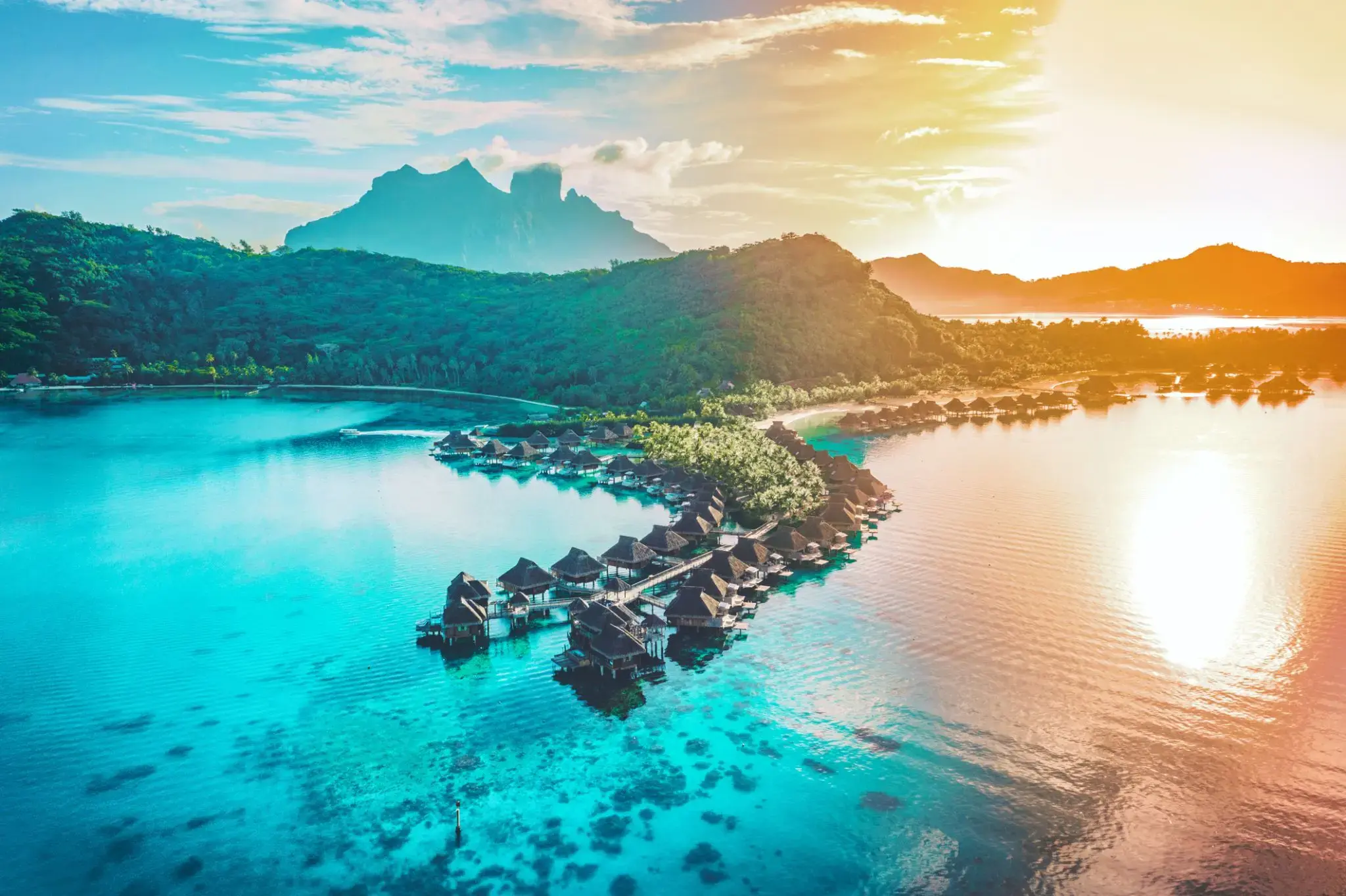
| 34 | 7.02 Mon | Bora Bora, Society Islands / French Polynesia | 08:00 | |
| 35 | 8.02 Tue | Bora Bora, Society Islands / French Polynesia | 18:00 | |
| 36 | 9.02 Wed | Day at sea / Sea | 15:00 | |
| 37 | 10.02 Thu | Day at sea / Sea | ||
| 38 | 11.02 Fri | Day at sea / Sea | ||
| 39 | 12.02 Sat | Day at sea / Sea | ||
| 40 | 13.02 Sun | Day at sea / Sea | ||
| 41 | 14.02 Mon | Day at sea / Sea | ||
| 42 | 15.02 Tue | Day at sea / Sea | ||
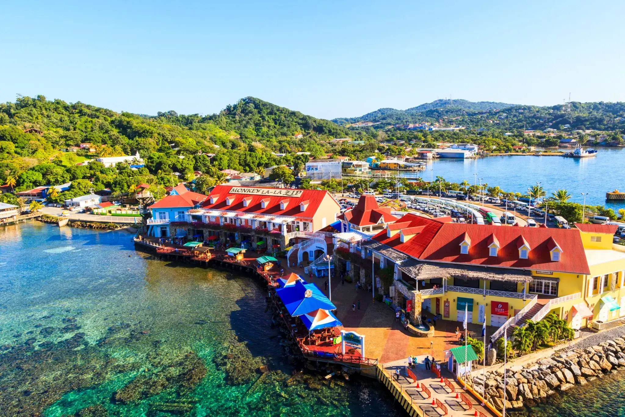
| 43 | 16.02 Wed | Cocksen Hole / Honduras | 08:00 | 19:00 |
| 44 | 17.02 Thu | Oakland / New Zealand | 07:00 |

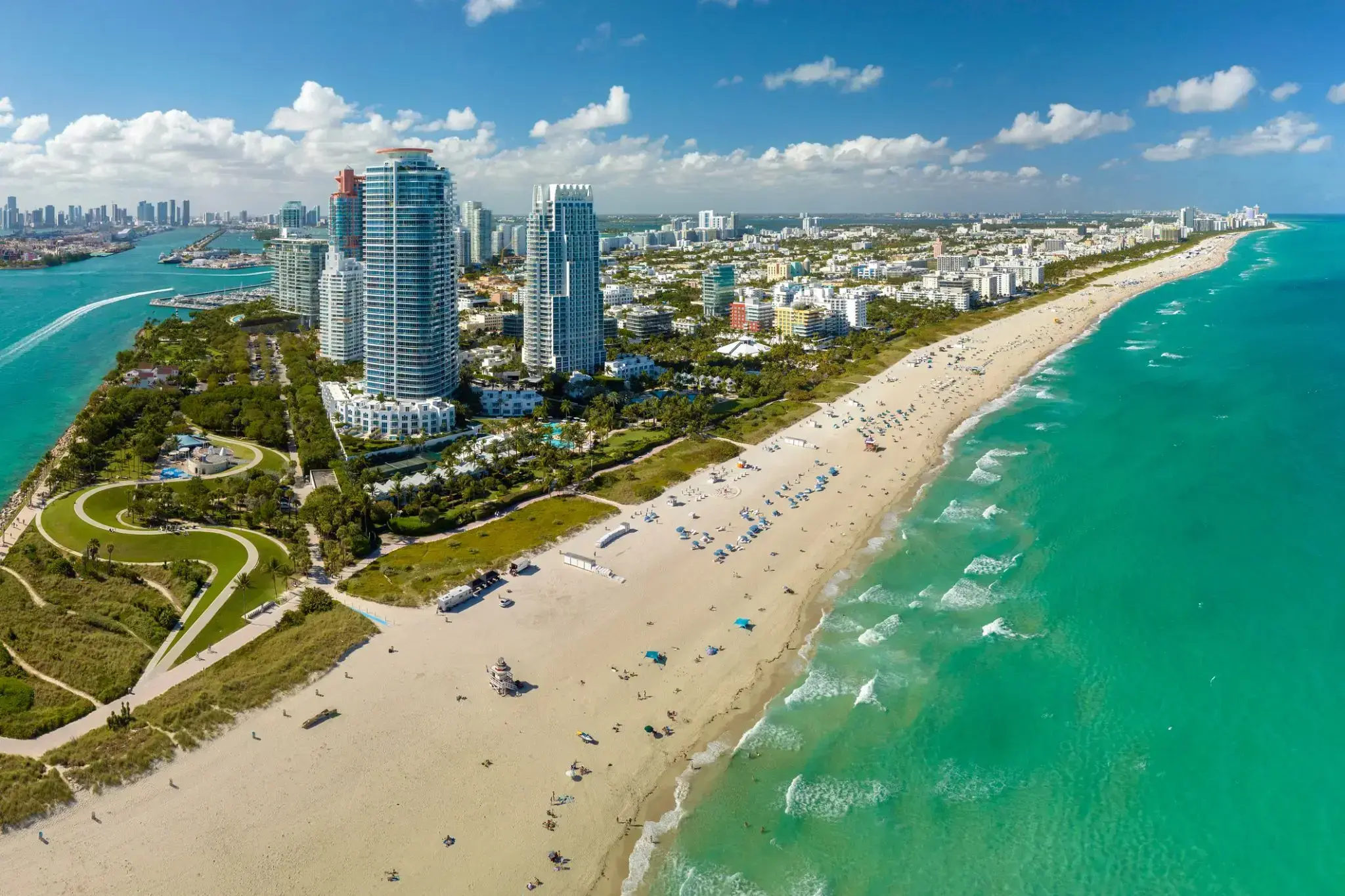
Miami, officially the City of Miami, is the cultural, economic and financial center of South Florida. Miami is the seat of Miami-Dade County, the most populous county in Florida. The city covers an area of about 56.6 square miles (147 km2), between the Everglades to the west and Biscayne Bay on the east; with a 2017 estimated population of 463,347, Miami is the sixth most densely populated major city in the United States. The Miami metropolitan area is home to 6.1 million people and the seventh-largest metropolitan area in the nation. Miami's metro area is the second-most populous metropolis in the southeastern United States and fourth-largest urban area in the U.S.
Miami is a major center, and a leader in finance, commerce, culture, media, entertainment, the arts, and international trade. The Miami Metropolitan Area is by far the largest urban economy in Florida and the 12th largest in the United States with a GDP of $344.9 billion as of 2017. In 2012, Miami was classified as an "Alpha−" level world city in the World Cities Study Group's inventory. In 2010, Miami ranked seventh in the United States and 33rd among global cities in terms of business activity, human capital, information exchange, cultural experience, and political engagement. In 2008, Forbes magazine ranked Miami "America's Cleanest City", for its year-round good air quality, vast green spaces, clean drinking water, clean streets, and citywide recycling programs. According to a 2009 UBS study of 73 world cities, Miami was ranked as the richest city in the United States, and the world's seventh-richest city in terms of purchasing power. Miami is nicknamed the "Capital of Latin America" and is the largest city with a Cuban-American plurality.
Greater Downtown Miami has one of the largest concentrations of international banks in the United States, and is home to many large national and international companies. The Civic Center is a major center for hospitals, research institutes, medical centers, and biotechnology industries. For more than two decades, the Port of Miami, known as the "Cruise Capital of the World", has been the number one cruise passenger port in the world. It accommodates some of the world's largest cruise ships and operations, and is the busiest port in both passenger traffic and cruise lines. Metropolitan Miami is also a major tourism hub in the southeastern U.S. for international visitors, ranking number two in the country after New York City.
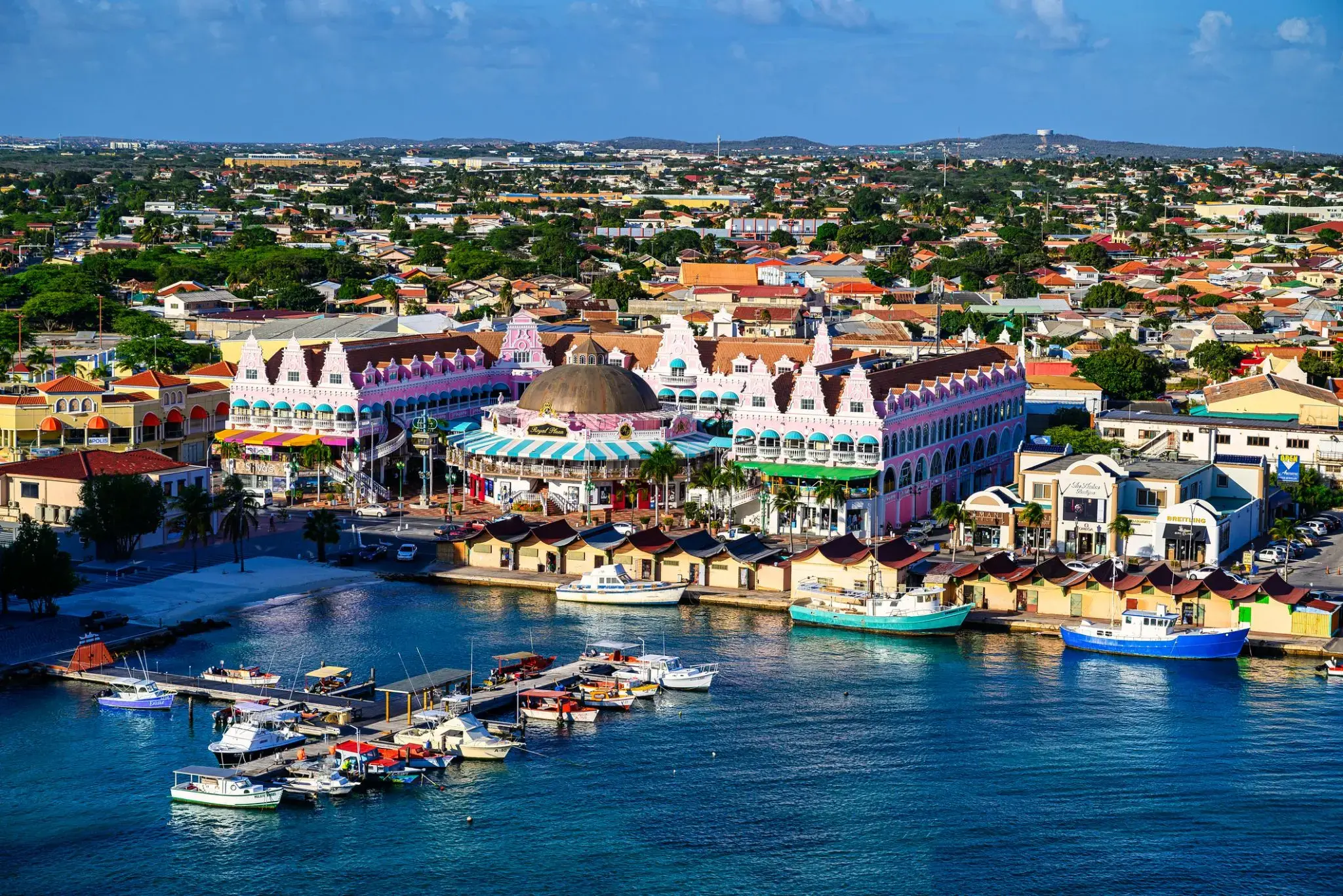
Aruba is an island and a constituent country of the Kingdom of the Netherlands in the southern Caribbean Sea, located about 1,600 kilometres (990 mi) west of the main part of the Lesser Antilles and 29 kilometres (18 mi) north of the coast of Venezuela. It measures 32 kilometres (20 mi) long from its northwestern to its southeastern end and 10 kilometres (6 mi) across at its widest point. Together with Bonaire and Curaçao, Aruba forms a group referred to as the ABC islands. Collectively, Aruba and the other Dutch islands in the Caribbean are often called the Dutch Caribbean.
Aruba is one of the four countries that form the Kingdom of the Netherlands, along with the Netherlands, Curaçao, and Sint Maarten; the citizens of these countries are all Dutch nationals. Aruba has no administrative subdivisions, but, for census purposes, is divided into eight regions. Its capital is Oranjestad.
Unlike much of the Caribbean region, Aruba has a dry climate and an arid, cactus-strewn landscape. This climate has helped tourism as visitors to the island can reliably expect warm, sunny weather. It has a land area of 179 km2(69.1 sq mi) and is densely populated, with a total of 102,484 inhabitants at the 2010 Census. It lies outside Hurricane Alley.
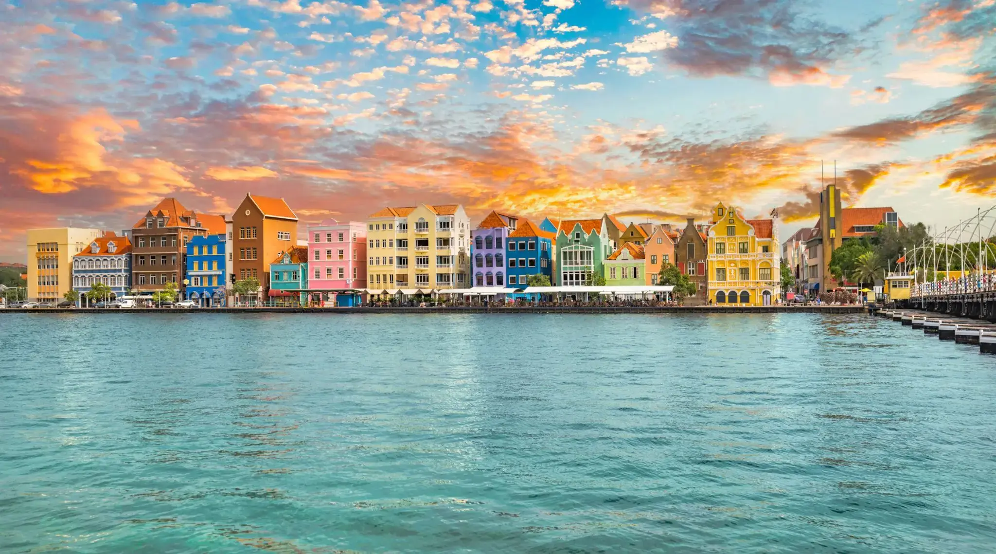
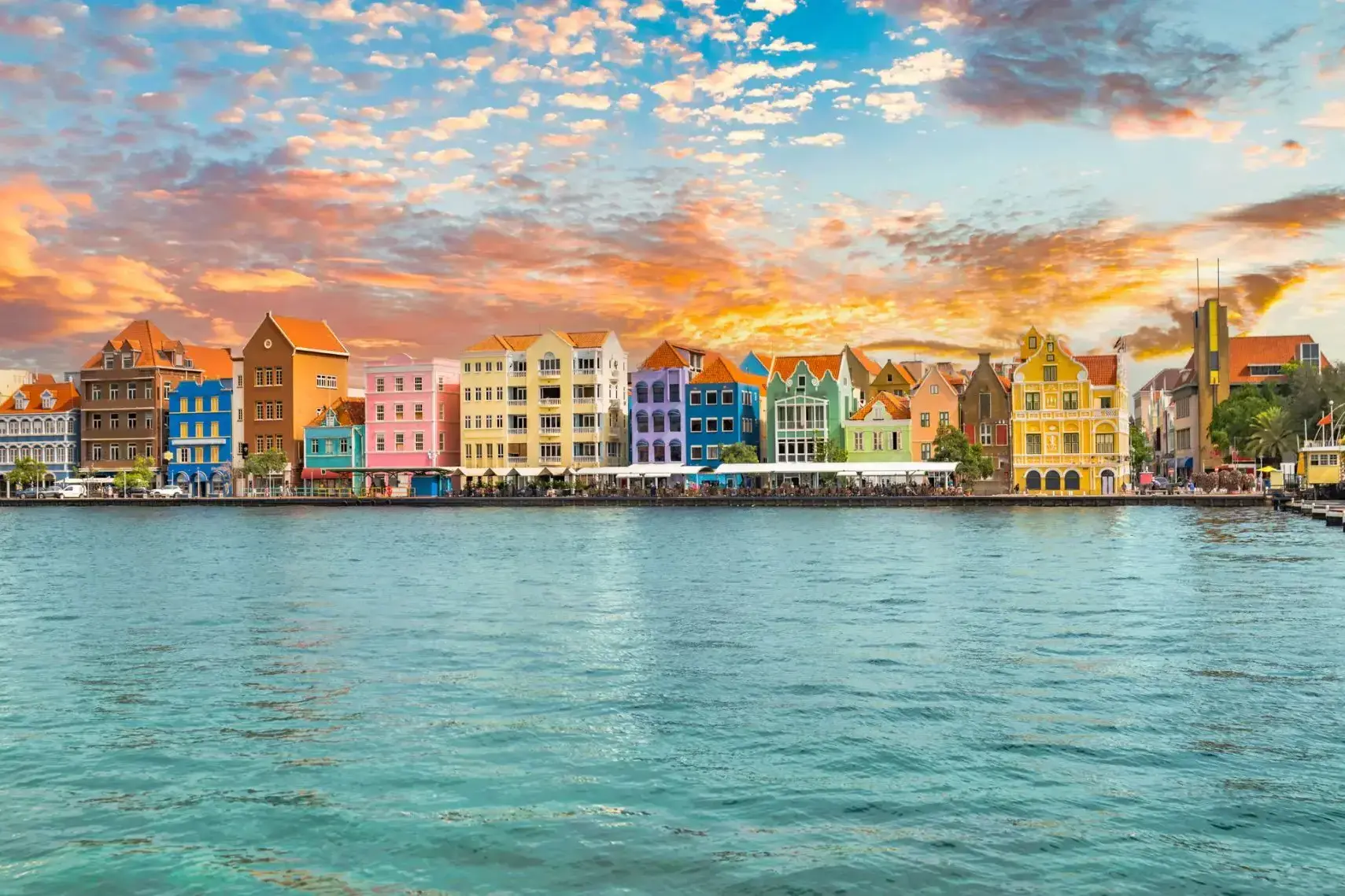
Curaçao is a Lesser Antilles island in the southern Caribbean Sea and the Dutch Caribbean region, about 65 km (40 mi) north of the Venezuelan coast. It is a constituent country (Dutch: land) of the Kingdom of the Netherlands.
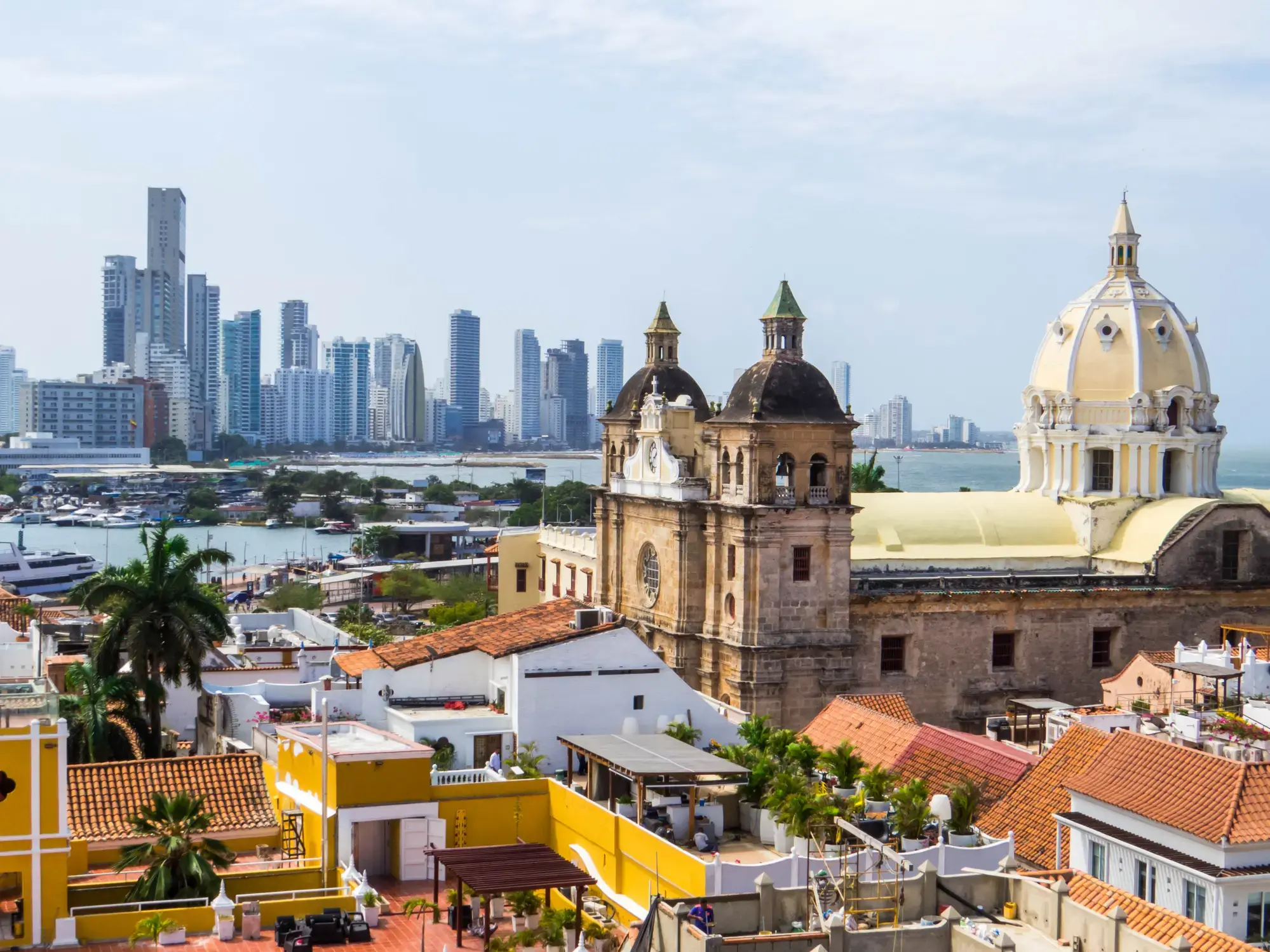
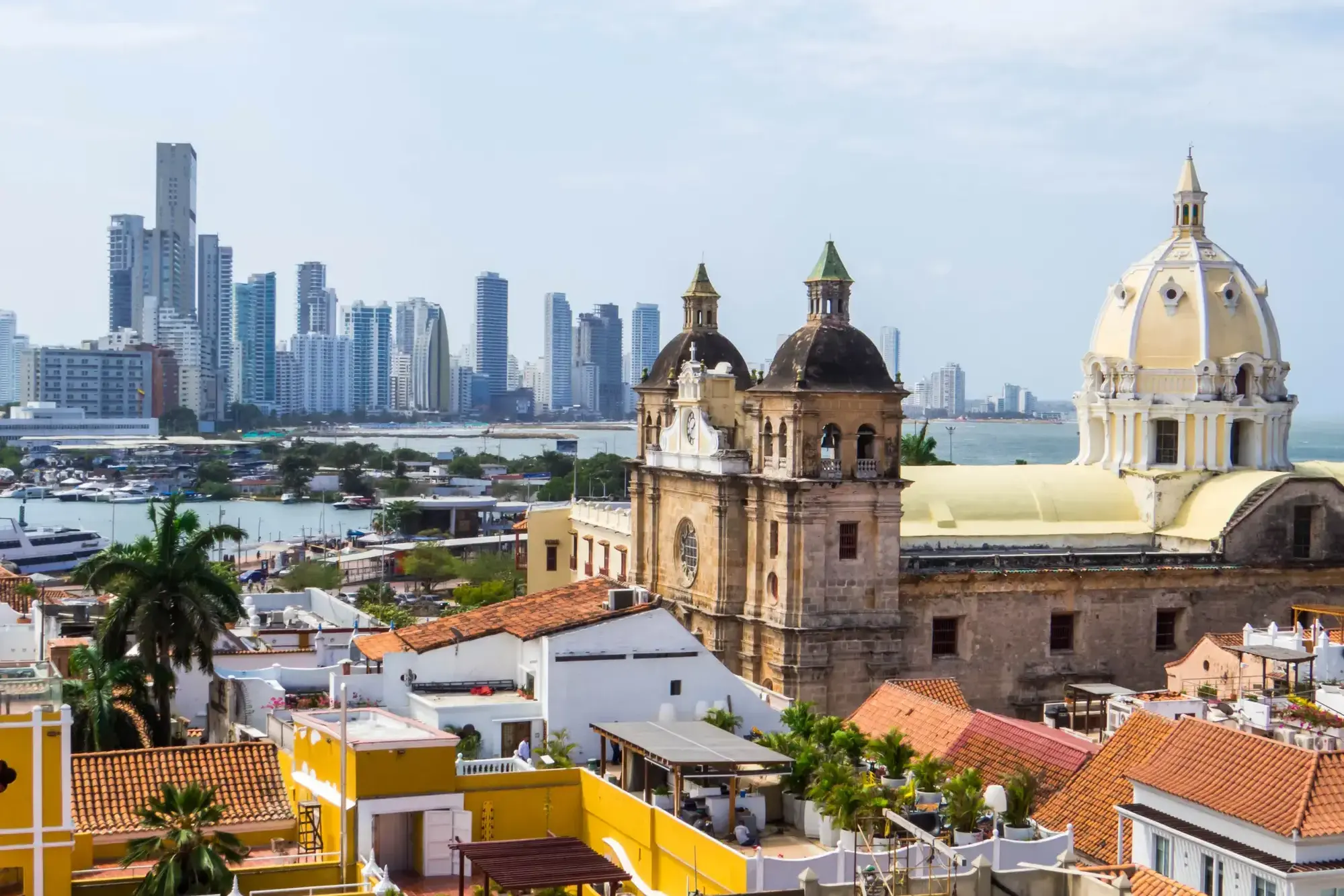
Ancient fortress walls, street musicians, and the Caribbean sun create an unforgettable atmosphere in Cartagena (Bolívar) — the gem of Colombia's coast. This city, listed as a UNESCO World Heritage Site, enchants visitors with its colonial architecture, charming courtyards, and the aroma of fresh coffee wafting from countless cafés.
Immerse yourself in the vibrant rhythm of Cartagena, strolling through the cobbled streets of the Old Town, where every corner holds tales of pirates and Spanish conquistadors. And the sunset near the ancient Castillo San Felipe de Barajas is the perfect ending to a day filled with culture, history, and tropical romance.

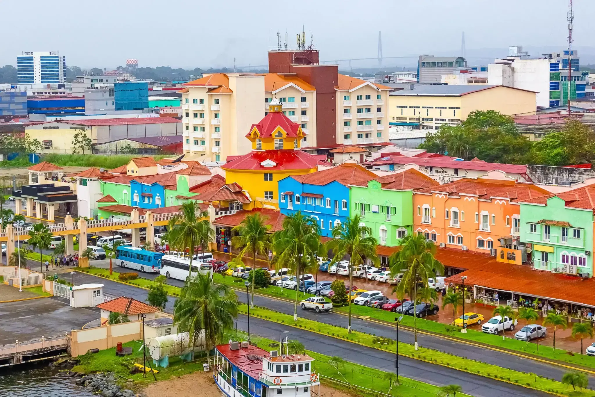
Colon

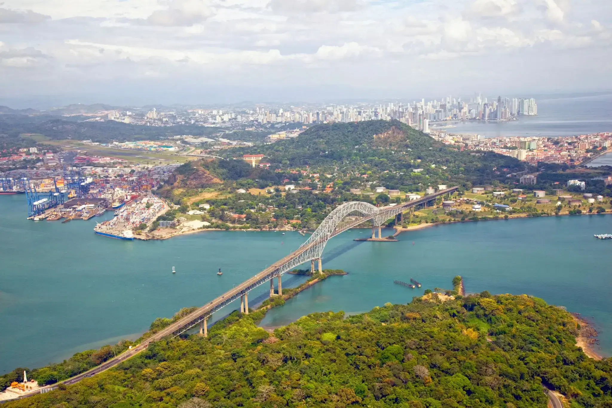
The Panama Canal is an artificial 82 km (51 mi) waterway in Panama that connects the Atlantic Ocean with the Pacific Ocean. The canal cuts across the Isthmus of Panama and is a conduit for maritime trade. Canal locks are at each end to lift ships up to Gatun Lake, an artificial lake created to reduce the amount of excavation work required for the canal, 26 m (85 ft) above sea level, and then lower the ships at the other end. The original locks are 34 m (110 ft) wide. A third, wider lane of locks was constructed between September 2007 and May 2016. The expanded canal began commercial operation on June 26, 2016. The new locks allow transit of larger, post-Panamax ships, capable of handling more cargo.
France began work on the canal in 1881, but stopped due to engineering problems and a high worker mortality rate. The United States took over the project in 1904 and opened the canal on August 15, 1914. One of the largest and most difficult engineering projects ever undertaken, the Panama Canal shortcut greatly reduced the time for ships to travel between the Atlantic and Pacific Oceans, enabling them to avoid the lengthy, hazardous Cape Horn route around the southernmost tip of South America via the Drake Passage or Strait of Magellan.
Colombia, France, and later the United States controlled the territory surrounding the canal during construction. The US continued to control the canal and surrounding Panama Canal Zone until the 1977 Torrijos–Carter Treatiesprovided for handover to Panama. After a period of joint American–Panamanian control, in 1999, the canal was taken over by the Panamanian government. It is now managed and operated by the government-owned Panama Canal Authority.

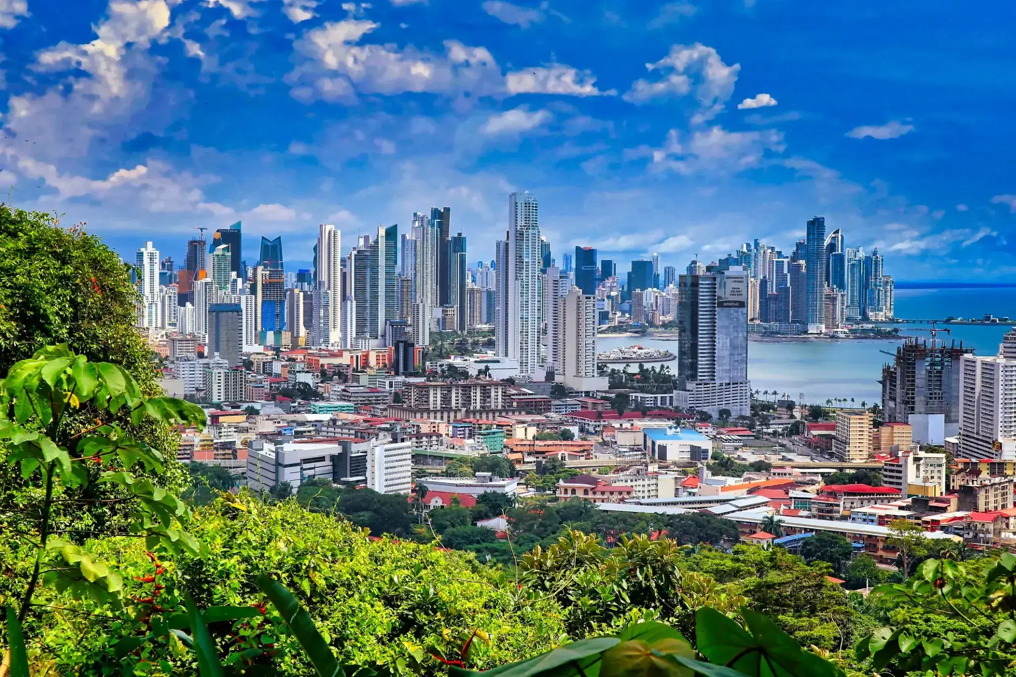
Panama City, located on the northwestern coast of Florida, is known for its long white beaches with soft quartz sand and the warm emerald waters of the Gulf of Mexico. This resort town is popular among both family vacationers and lovers of water activities: here you can enjoy kayaking, parasailing, diving, and fishing. One of the highlights is the local promenade — Pier Park — home to shops, restaurants, and entertainment venues.
In addition to beach relaxation, Panama City offers unique natural attractions. Nearby is the St. Andrews State Park, where visitors can watch dolphins, walk along trails through dunes and pine forests, or take a trip to Shell Island, a place of untouched nature. The city blends a resort atmosphere with Southern charm, offering a peaceful yet activity-filled vacation experience.
Manta


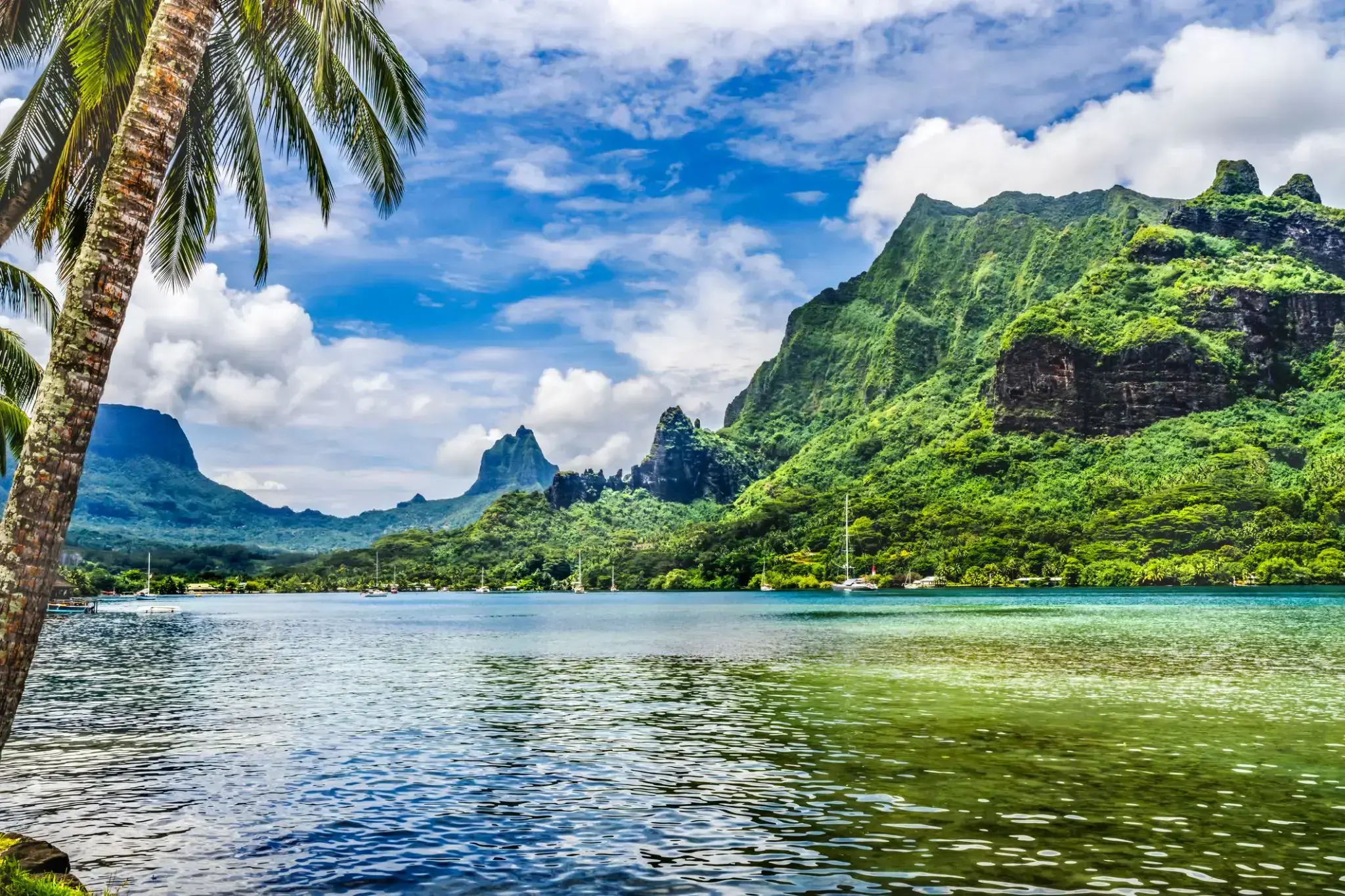
The island was formed as a volcano 1.5 to 2.5 million years ago, the result of a Society hotspot in the mantle under the oceanic plate that formed the whole of the Society Archipelago. It is theorized that the current bays were formerly river basins that filled during the Holocene searise.
Mo'orea is about 10 miles in width from the west to the east. There are two small, nearly symmetrical bays on the north shore. The one to the west is called 'Ōpūnohu Bay, which is not very populated but many travelers have come into the bay. The main surrounding communes of the bay are Piha'ena in the east and Papetō'ai to the west. The one to the east is Cook's Bay, also called Pao Pao Bay since the largest commune of Mo'orea is at the bottom of the bay. The other communes are Piha'ena to the west and busy Maharepa to the east. The highest point is Mount Tohi'e'a, near the center of Mo'orea. It dominates the vista from the two bays and can be seen from Tahiti. There are also hiking trails in the mountains. The Vai'are Bay is another small inlet, smaller than the two main bays, on the east shore. This bay has been settled a lot and has a lot of business. The main village is located just south of the bay.

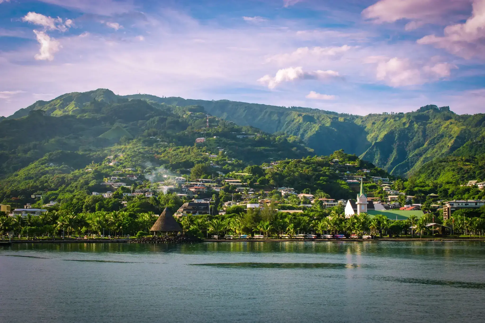
Papeete is the capital city of French Polynesia, an overseas collectivity of France in the Pacific Ocean. The commune of Papeete is located on the island of Tahiti, in the administrative subdivision of the Windward Islands, of which Papeete is the administrative capital. The French High Commissioner also resides in Papeete. It is the primary center of Tahitian and French Polynesian public and private governmental, commercial, industrial and financial services, the hub of French Polynesian tourism and a commonly used port of call. The Windward Islands are themselves part of the Society Islands. The name Papeete means "water from a basket".
The urban area of Papeete had a total population of 136,771 inhabitants at the August 2017 census, 26,926 of whom lived in the commune of Papeete proper.
The island was formed as a volcano 1.5 to 2.5 million years ago, the result of a Society hotspot in the mantle under the oceanic plate that formed the whole of the Society Archipelago. It is theorized that the current bays were formerly river basins that filled during the Holocene searise.
Mo'orea is about 10 miles in width from the west to the east. There are two small, nearly symmetrical bays on the north shore. The one to the west is called 'Ōpūnohu Bay, which is not very populated but many travelers have come into the bay. The main surrounding communes of the bay are Piha'ena in the east and Papetō'ai to the west. The one to the east is Cook's Bay, also called Pao Pao Bay since the largest commune of Mo'orea is at the bottom of the bay. The other communes are Piha'ena to the west and busy Maharepa to the east. The highest point is Mount Tohi'e'a, near the center of Mo'orea. It dominates the vista from the two bays and can be seen from Tahiti. There are also hiking trails in the mountains. The Vai'are Bay is another small inlet, smaller than the two main bays, on the east shore. This bay has been settled a lot and has a lot of business. The main village is located just south of the bay.
Papeete is the capital city of French Polynesia, an overseas collectivity of France in the Pacific Ocean. The commune of Papeete is located on the island of Tahiti, in the administrative subdivision of the Windward Islands, of which Papeete is the administrative capital. The French High Commissioner also resides in Papeete. It is the primary center of Tahitian and French Polynesian public and private governmental, commercial, industrial and financial services, the hub of French Polynesian tourism and a commonly used port of call. The Windward Islands are themselves part of the Society Islands. The name Papeete means "water from a basket".
The urban area of Papeete had a total population of 136,771 inhabitants at the August 2017 census, 26,926 of whom lived in the commune of Papeete proper.