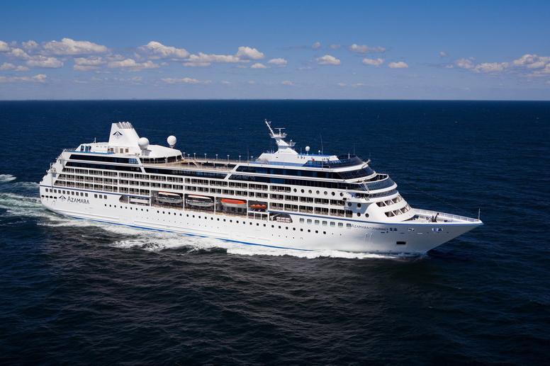
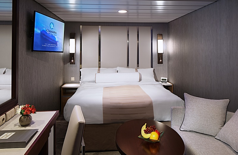
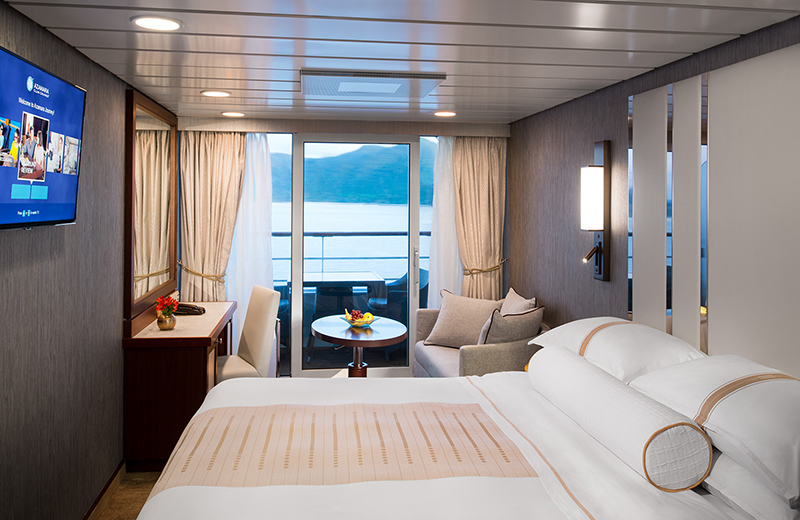
| Company : Azamara Cruises |
| Ship : Azamara Journey |
| Journey Start : չրք 07 հլս 2027 |
| Journey End : հնգ 09 սեպ 2027 |
| Count Nights : 64 nights |
| Day | Date | Port | Arrival | Departure |
|---|---|---|---|---|
| 1 | 7.07 չրք | Պորտսմութ / Dominica | 18:00 | |
| 2 | 8.07 հնգ | Օր ծովում / Sea | ||
| 3 | 9.07 ուր | Լիվերպուլ | 07:00 | 22:00 |
| 4 | 10.07 շբթ | Դուբլին / Ireland | 08:00 | |
| 5 | 11.07 կիր | Դուբլին / Ireland | 18:00 | |
| 6 | 12.07 երկ | Գրինոկ / Scotland | 07:30 | 21:00 |
| 7 | 13.07 երք | Դուգլաս / Maine Island | 08:00 | 18:00 |
| 8 | 14.07 չրք | Օր ծովում / Sea | ||
| 9 | 15.07 հնգ | Ինվերգորդոն / Great Britain | 07:30 | 20:00 |
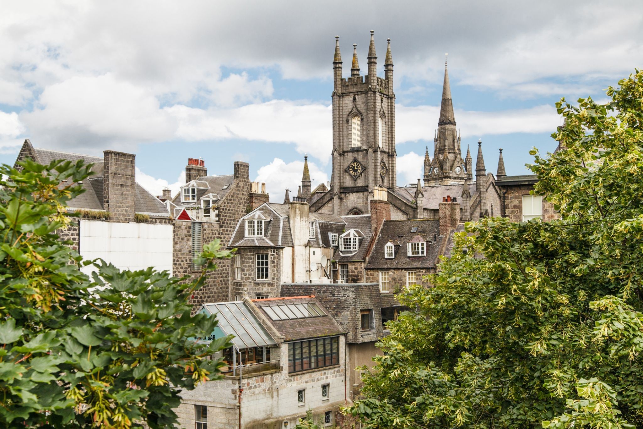
| 10 | 16.07 ուր | Աբերդին / Great Britain | 07:30 | 19:00 |
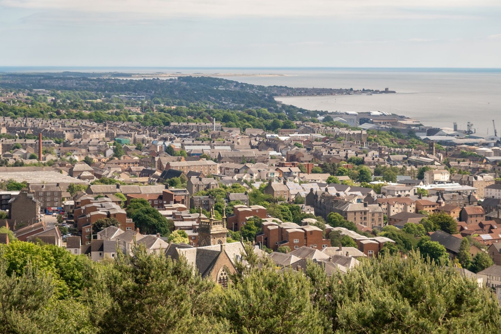
| 11 | 17.07 շբթ | Դանդի / Great Britain | 02:13 | |
| 12 | 18.07 կիր | Դանդի / Great Britain | 23:30 | |
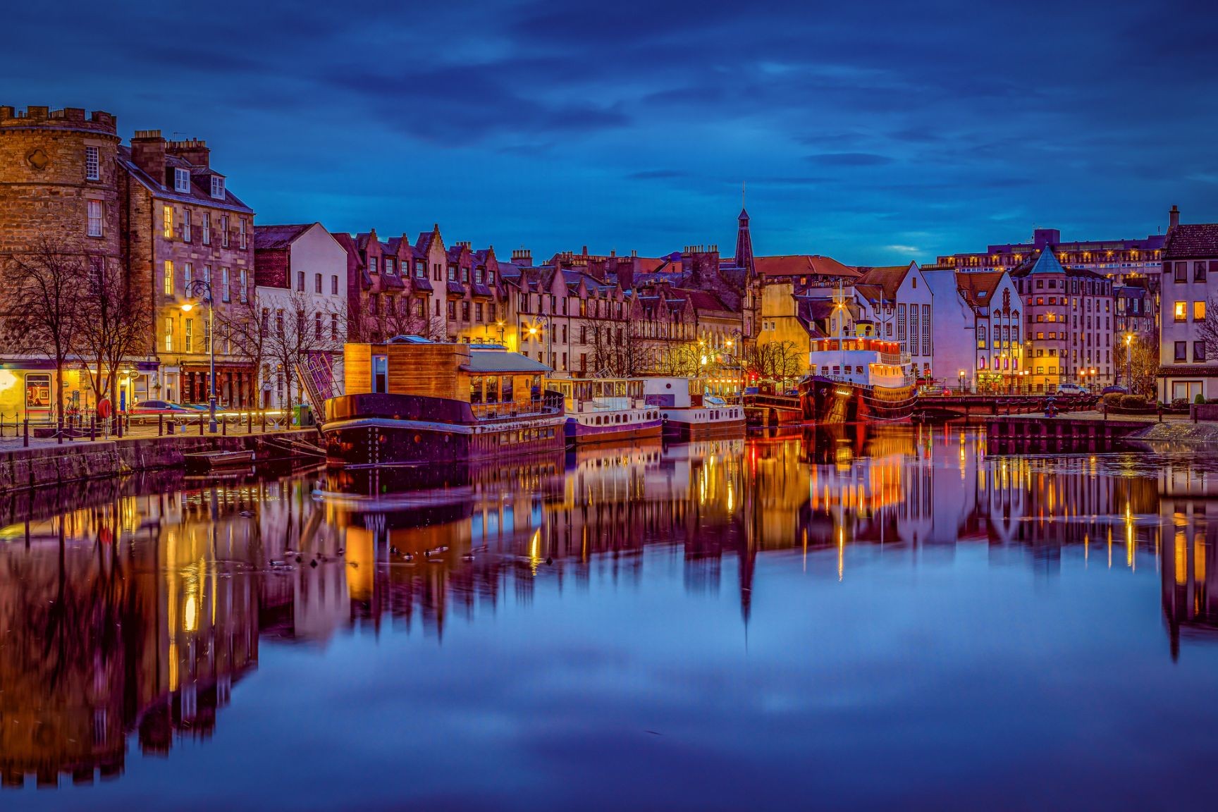
| 13 | 19.07 երկ | Լեյթ, Էդինբուրգ / Great Britain | 16:30 | |
| 14 | 20.07 երք | Լեյթ, Էդինբուրգ / Great Britain | 08:00 | 21:00 |
| 15 | 21.07 չրք | Օր ծովում / Sea | ||
| 16 | 22.07 հնգ | Ռոզենդալ / Norway | 08:00 | 17:00 |
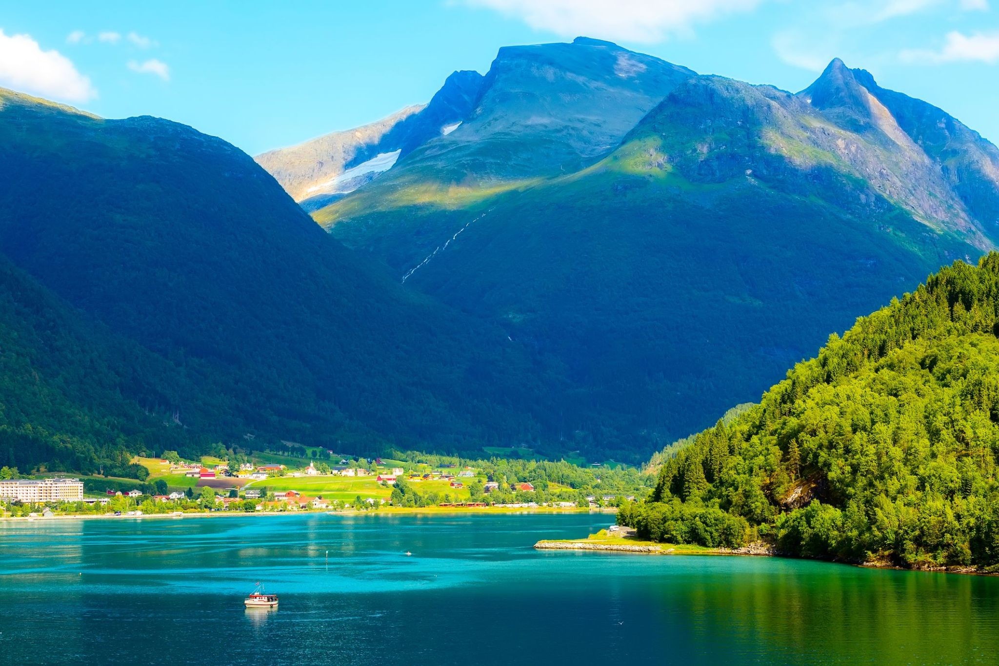
| 17 | 23.07 ուր | Օլդեն / Norway | 09:00 | 20:00 |
| 18 | 24.07 շբթ | Օլեսից / Norway | 08:00 | 22:00 |
| 19 | 25.07 կիր | Օր ծովում / Sea | ||
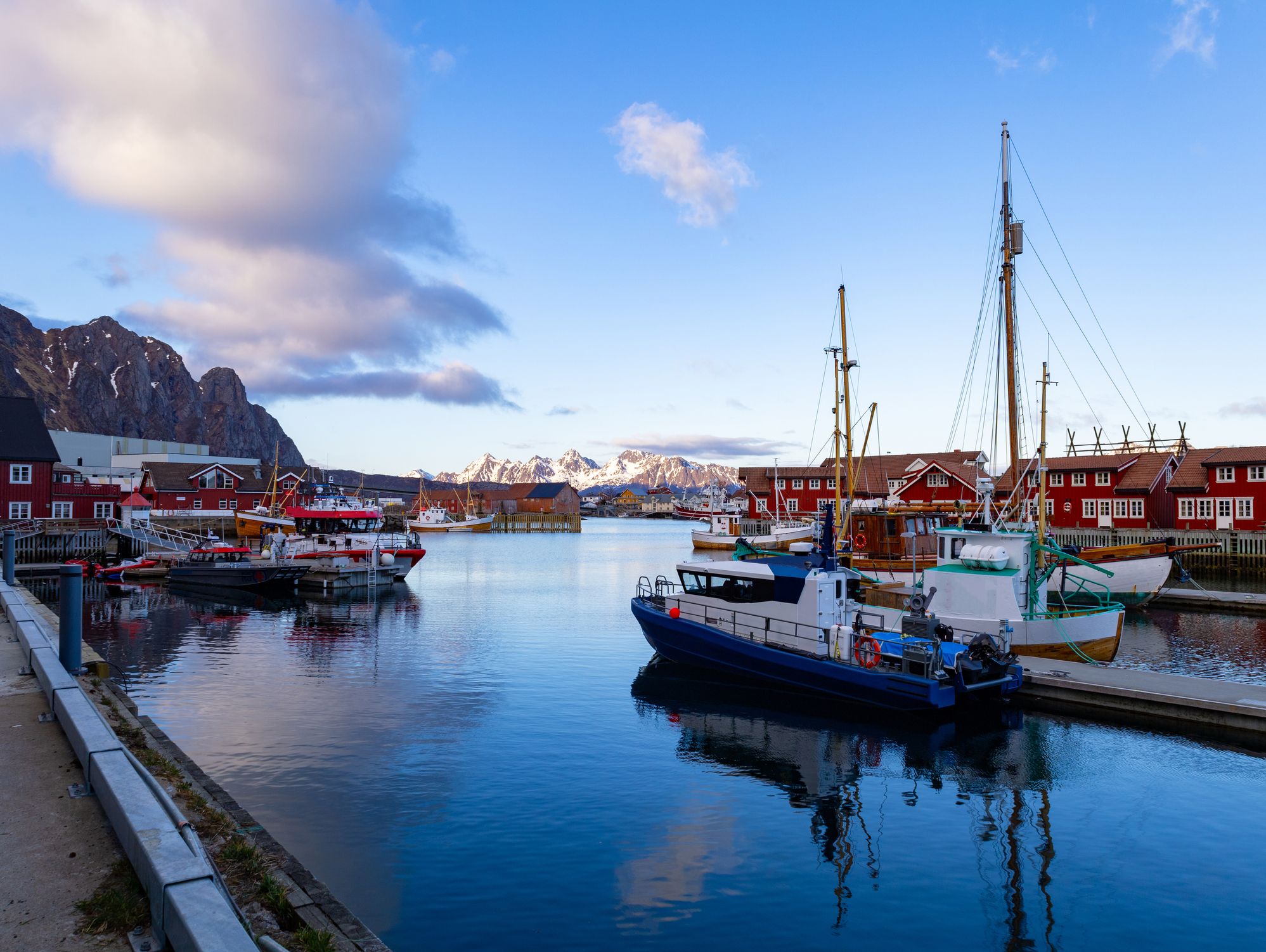
| 20 | 26.07 երկ | Սվոլվեր / Norway | 07:00 | 17:00 |
| 21 | 27.07 երք | ՏՐՈԼ ՖՅՈՐԴ | 18:30 | 19:00 |
| 22 | 28.07 չրք | Տրոմսյո / Norway | 09:00 | 22:00 |
| 23 | 29.07 հնգ | Հոննինսվոգ / Norway | 14:00 | 20:00 |
| 24 | 30.07 ուր | Հոննինսվոգ / Norway | 23:58 | |
| 25 | 31.07 շբթ | Ալթա / Norway | 09:00 | 17:00 |
| 26 | 1.08 կիր | Հարստադ / Norway | 10:00 | 22:00 |
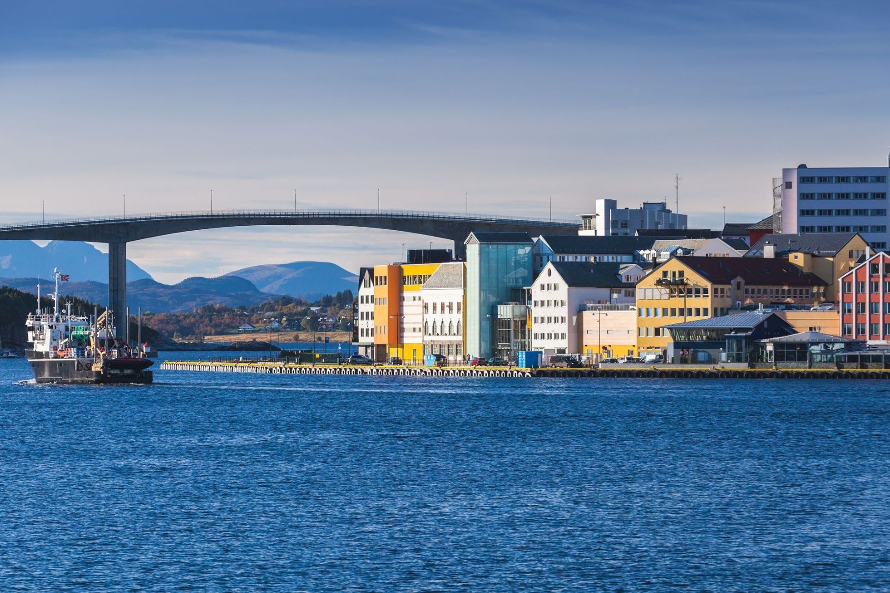
| 27 | 2.08 երկ | Բոդո / Norway | 07:00 | 17:00 |
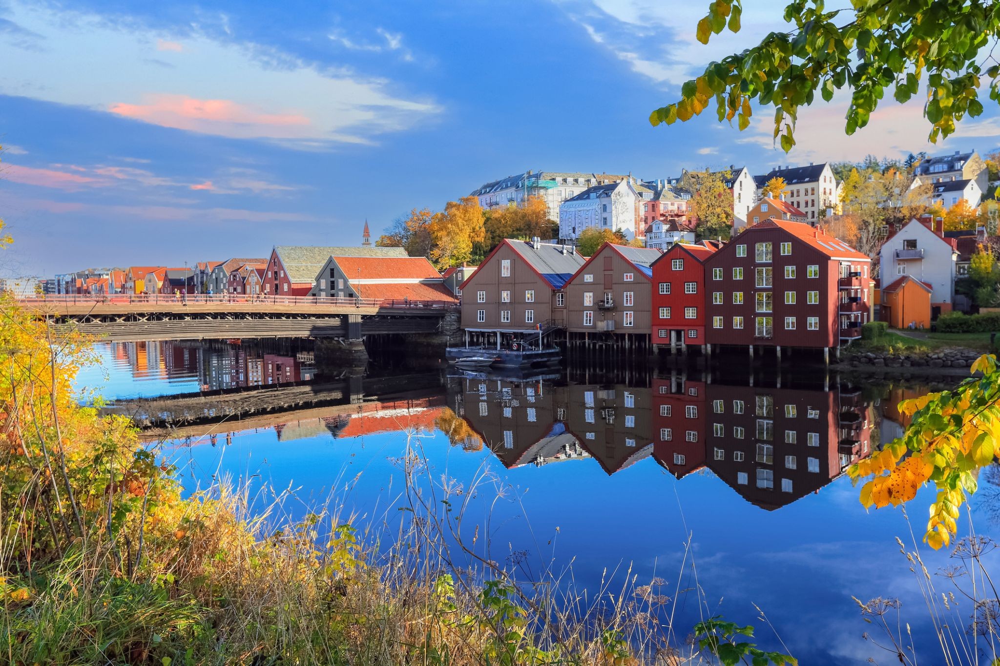
| 28 | 3.08 երք | Տրոնհեյմ / Norway | 13:30 | 22:00 |
| 29 | 4.08 չրք | Քրիստիանսանդ / Norway | 08:00 | 20:00 |
| 30 | 5.08 հնգ | Օր ծովում / Sea | ||
| 31 | 6.08 ուր | Արենդալ / Norway | 08:00 | 22:00 |
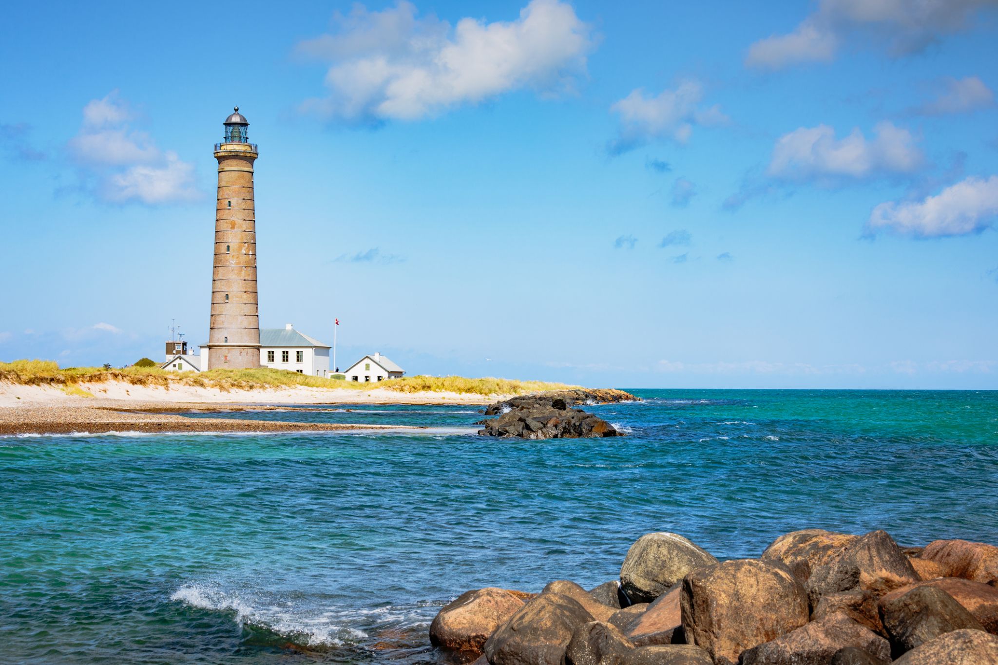
| 32 | 7.08 շբթ | Սկագեն / Denmark | 08:00 | 17:00 |
| 33 | 8.08 կիր | Կոպենհագեն / Denmark | 06:00 | 17:00 |
| 34 | 9.08 երկ | Վիսբի / Sweden | 13:30 | 20:00 |
| 35 | 10.08 երք | Ստոկհոլմ / Sweden | 08:00 | |
| 36 | 11.08 չրք | Ստոկհոլմ / Sweden | 15:00 | |
| 37 | 12.08 հնգ | Հելսինկի / Finland | 08:00 | 22:00 |
| 38 | 13.08 ուր | Տալլին / Estonia | 08:00 | 22:00 |
| 39 | 14.08 շբթ | Օր ծովում / Sea | ||
| 40 | 15.08 կիր | Ռիգա / Latvia | 07:00 | 18:00 |
| 41 | 16.08 երկ | Կլայպեդա (Մեմել) / Lithuania | 13:00 | 22:00 |
| 42 | 17.08 երք | Գդանսկ / Poland | 07:30 | 21:00 |
| 43 | 18.08 չրք | Ռոննե / Denmark | 11:00 | 20:00 |
| 44 | 19.08 հնգ | Կոպենհագեն / Denmark | 06:00 | 17:00 |
| 45 | 20.08 ուր | Գյոթեբորգ / Sweden | 08:00 | 17:00 |
| 46 | 21.08 շբթ | Օր ծովում / Sea | ||
| 47 | 22.08 կիր | Լեյթ, Էդինբուրգ / Great Britain | 05:00 | |
| 48 | 23.08 երկ | Լեյթ, Էդինբուրգ / Great Britain | 16:00 | |
| 49 | 24.08 երք | Դանդի / Great Britain | 05:45 | |
| 50 | 25.08 չրք | Աբերդին / Great Britain | 09:30 | 22:00 |
| 51 | 26.08 հնգ | Դանդի / Great Britain | 02:00 | |
| 52 | 27.08 ուր | Ինվերգորդոն / Great Britain | 08:00 | 20:00 |
| 53 | 28.08 շբթ | Օր ծովում / Sea | ||
| 54 | 29.08 կիր | Օբան / Great Britain | 08:00 | 18:00 |
| 55 | 30.08 երկ | Գրինոկ / Scotland | 07:30 | 20:00 |
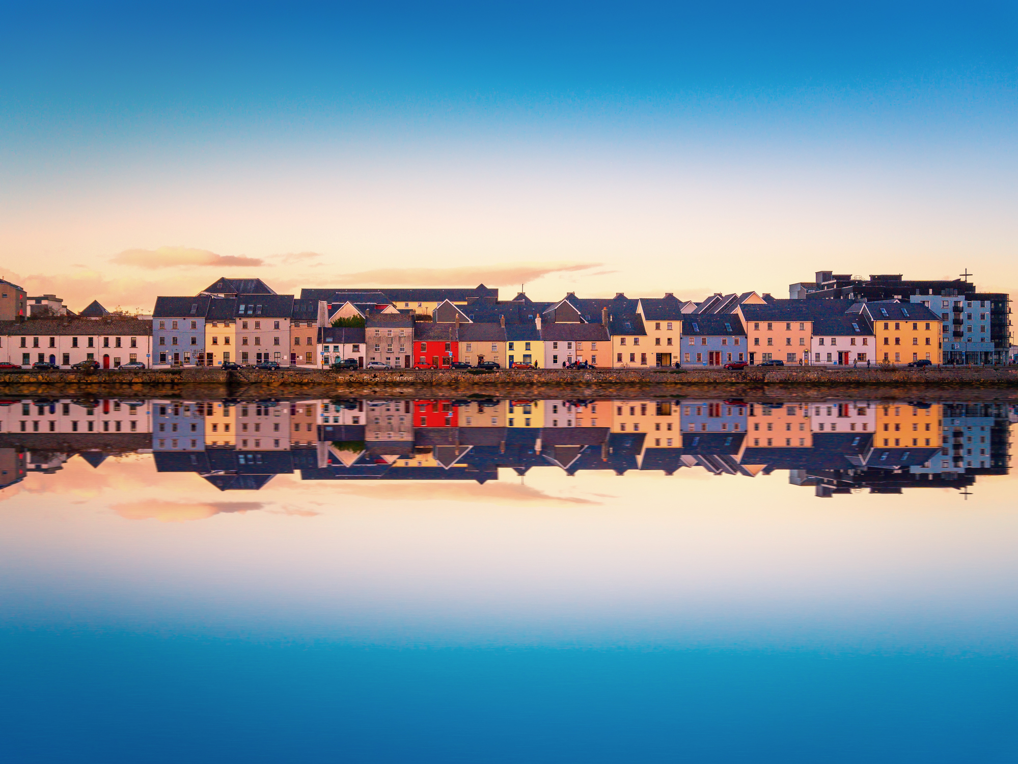
| 56 | 31.08 երք | Դուգլաս / Maine Island | 08:00 | 17:00 |
| 57 | 1.09 չրք | Դուբլին / Ireland | 06:00 | |
| 58 | 2.09 հնգ | Դուբլին / Ireland | 18:00 | |
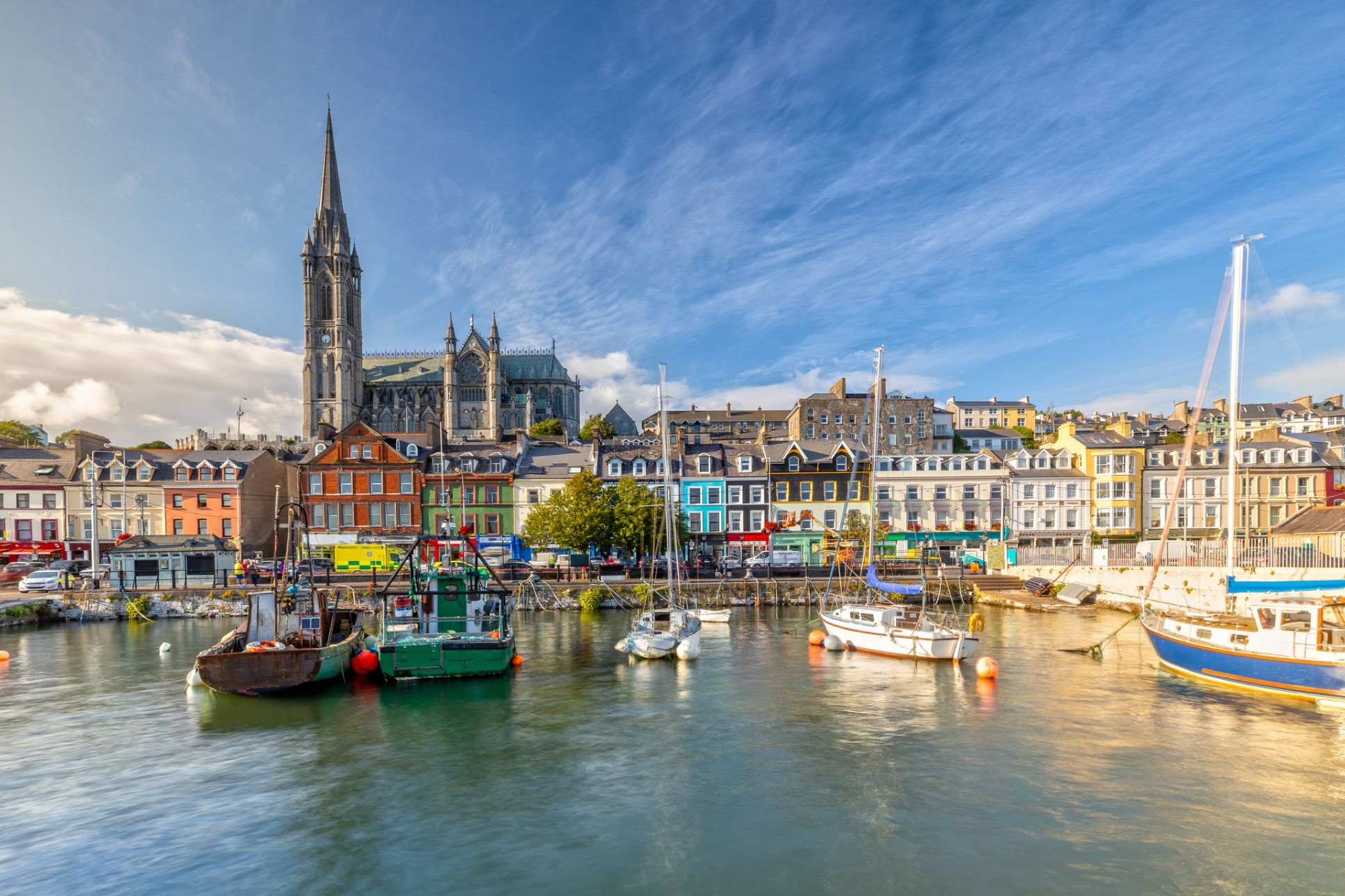
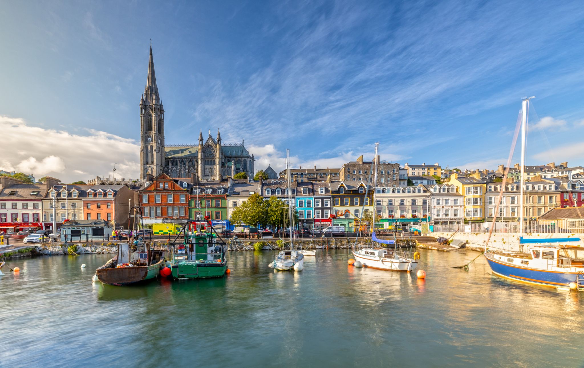
| 59 | 3.09 ուր | Կոբհ / Ireland | 07:30 | 20:00 |
| 60 | 4.09 շբթ | BANTRY HARBOR | 08:00 | 18:00 |
| 61 | 5.09 կիր | Ֆոյնս, Լիմերիկ / Ireland | 07:00 | 20:00 |
| 62 | 6.09 երկ | Գոլվեյ / Ireland | 08:00 | 18:00 |
| 63 | 7.09 երք | Դոնեգալ | 07:30 | 18:00 |
| 64 | 8.09 չրք | Բելֆաստ / Great Britain | 09:00 | |
| 65 | 9.09 հնգ | Բելֆաստ / Great Britain | 20:00 | |
| 66 | 10.09 ուր | Օր ծովում / Sea | ||
| 67 | 11.09 շբթ | Ես փայփայեցի | 08:00 | 18:00 |
| 68 | 12.09 կիր | Պորտսմութ / Dominica | 06:00 |
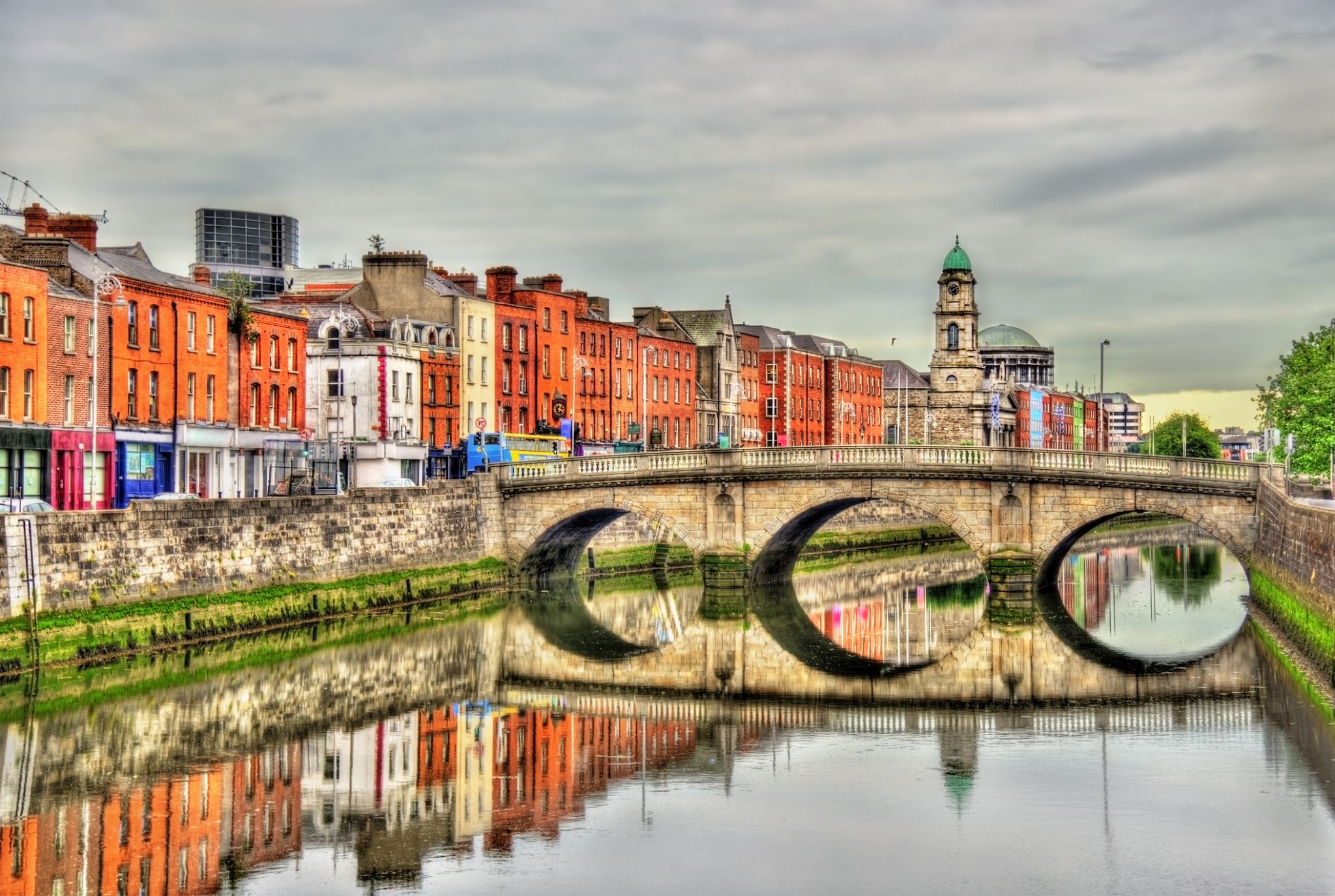
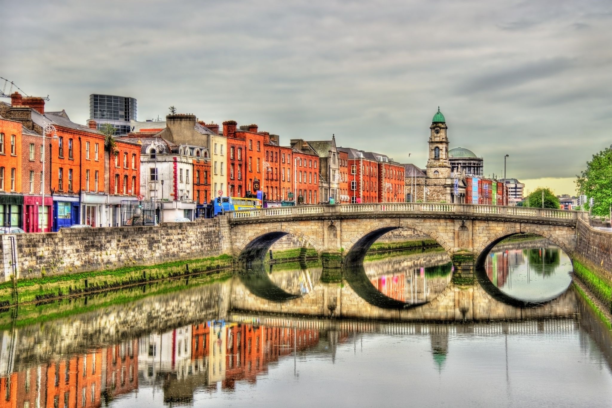
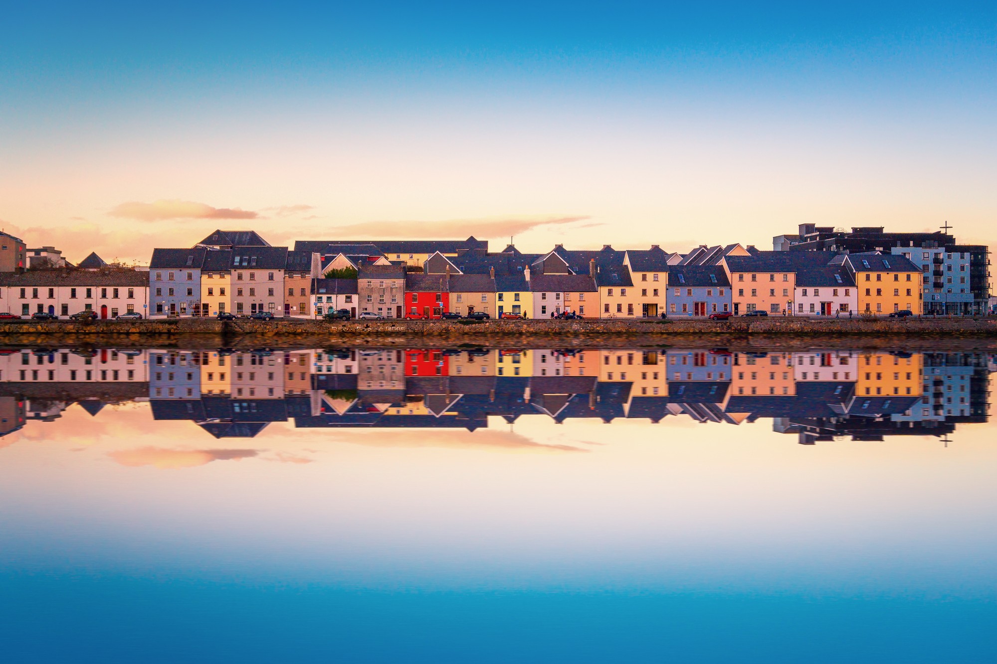
Dublin is the capital of, and largest city in, Ireland. It is on the east coast of Ireland, in the province of Leinster, at the mouth of the River Liffey, and is bordered on the south by the Wicklow mountains. It has an urban area population of 1,173,179, while the population of the Dublin Region (formerly County Dublin), as of 2016, was 1,347,359, and the population of the Greater Dublin area was 1,904,806.
There is archaeological debate regarding precisely where Dublin was established by Celtic-speaking people in the 7th century AD. Later expanded as a Viking settlement, the Kingdom of Dublin, the city became Ireland's principal settlement following the Norman invasion. The city expanded rapidly from the 17th century and was briefly the second largest city in the British Empire before the Acts of Union in 1800. Following the partition of Ireland in 1922, Dublin became the capital of the Irish Free State, later renamed Ireland.
Dublin is a historical and contemporary centre for education, the arts, administration and industry. As of 2018 the city was listed by the Globalization and World Cities Research Network (GaWC) as a global city, with a ranking of "Alpha -", which places it amongst the top thirty cities in the world.

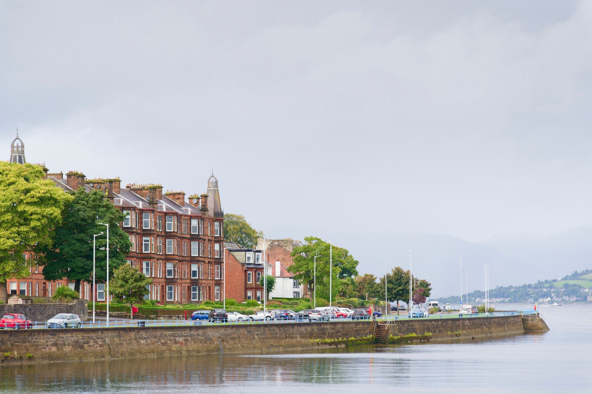
Գրինոքը Շոտլանդիայի քաղաք է, որը գտնվում է հարավ-արևմտյան ափին, Գլազգոյից 32 կիլոմետր արևմուտք: Գրինոքն հիմնադրվել է որպես նավահանգիստ, և նրա պատմական նշանակությունը կապված է նավաշինության և առևտրի զարգացման հետ: Շատ տարիներ շարունակ քաղաքը եղել է կարևոր ծովագնացության կենտրոն, իսկ այսօր այն շարունակում է ծառայել որպես կարևոր տրանսպորտային հանգույց՝ մեծ նավահանգստով և ժամանակակից ենթակառուցվածքով: Գրինոքը նաև հայտնի է իր պատմական շենքերով, ինչպիսիք են Գրինոքի մախլախամահակը, և դրա մերձակայքում գտնվում են նավատորմի թանգարանն ու բազմաթիվ հին պահեստներ, որոնք պահպանել են անցյալի մթնոլորտը:
Զբոսաշրջիկների համար Գրինոքը հետաքրքիր վայր է ծովափնյա զբոսանքների և պուրակներում քայլելու համար, ինչպես նաև հիանալի տեղ է Շոտլանդիայի ծովագնացության պատմությունը ուսումնասիրելու համար: Քաղաքը նաև հայտնի է որպես զբոսաշրջիկների համար իդեալական կետ, քանի որ դրա նավահանգիստը կապում է այն երկրի արևմտյան ափի ամենագեղեցիկ հատվածների հետ: Քաղաքի շրջակայքում կան բազմաթիվ բնական տեսարժան վայրեր՝ այդ թվում՝ հարևան կղզիներ և գեղեցիկ ավազափնյակներ, որտեղ կարելի է հանգստանալ և վայելել ծովի ու ափի գեղեցիկ տեսարանները:
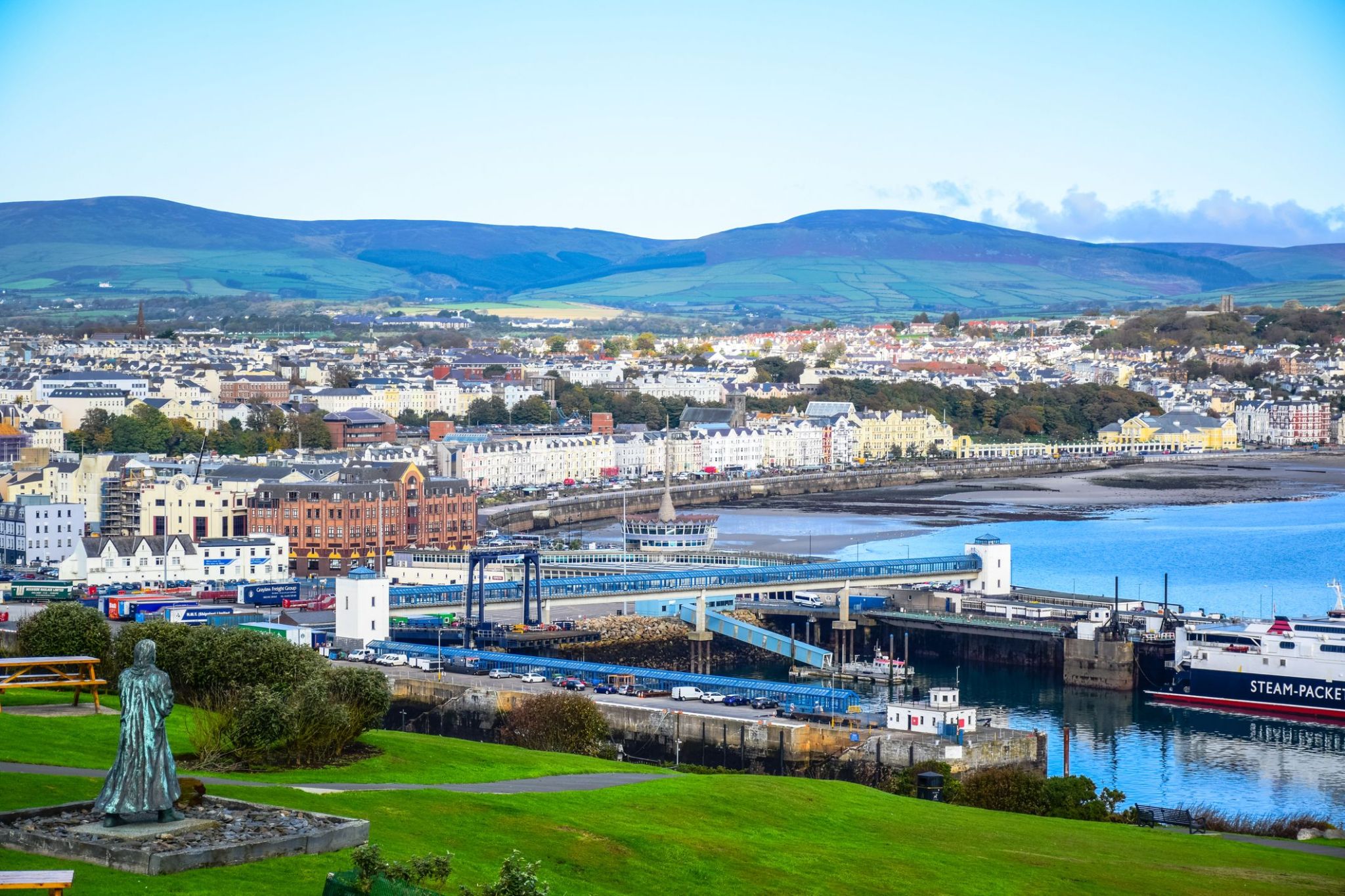
Դուգլասը Մեն կղզու մայրաքաղաքն ու ամենամեծ քաղաքն է, որը գտնվում է Իռլանդական ծովում: Քաղաքը, որը հայտնի է իր հարուստ ծովային պատմությամբ, հայտնի է իր գեղեցիկ ափամերձ տեսարաններով և հարմարավետ մթնոլորտով: Դուգլասում կարելի է զբոսնել պատմական ափամերձ գծով, որտեղ գտնվում են հին շենքեր և ժամանակակից սրճարաններ, ինչպես նաև այցելել տեղական թանգարան, որը պատմում է կղզու ծովային մշակույթի և ավանդույթների մասին: Քաղաքը նաև հայտնի է իր ճարտարապետական հուշարձաններով, ինչպիսիք են ամրոցը և պատմական վիկտորիականական շենքերը, որոնք տալիս են նրան յուրօրինակ հմայք:
Դուգլասի շրջակայքում կան բացօթյա գործունեության համար հիանալի հնարավորություններ, այդ թվում՝ քայլարշավներ, ափամերձ զբոսանքներ և հեծանվային էքսկուրսիաներ: Մեն կղզին հայտնի է իր յուրահատուկ բնությամբ, և զբոսաշրջիկները կարող են վայելել դիտարժան սարերը, գեղեցիկ ծոցերն ու ավանդական գյուղերը: Այս Բրիտանիայի հատվածը գրավում է զբոսաշրջիկներին իր յուրահատուկ մշակույթով, հին ավանդույթներով և գեղեցիկ բնական տեսարաններով, ինչը այն դարձնում է հիանալի վայր՝ հանգիստ արձակուրդների և հետաքրքիր ճամփորդությունների համար:

The town is well known for the Invergordon Mutiny of 1931. More recently it has also become known for the repair of oil rigs which line up in the Cromarty Firth on which the town is situated. In the 1970s and 1980s nearby Nigg was known for the construction of these rigs. The yard used for this is now attempting to re-establish itself as a fabricator of large offshore wind turbines and oil rig refurbishment since being purchased by Global Energy Group.
For a number of years Invergordon was the site of an aluminium smelter until 1981 when British Aluminium closed it down. The pipeline that covered the conveyor belt from the smelter to the BA pier was not dismantled until the early 2000s and the two large tanks still stand today as well as a water tower.
It still has a grain whisky distillery, operated by Philippines-owned whisky giant Whyte and Mackay, the output of which contributes to many blended whiskies. Connected to the distillery was the Invergordon Distillery Pipe Band.
At present the port is visited by many large cruise liners each year, as the deep water port allows disembarkation for coach tours in the northern Highlands.
Since the 1970s some would perceive the town as a 'Glasgow colony', since many workers were recruited from southern Scotland to work in the oil rig fabrication and aluminium smelting industries. As a result, the residents' accents often show more influence from Glasgow, than the surrounding Easter Ross dialect of Highland Englishalthough this has changed in recent years.
In recent years Global Energy Group have been expanding, with the purchase of the Nigg fabrication yard it has also brought much appreciated work to Invergordon's Docks with the town again full of oil company workers through the day.

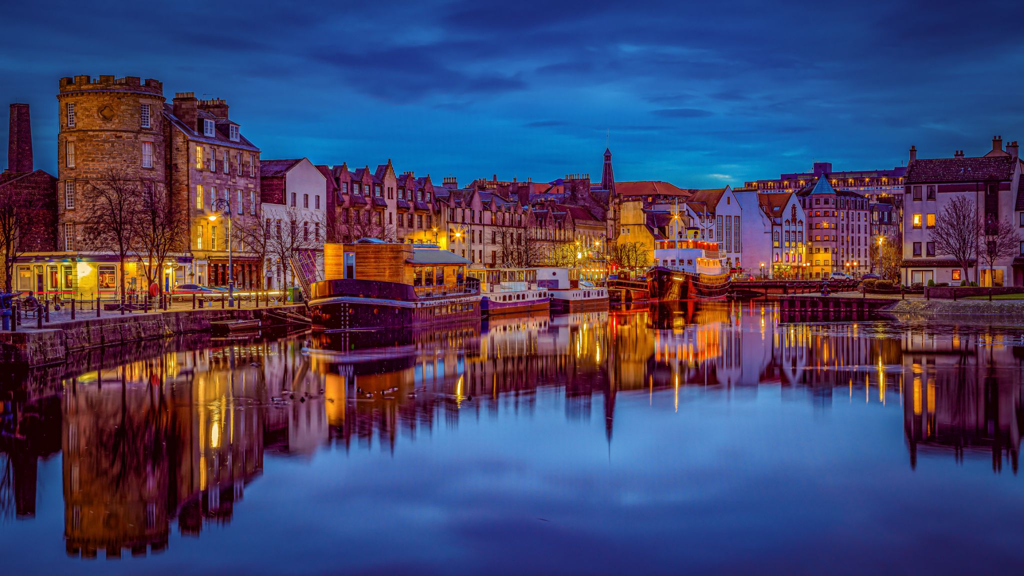
Leith is an area to the north of the city of Edinburgh, Scotland, at the mouth of the Water of Leith.
The earliest surviving historical references are in the royal charter authorising the construction of Holyrood Abbey in 1128. The medieval settlements of Leith had grown into a burgh by 1833, and the burgh was merged into Edinburgh in 1920.
Historically part of the county of Midlothian, Leith is sited on the coast of the Firth of Forth and lies within the council area of the City of Edinburgh.
The port remains one of its most valuable enterprises, handling over 1.5 million tonnes of cargo in 2003.
Previous to the bridge being built in the late 15th century, Leith had settlements on either side of the river, lacking an easy crossing.
South Leith was larger and was controlled by the lairds of Restalrig: the Logan family. It was based on trade and had many merchants' houses and warehouses. This was where ships offloaded their cargoes at The Shore where they were collected by Edinburgh merchants. Leithers were explicitly forbidden by statute to participate directly in the trade at the port, to ensure that landed goods were not sold elsewhere.
North Leith was smaller but proportionately richer, coming under the jurisdiction of Holyrood Abbey. It was effectively a fishing village consisting of one street, now Sandport Street and Quayside Lane. Burgage plots ran down to the river from each house.[6] This has traditionally been the shipbuilding side of Leith with several wet and dry docks built over time. The first dry dock in Scotland was built here in 1720. A small peninsula of land on the east bank also came under the same jurisdiction on what is now Sheriff Brae/Sheriff Bank.
The first bridge to link both banks of the river was built in 1493 by Abbot Bellenden, who controlled the church at North Leith. The bridge was a toll bridge, the revenue supplementing the church's income. Reputedly Leith's oldest building, it was demolished in 1780 to allow ships to sail further upstream.

Նուրբ առավոտյան մառախուղն ու հայելիանման ջրի մակերեսը ողջունում են ճանապարհորդներին Օլդեն-ում՝ բացելով սառցադաշտերի և զմրուխտե հովիտների տեսարաններ, որոնք կարծես բնության կողմից ստեղծված լինեն դանդաղ զբոսանքների համար։ Այս փոքրիկ նորվեգական գյուղը Նորդֆյորդի ափին պարգևում է առանձնացման հազվագյուտ զգացողություն, երբ ջրվեժների աղմուկն ու ճայերի ճիչերը դառնում են միակ ձայները շուրջբոլորը, մինչ դուք շնչում եք բյուրեղյա մաքուր օդը։
Օլդեն հայտնի է Բրիկսդալի սառցադաշտի մոտակայքով, որտեղ սկսվում են քայլարշավի ճանապարհներ՝ բացելով շնչառություն կտրող տեսարաններ կապույտ սառցե զանգվածների և լեռների գագաթների վրա։ Ճանապարհին կանցնեք կարմիր տներով փոքրիկ ֆերմաներով, իսկ տեղական սրճարաններում կարող եք վայելել թարմ թխված դարչինով բուլկիներ՝ վայելելով ֆյորդի տեսարանը և այս նորվեգական անկյան դանդաղ ռիթմը։

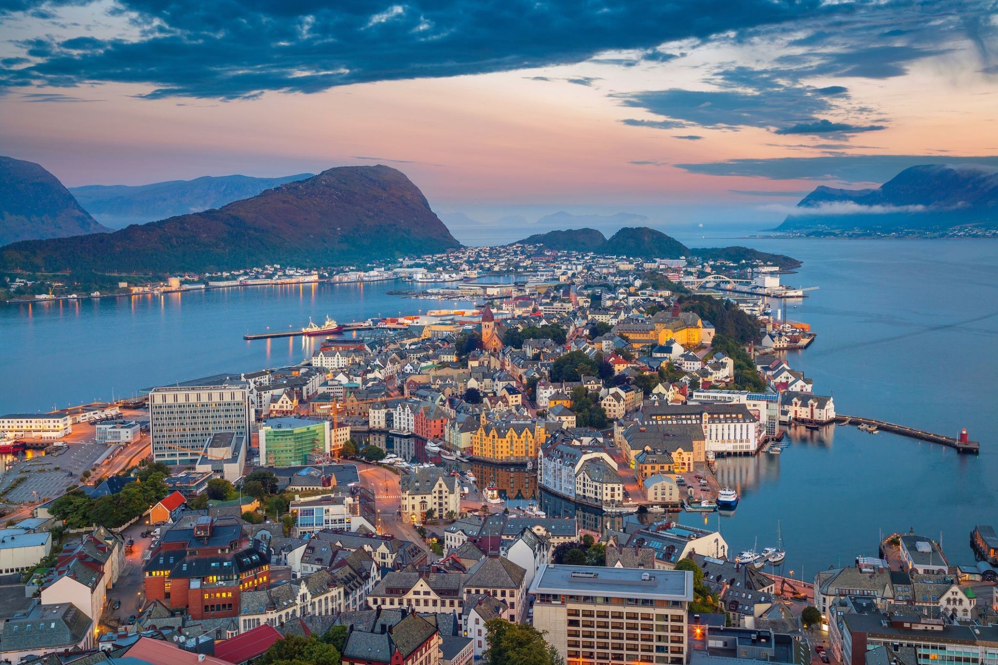
Położone między majestatycznymi fiordami a otwartym morzem, Ålesund zachwyca odwiedzających swoim wyjątkowym połączeniem naturalnego piękna i charakterystycznej architektury. Znane ze swojego imponującego stylu secesyjnego, odbudowanego po niszczącym pożarze w 1904 roku, miasto oferuje urokliwą atmosferę, gdzie kolorowe budynki ciągną się wzdłuż nabrzeża, tworząc malowniczy krajobraz niepodobny do żadnego innego w Norwegii.
Miłośnicy przygód i kultury znajdą w Ålesund wiele atrakcji. Od wspinaczki na punkt widokowy na wzgórzu Aksla z panoramicznym widokiem na archipelag, po zwiedzanie lokalnych muzeów i świeżych targów rybnych – to nadmorskie miasto zaprasza podróżnych do zanurzenia się w morskie dziedzictwo i zapierające dech w piersiach krajobrazy Norwegii. Niezależnie od tego, czy rejsujesz po pobliskich fiordach, czy spacerujesz wąskimi uliczkami, każda chwila w Ålesund obiecuje niezapomniane odkrycia.
Հայտնի Լոֆոտեն կղզիների արխիպելագի մեջ գտնվում է Սվոլվաերը, որը առաջարկում է բուռն բնական գեղեցկության և կենդանարար մշակութային փորձառությունների յուրահատուկ համադրություն։ Այստեղ այցելուները կարող են հիանալ ծովից սուր բարձրացող ժայռերով, վայելել ծովարշավական գեղատեսիլ ավանդույթները և շրջել ծովածոցն առնչվող գունագեղ փայտե տների լի քաղաքում։
Սվոլվաերը նաև հայտնի է իր հարուստ արվեստարվեստային կյանքով, որտեղ ներկայացված են տեղացի նկարիչների և արհեստավորների ցուցասրահներ։ Արտաքին սիրահարները կարող են զբաղվել ծովային կայակինգով, լեռնագնացությամբ կամ ձմռանը մասնակցել Հյուսիսային լույսերի սափարիին՝ այն դարձնելով կատարյալ վայր արկածախնդիրների և իսկական արևադարձային հմայքի սիրահարների համար։
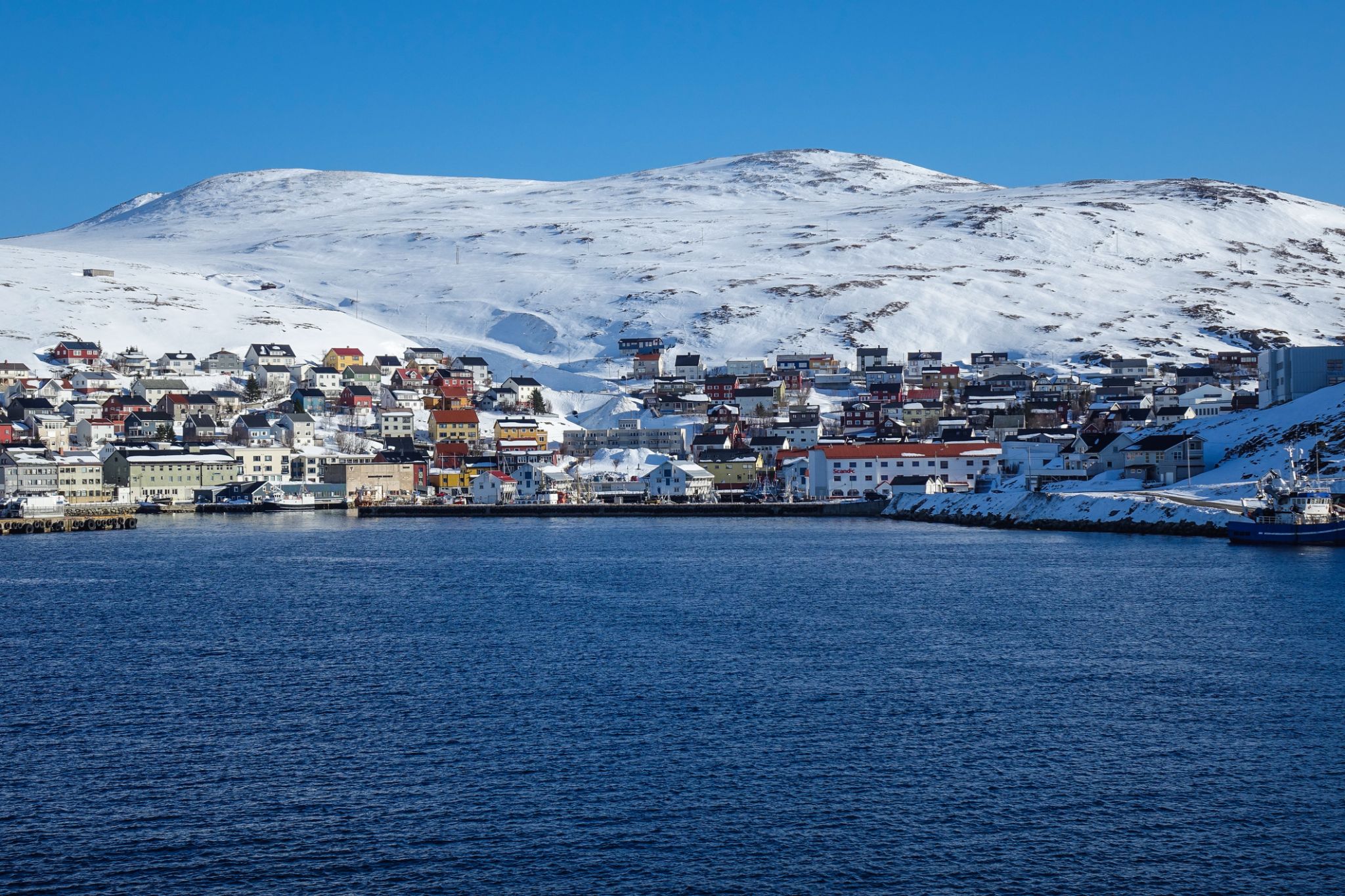
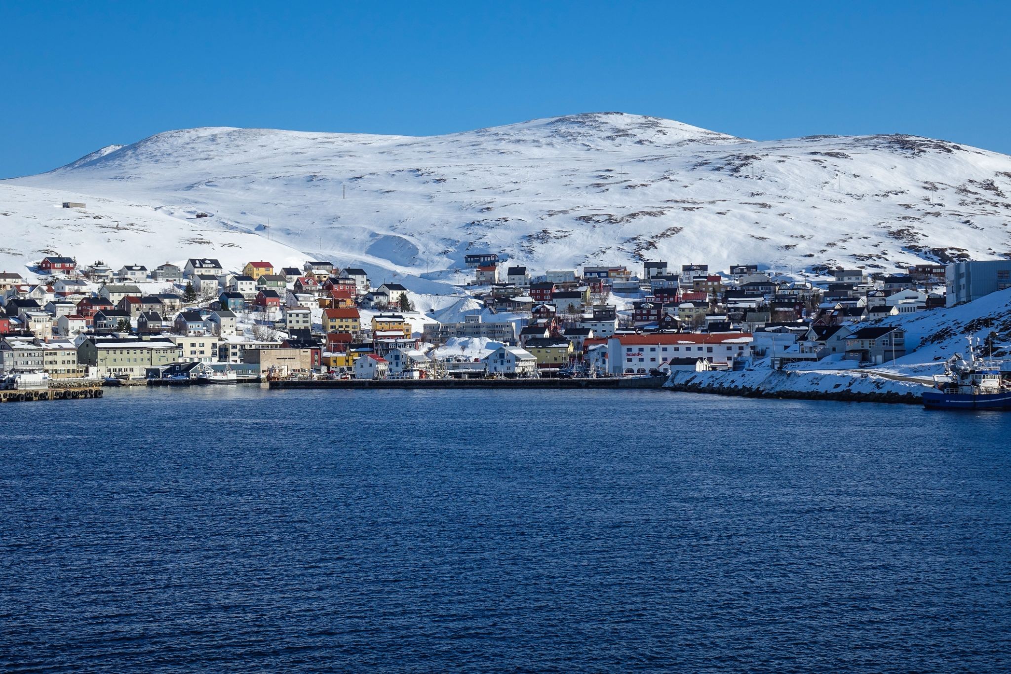
Honningsvåg is the northernmost city in Norway. It is located in Nordkapp Municipality in Finnmark county. Legislation effective in 1997 states that a Norwegian city/town (same word in Norwegian) must have at least 5,000 inhabitants, but Honningsvåg was declared a city in 1996, thus exempt from this legislation, so it is also one of the smallest cities in Norway. The 1.05-square-kilometre (260-acre) town has a population (2017) of 2,484 which gives the town a population density of 2,366 inhabitants per square kilometre (6,130/sq mi).
Honningsvåg is situated at a bay on the southeastern side of the large island of Magerøya, while the famous North Cape and its visitor center is on the northern side of the island. Honningsvåg is a port of call for cruise ships, especially in the summer months. The ice-free ocean (southwestern part of the Barents Sea) provides rich fisheries and tourism is also important to the town. Even at 71°N, many private gardens in Honningsvåg have trees, although rarely more than 3 to 4 metres (9.8 to 13.1 ft) tall.
Մեծարաշուք հյուսիսի մթնոլորտում խարիսխ գտած Ալթա քաղաքը Նորվեգիայում առաջարկում է վայրի բնության, մշակութային ժառանգության և արկտիկական հանգստության յուրօրինակ համադրություն։ Ֆինմարկի շրջանում գտնվող այս քաղաքը հայտնի է իր հնագույն ժայռապատկերներով, որոնք ընդգրկված են ՅՈՒՆԵՍԿՕ-ի համաշխարհային ժառանգության ցանկում, ինչպես նաև հյուսիսափայլը դիտելու լավագույն վայրերից մեկն է երկրում։ Ալթա նաև մեկնարկային կետ է արշավների դեպի արկտիկական սարահարթ և սառցե քարանձավներով ու ձյունապատ անտառներով շրջագայությունների համար։
Ալթա ոչ միայն բնական հրաշքների վայր է, այլև ժամանակակից հյուսիսի կենտրոն, որտեղ սամի մշակույթի ավանդույթները ներդաշնակորեն միահյուսվում են նորվեգական նորարարությունների հետ։ Այստեղ կարելի է այցելել հայտնի Sorrisniva սառցե հյուրանոցը, փորձել արկտիկական ձկան ապուր կամ ձյունոտ անտառներով սահել շների սահնակով։ Տարվա ցանկացած ժամանակ քաղաքը հրավիրում է ճանապարհորդներին նորից բացահայտելու հյուսիսը՝ ջերմությամբ, հյուրընկալությամբ և անմոռանալի բևեռային արկածներով։
Ֆյորդերի և կանաչ բլուրների միջև, Harstad-ը Հյուսիսային Նորվեգիայում ուրախացնում է այցելուներին հարմարավետ քաղաքային մթնոլորտով և տպավորիչ բևեռային տեսարաններով: Քաղաքը հայտնի է որպես «Հյուսիսային Նորվեգիայի երաժշտական մայրաքաղաք» շնորհիվ ամենամյա Հյուսիսային Նորվեգիայի փառատոնի, որն իր երաժշտությամբ և ստեղծագործական էներգիայով լցնում է փողոցները: Այստեղ կարելի է քայլել գեղեցիկ ծովափնյա գծով, հիանալ նավահանգստում գտնվող ձկնորսական նավերով և վայելել ֆյորդերի տեսարանը, որտեղ հաճախ կարելի է տեսնել ծովային արծիվների:
Harstad այցելողները կարող են բացահայտել հյուսիսային ափերը՝ գնալով ծովային կռուիզի կամ կանոյով շրջագայության, որպեսզի իսկապես զգան բնության հետ կապը: Մոտակայքում գտնվում է Տրոնդելագի պատմական կենտրոնը, ինչպես նաև Հյուսիսային Նորվեգիայի ամենահին եկեղեցու՝ Տրոնդենեսի ավերակները, որտեղ կարելի է դիպչել վիկինգների պատմությանը: Այս վայրը պարգևում է հանգիստ, ոգեշնչում և Հյուսիսային Նորվեգիայի բևեռային գեղեցկությունը:

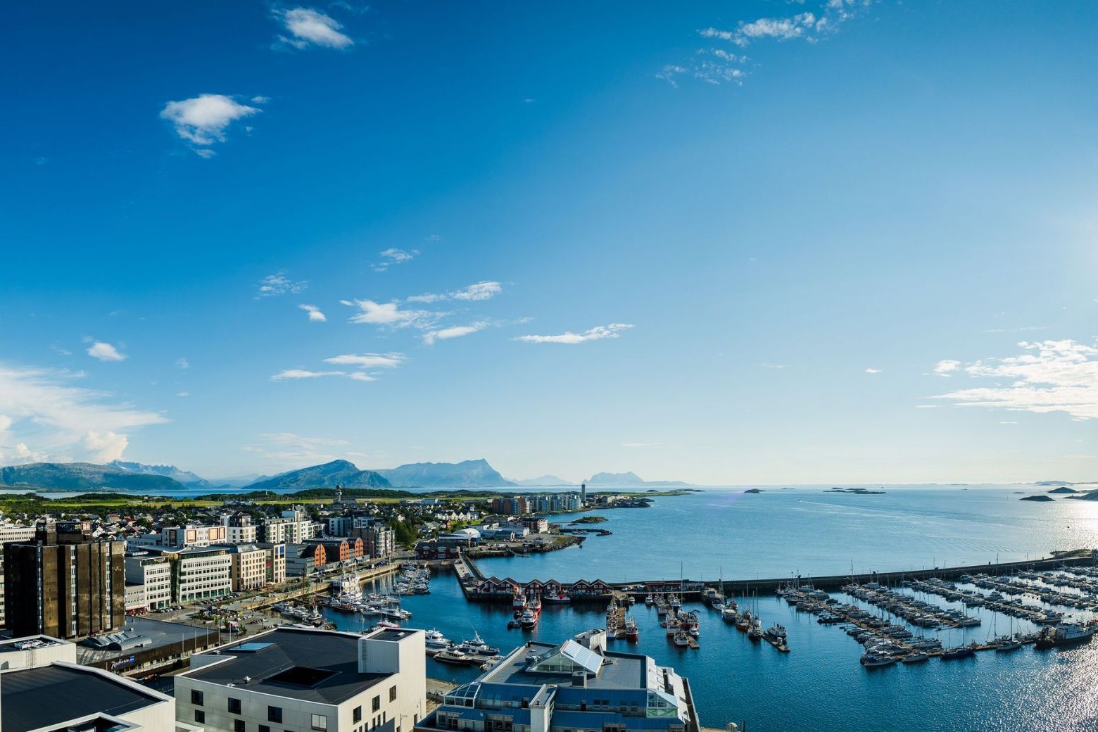
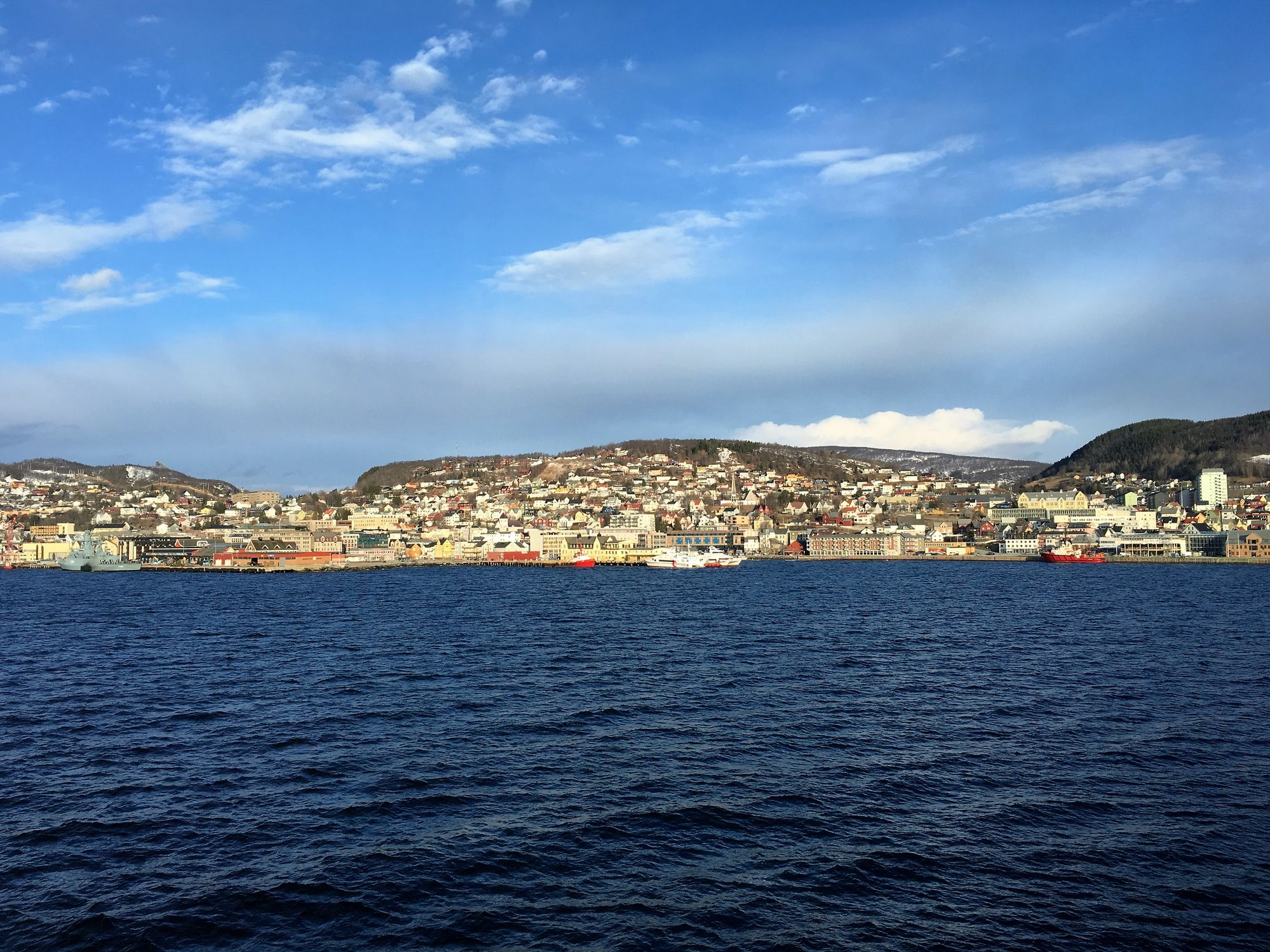
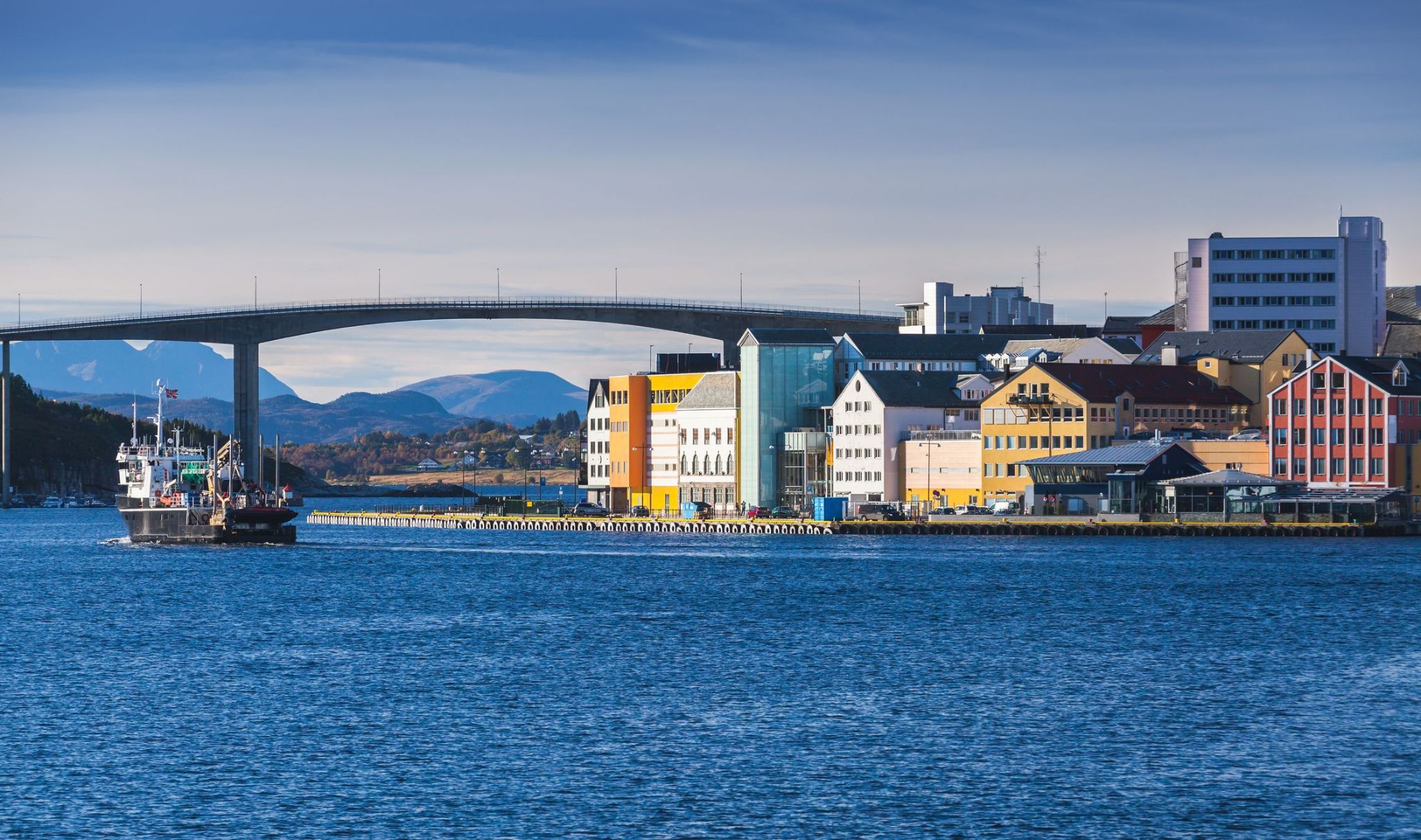
Հյուսիսային Նորվեգիայի գեղեցիկ ծովափին տեղակայված այս քաղաքը գրավում է ճանապարհորդներին իր եզակի բնությամբ և աշխույժ մշակութային կյանքով։ Bodø-ն կարևոր նավահանգիստ է և դեպի Արկտիկա ճանապարհի շեմ, որտեղ այցելուները կարող են վայելել Ֆյորդերի և լեռների տեսարանները, ինչպես նաև տեսնել բնական երևույթներից ամենահետաքրքիրներից մեկը՝ հյուսիսային լուսարձակումը։
Bodø-ում յուրաքանչյուրն իր համար ինչ-որ բան կգտնի՝ բացօթյա գործունեություններից՝ հետիոտն զբոսանքներ, ձկնորսություն և նավարկություն, մինչև տեղական պատմության ուսումնասիրություն թանգարաններում և ժամանակակից արվեստի տարածքներում։ Քաղաքը նաև հայտնի է Սալտֆյելլետ բնության պահպանվող տարածքի և Ռոնդանի ազգային պարկի մոտակայքով, ինչը այն դարձնում է հիանալի սկզբնակետ հյուսիսային տեսարանների ուսումնասիրության համար։

Նորվեգիայի ամենահարավային ափը հրավիրում է ձեզ այցելելու հրաշալի Կրիստիանսանդ քաղաքը։ Այս հիասքանչ քաղաքը երեք կողմերից շրջապատված է ծովով։ Սա երկրի հինգերորդ ամենամեծ քաղաքն է, և, չնայած նրա կենտրոնը զբաղեցնում է ընդամենը 1 կմ² տարածք, Կրիստիանսանդ ունի շատ բան առաջարկելու իր հյուրերին։ Խոսքը միայն չափազանց մաքուր նորվեգական օդի մասին չէ, այլ նաև բազմաթիվ հետաքրքիր տեսարժան վայրերի մասին։
Դրանց թվում է Նորվեգիայի ամենամեծ կենդանաբանական այգին, որտեղ բնակվում է 80 տեսակի կենդանի։ Այցելությունը այստեղ կուրախացնի և երեխաներին, և մեծերին։ Կարող եք նստել կարուսելների վրա, անկեղծ ծիծաղել կրկեսում, ինչպես նաև ամբողջ ընտանիքով գնալ ծովային զբոսանքի կամ խաղահրապարակում անցկացնել ժամանակը։

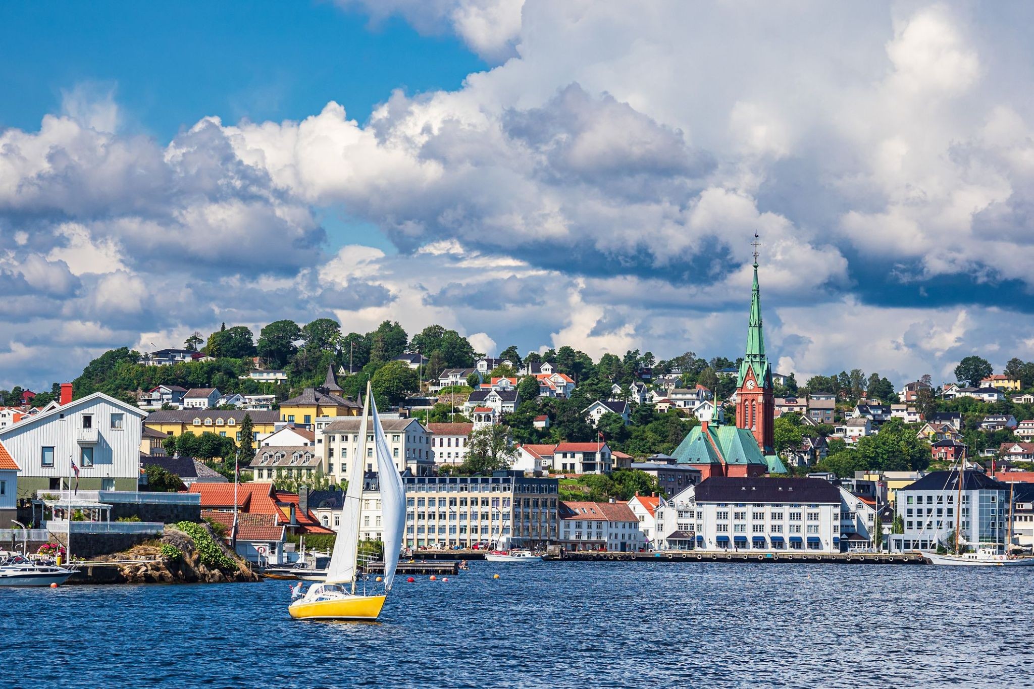
Նորվեգիայի հարավային ծովափին հարմարավետորեն տեղակայված, Արենդալը գրավում է իր ծովային հմայքով և պատմական սկանդինավյան ճաշակով: Այս հրաշալի նավահանգիստ քաղաքը, իր գունագեղ փայտե տներով և նեղ փողոցներով, իդեալական է հանգիստ զբոսանքների և նորվեգական կյանքի ոճի հետ ծանոթանալու համար: Տրեֆոլդիգետեն շրջանը, որը պատկանում է քաղաքի ամենահին բնակելի տարածքներին, ունի XVIII դարից պահպանված շենքեր:
Արենդալը նաև գրավում է իր ծովային փառատոններով, թանգարաններով և մոտակա կղզիների արշավներով նավով: Ամռանը քաղաքը կյանքի է վերադառնում՝ յախտներ, բացօթյա սրճարաններ և բացօթյա ցուցադրություններ ստեղծում են ջերմ և հյուրընկալ մթնոլորտ: Այստեղ բնությունը, պատմությունը և արդի կյանքը ներդաշնակորեն միավորվում են՝ զբոսաշրջիկներին առաջարկելով իսկական մշակութային փորձառություն:
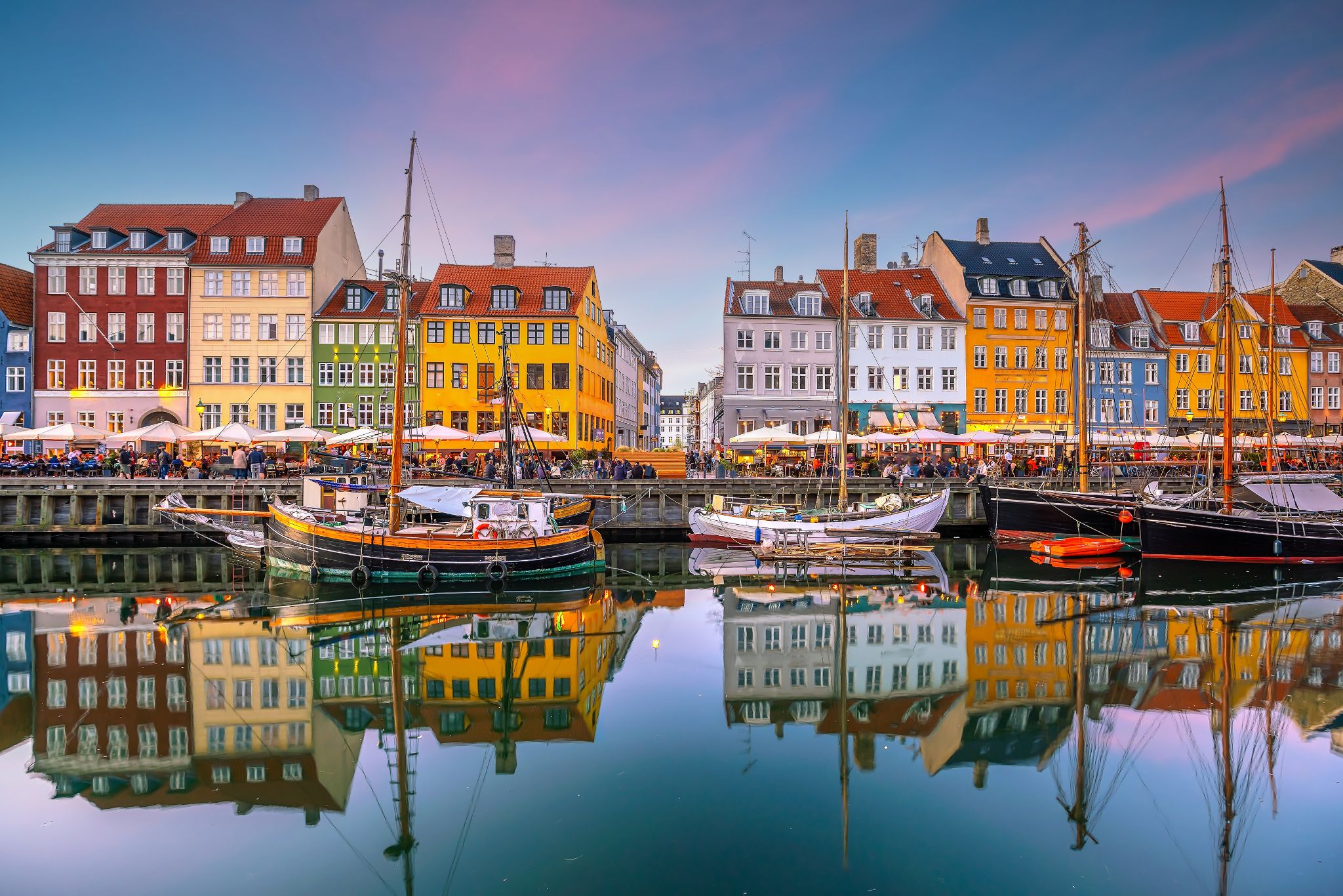
the capital and chief port of Denmark, a city that occupies the eastern part of Zealand and northern part of the island of Amager; population 518,574 (2009).
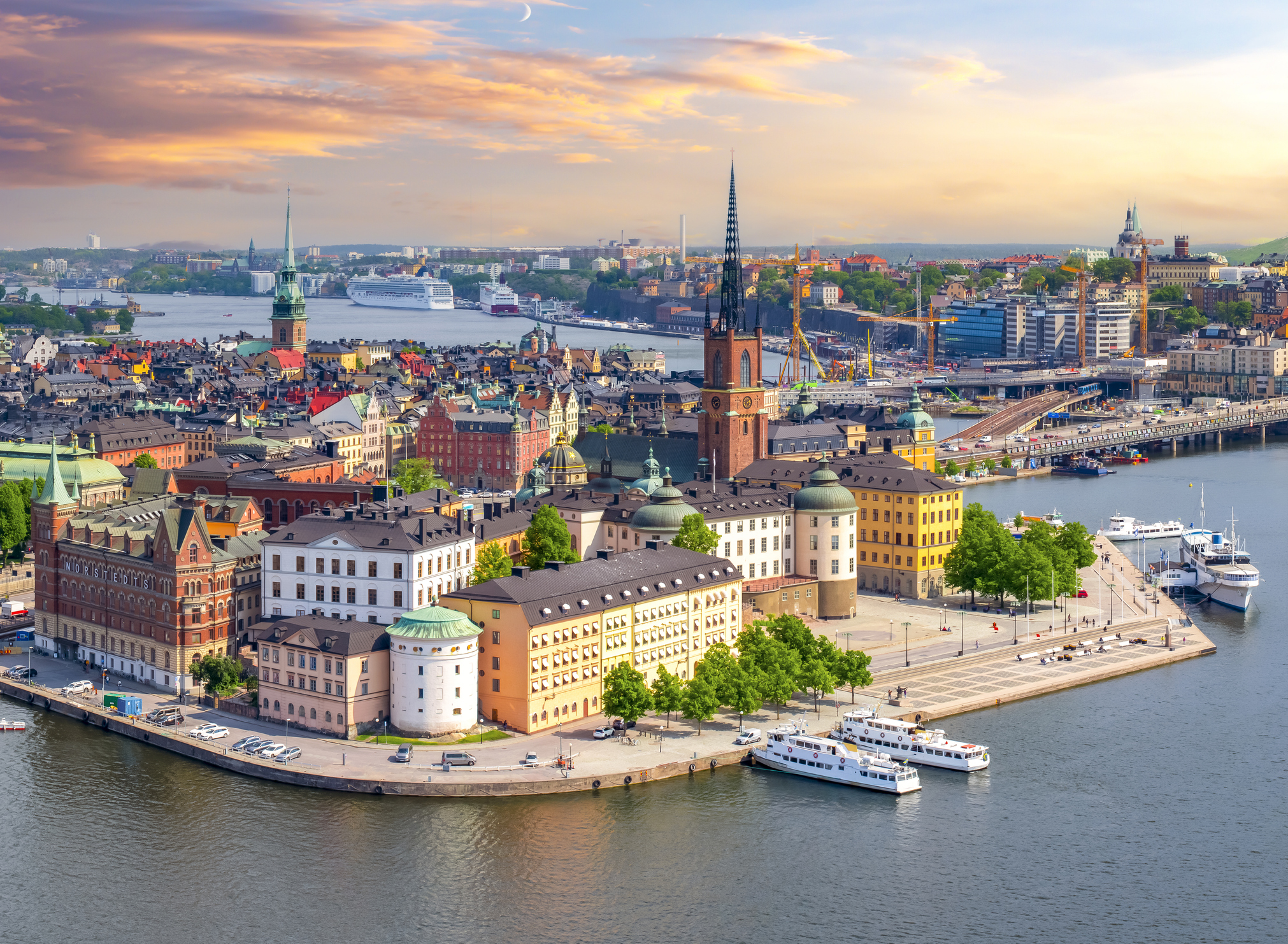
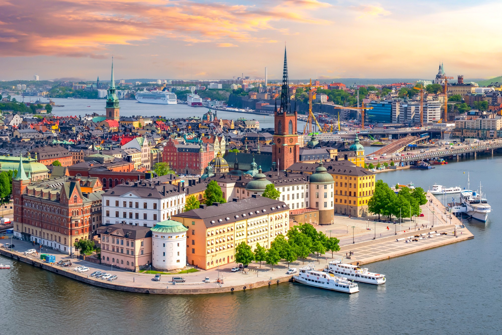
Stockholm is the capital of Sweden and the most populous urban area in the Nordic countries; 960,031 people live in the municipality, approximately 1.5 million in the urban area, and 2.3 million in the metropolitan area. The city stretches across fourteen islands where Lake Mälaren flows into the Baltic Sea. Just outside the city and along the coast is the island chain of the Stockholm archipelago. The area has been settled since the Stone Age, in the 6th millennium BC, and was founded as a city in 1252 by Swedish statesman Birger Jarl. It is also the capital of Stockholm County.
Stockholm is the cultural, media, political, and economic centre of Sweden. The Stockholm region alone accounts for over a third of the country's GDP, and is among the top 10 regions in Europe by GDP per capita. It is an important global city, and the main centre for corporate headquarters in the Nordic region. The city is home to some of Europe's top ranking universities, such as the Stockholm School of Economics, Karolinska Institute and Royal Institute of Technology (KTH). It hosts the annual Nobel Prize ceremonies and banquet at the Stockholm Concert Hall and Stockholm City Hall. One of the city's most prized museums, the Vasa Museum, is the most visited non-art museum in Scandinavia. The Stockholm metro, opened in 1950, is well known for the decor of its stations; it has been called the longest art gallery in the world. Sweden's national football arena is located north of the city centre, in Solna. Ericsson Globe, the national indoor arena, is in the southern part of the city. The city was the host of the 1912 Summer Olympics, and hosted the equestrian portion of the 1956 Summer Olympicsotherwise held in Melbourne, Victoria, Australia.
Stockholm is the seat of the Swedish government and most of its agencies, including the highest courts in the judiciary, and the official residencies of the Swedish monarch and the Prime Minister. The government has its seat in the Rosenbad building, the Riksdag (Swedish parliament) is seated in the Parliament House, and the Prime Minister's residence is adjacent at Sager House. Stockholm Palace is the official residence and principal workplace of the Swedish monarch, while Drottningholm Palace, a World Heritage Site on the outskirts of Stockholm, serves as the Royal Family's private residence.
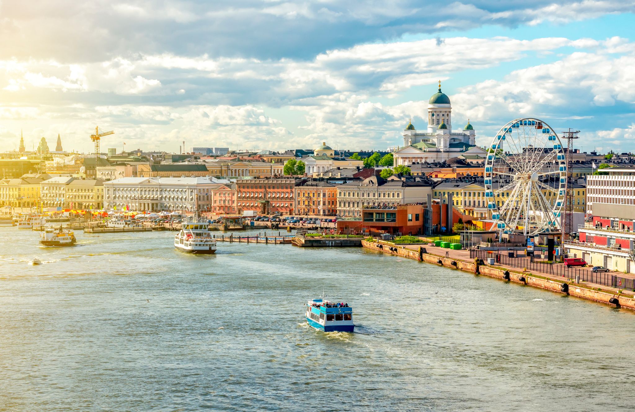
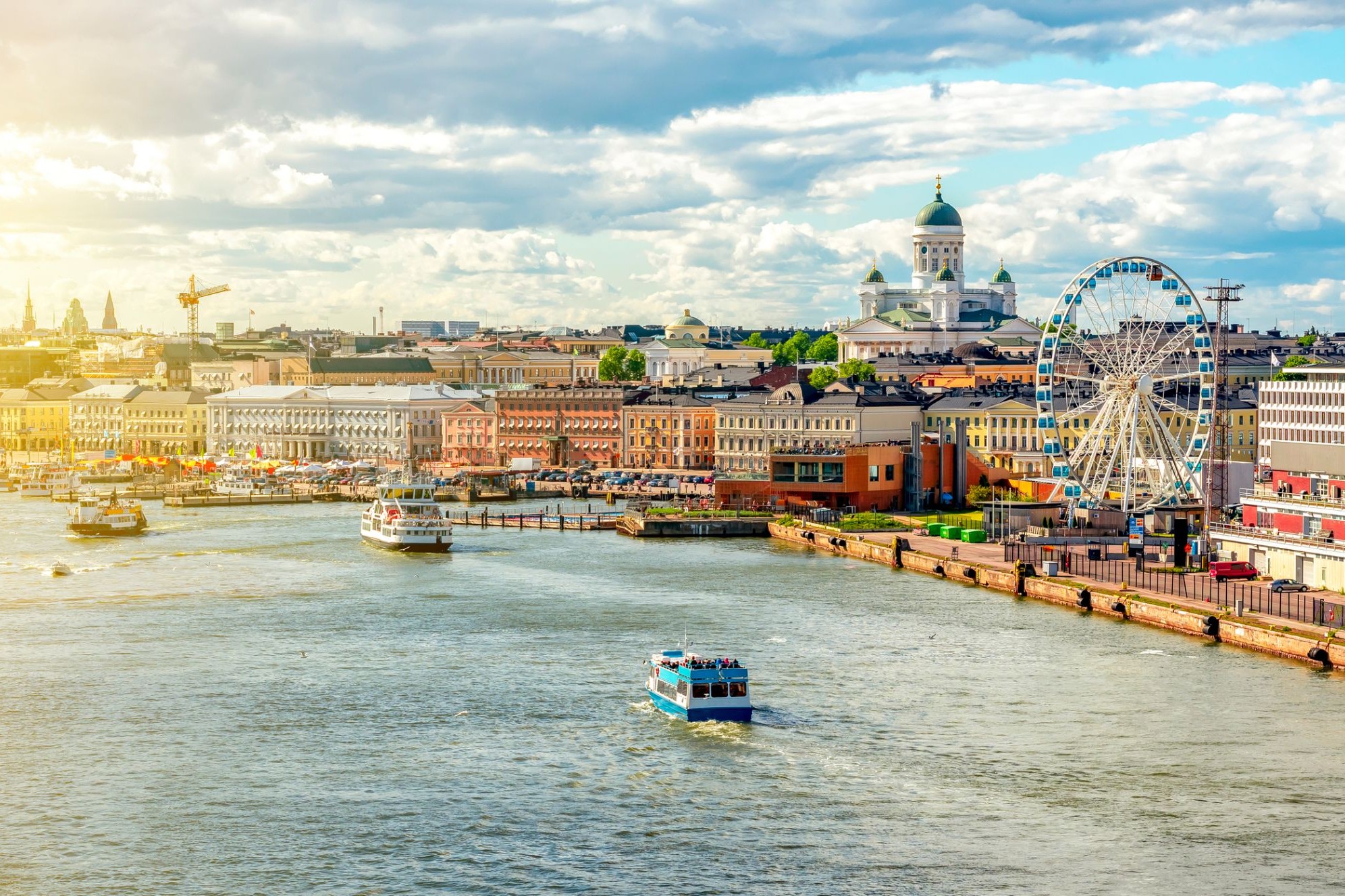
Helsinki located in the southern Finland, and has a population of 648,650. The city's urban area has a population of 1,268,296, it’s the most important center for politics, education, finance, culture, and research. Helsinki is located 80 kilometers (50 mi) north of Tallinn, Estonia, 400 km (250 mi) east of Stockholm, Sweden, and 390 km (240 mi) west of Saint Petersburg, Russia. It has close ties with these three cities.
Together with the cities of Espoo, Vantaa, and Kauniainen, and the surrounding commuter towns, Helsinki forms the Greater Helsinki metropolitan area, which has a population of nearly 1.5 million. Often being considered a metropolis of the EU member state. After Stockholm and Oslo, Helsinki is the third largest city in the Nordic countries. It is located in the city of Vantaa and is located in the city of Vantaa.
Helsinki was the World Design Capital for 2012, the 1952 Summer Olympics and the 52nd Eurovision Song Contest.
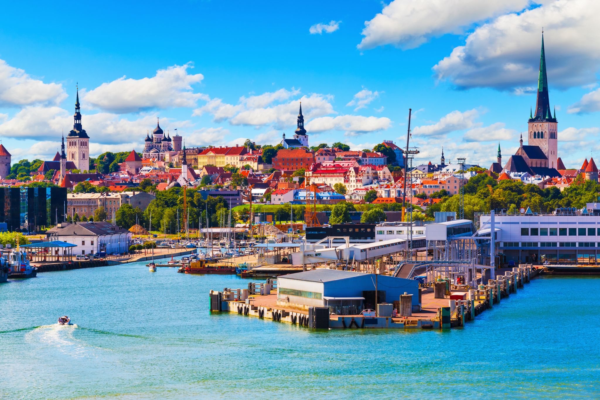
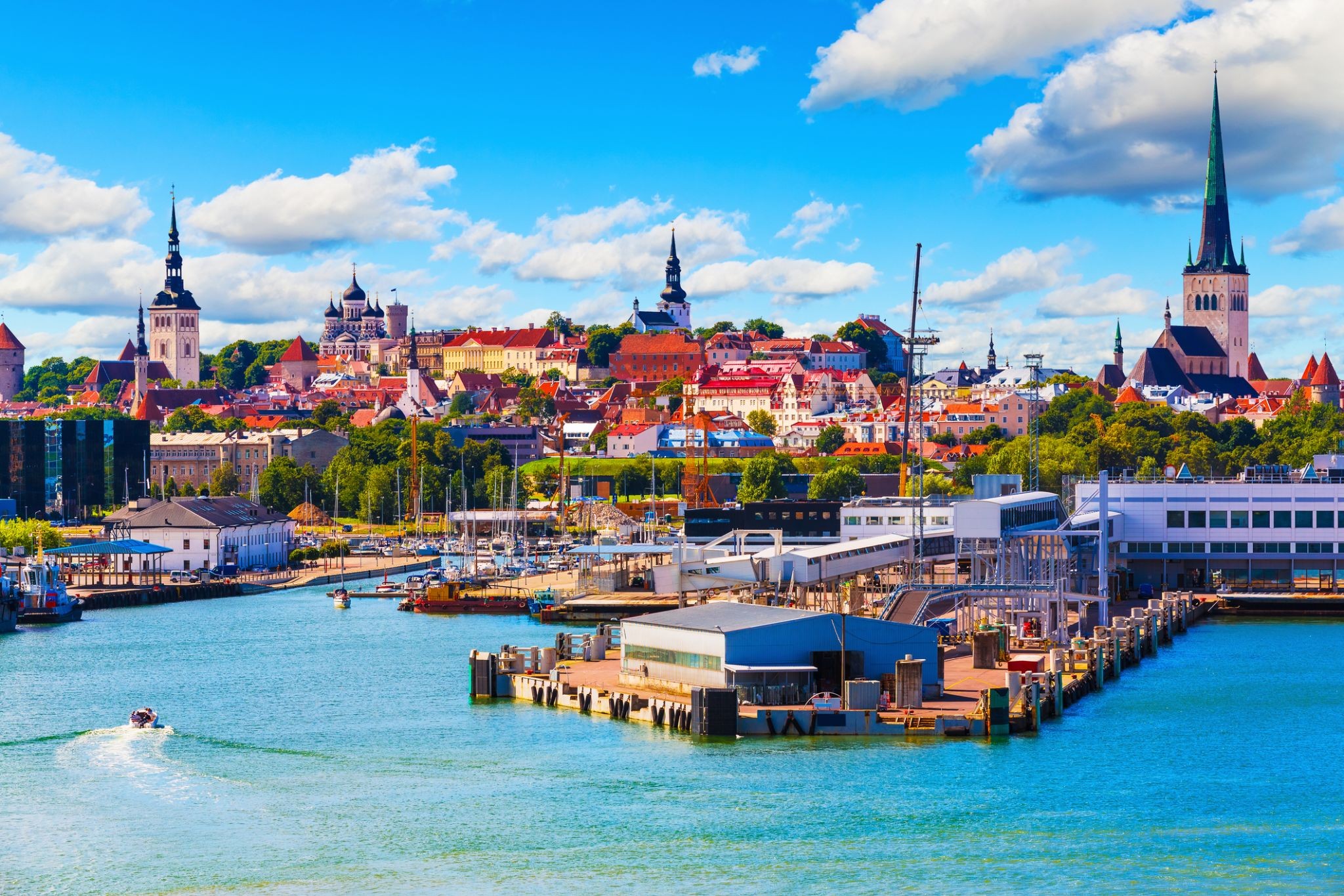
Tallinn is the capital and largest city of Estonia. It is on the northern coast of the country, on the shore of the Gulf of Finland in Harju County. From the 13th century until 1918 (and briefly during the Nazi occupation of Estonia from 1941 to 1944), the city was known as Reval. Tallinn occupies an area of 159.2 km2 (61.5 sq mi) and has a population of 453,033.
Tallinn, first mentioned in 1219, received city rights in 1248, but the earliest human settlements date back 5,000 years. The initial claim over the land was laid by the Danes in 1219, after a successful raid of Lindanise led by Valdemar II of Denmark, followed by a period of alternating Scandinavian and German rule. Due to its strategic location, the city became a major trade hub, especially from the 14th to the 16th century, when it grew in importance as part of the Hanseatic League.
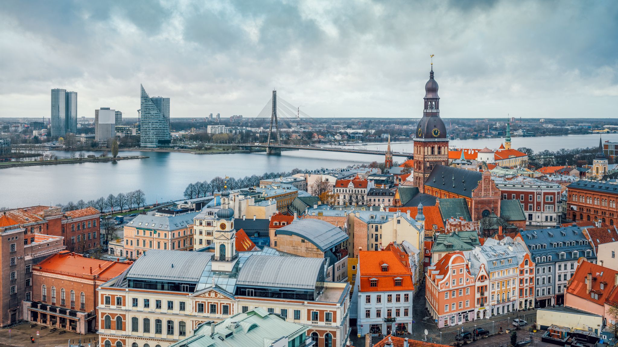
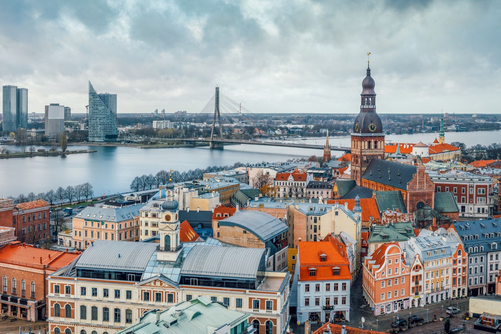
Riga is the capital and largest city of Latvia. With 637,827 inhabitants (2018), it is also the largest city in the three Baltic states, home to one third of Latvia's population and one tenth of the three Baltic states' combined population. The city lies on the Gulf of Riga, at the mouth of the Daugava. Riga's territory covers 307.17 km2 (118.60 sq mi) and lies 1–10 m (3 ft 3 in–32 ft 10 in) above sea level, on a flat and sandy plain.
Riga was founded in 1201 and is a former Hanseatic League member. Riga's historical centre is a UNESCO World Heritage Site, noted for its Art Nouveau/Jugendstil architecture and 19th century wooden architecture. Riga was the European Capital of Culture during 2014, along with Umeå in Sweden. Riga hosted the 2006 NATO Summit, the Eurovision Song Contest 2003, the 2006 IIHF Men's World Ice Hockey Championships and the 2013 World Women's Curling Championship. It is home to the European Union's office of European Regulators for Electronic Communications (BEREC).
In 2016, Riga received over 1.4 million visitors. It is served by Riga International Airport, the largest and busiest airport in the Baltic states. Riga is a member of Eurocities, the Union of the Baltic Cities (UBC) and Union of Capitals of the European Union (UCEU).
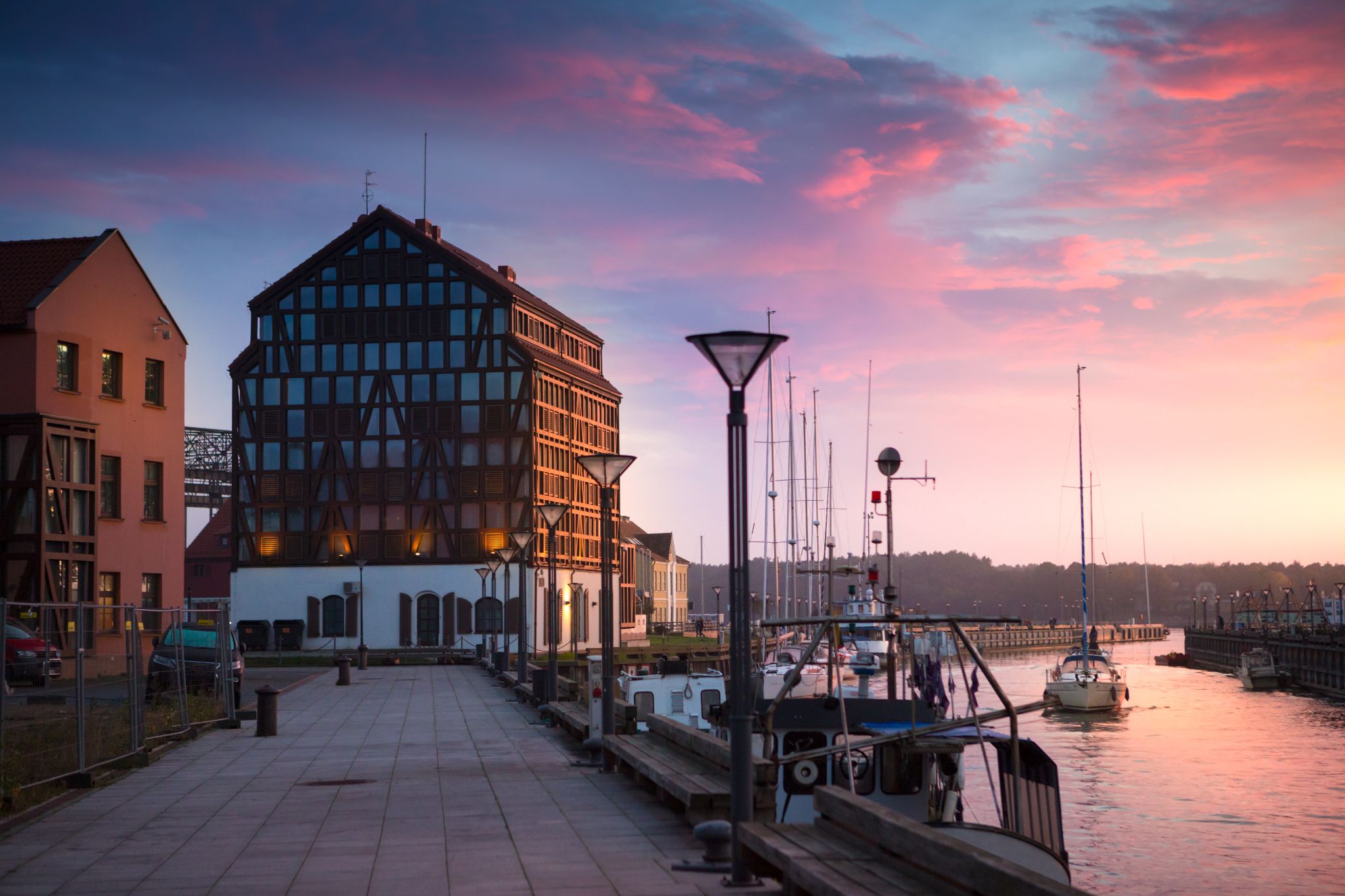
Klaipėda is a city in Lithuania on the Baltic Sea coast. It is the third largest city in Lithuania and the capital of Klaipėda County.
The city has a complex recorded history, partially due to the combined regional importance of the usually ice-free Port of Klaipėda at the mouth of the Akmena-Danė River. It was controlled by successive German states until the 1919 Treaty of Versailles. As a result of the 1923 Klaipėda Revolt it was added to Lithuania and has remained with Lithuania to this day, except for the period between 1939 and 1945 when it returned to Germany following the 1939 German ultimatum to Lithuania and the German–Soviet Union Molotov–Ribbentrop Pact.
The population has shrunk from the city to suburbs and the hinterland. The city had a population of 207,100 in 1992 to 157,350 in 2014 but the city is growing again. Popular seaside resorts found close to Klaipėda are Nida to the south on the Curonian Spit and Palanga to the north.
Լուռ փողոցներն իրենց կիսափայտյա տներով Ռեննե-ն դարձնում են հարմարավետ անկյուն Դանիայի Բորնհոլմ կղզում, որտեղ յուրաքանչյուր քայլ լցված է ծովի բույրով և տեղական հացաթխման վայրերից եկող թարմ հացի հոտով։ Քաղաքը հայտնի է իր կերամիկայի և ապակու արվեստանոցներով, ինչպես նաև ձկնորսական նավահանգստի հարմարավետ մթնոլորտով, որտեղ կարելի է համտեսել թարմ ծխեցված ծովախեցգետին և հետևել, թե ինչպես են նավերը դանդաղ մտնում նավահանգիստ։ Այստեղ ժամանակը կարծես դանդաղում է, հնարավորություն տալով վայելել զբոսանքները հին քաղաքի կաղապարված փողոցներով և գեղատեսիլ տներով, որոնք պահպանում են իրենց XVIII դարի հմայքը։
Ռեննե-ում ճանապարհորդներին սպասում է հանգիստ և խաղաղ հանգիստ՝ դանիական հարմարավետության և կղզու ստեղծագործական ոգու ներքո։ Բորնհոլմի թանգարանը բացահայտում է կղզու պատմությունը և ծովային ավանդույթները, իսկ ափամերձ զբոսանքները ցույց են տալիս ժայռոտ ափերը և մաքուր լողափերը, որոնք ողջ տարվա ընթացքում հրավիրում են հանգստի։ Այս քաղաքը իդեալական վայր է նրանց համար, ովքեր ցանկանում են զգալ իսկական Դանիան, շնչել ծովի օդը և բացահայտել Բորնհոլմի ջերմ հյուրընկալությունը։
the capital and chief port of Denmark, a city that occupies the eastern part of Zealand and northern part of the island of Amager; population 518,574 (2009).

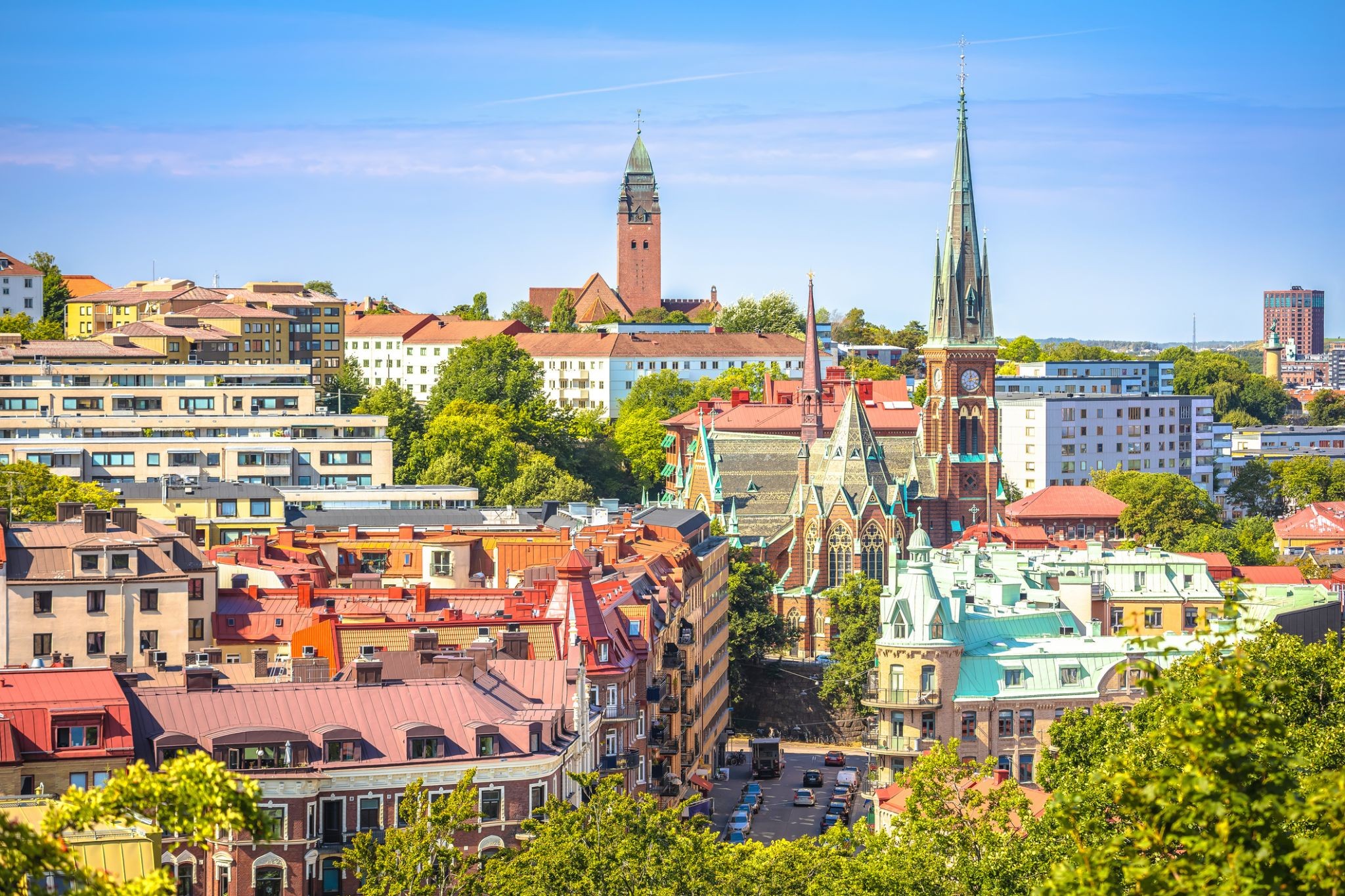
Gothenburg is the second-largest city in Sweden, fifth-largest in the Nordic countries, and capital of the Västra Götaland County. It is situated by Kattegat, on the west coast of Sweden, and has a population of approximately 570,000 in the city center and about 1 million inhabitants in the metropolitan area.
Gothenburg was founded as a heavily fortified, primarily Dutch, trading colony, by royal charter in 1621 by King Gustavus Adolphus. In addition to the generous privileges (e.g. tax relaxation) given to his Dutch allies from the then-ongoing Thirty Years' War, the king also attracted significant numbers of his German and Scottish allies to populate his only town on the western coast. At a key strategic location at the mouth of the Göta älv, where Scandinavia's largest drainage basin enters the sea, the Port of Gothenburg is now the largest port in the Nordic countries.
Gothenburg is home to many students, as the city includes the University of Gothenburg and Chalmers University of Technology. Volvo was founded in Gothenburg in 1927. The original parent Volvo Group and the now separate Volvo Car Corporation are still headquartered on the island of Hisingen in the city. Other key companies are SKF and Astra Zeneca.
The city hosts the Gothia Cup, the world's largest youth football tournament, alongside some of the largest annual events in Scandinavia. The Gothenburg Film Festival, held in January since 1979, is the leading Scandinavian film festival with over 155,000 visitors each year. In summer, a wide variety of music festivals are held in the city, including the popular Way Out West Festival.
Leith is an area to the north of the city of Edinburgh, Scotland, at the mouth of the Water of Leith.
The earliest surviving historical references are in the royal charter authorising the construction of Holyrood Abbey in 1128. The medieval settlements of Leith had grown into a burgh by 1833, and the burgh was merged into Edinburgh in 1920.
Historically part of the county of Midlothian, Leith is sited on the coast of the Firth of Forth and lies within the council area of the City of Edinburgh.
The port remains one of its most valuable enterprises, handling over 1.5 million tonnes of cargo in 2003.
Previous to the bridge being built in the late 15th century, Leith had settlements on either side of the river, lacking an easy crossing.
South Leith was larger and was controlled by the lairds of Restalrig: the Logan family. It was based on trade and had many merchants' houses and warehouses. This was where ships offloaded their cargoes at The Shore where they were collected by Edinburgh merchants. Leithers were explicitly forbidden by statute to participate directly in the trade at the port, to ensure that landed goods were not sold elsewhere.
North Leith was smaller but proportionately richer, coming under the jurisdiction of Holyrood Abbey. It was effectively a fishing village consisting of one street, now Sandport Street and Quayside Lane. Burgage plots ran down to the river from each house.[6] This has traditionally been the shipbuilding side of Leith with several wet and dry docks built over time. The first dry dock in Scotland was built here in 1720. A small peninsula of land on the east bank also came under the same jurisdiction on what is now Sheriff Brae/Sheriff Bank.
The first bridge to link both banks of the river was built in 1493 by Abbot Bellenden, who controlled the church at North Leith. The bridge was a toll bridge, the revenue supplementing the church's income. Reputedly Leith's oldest building, it was demolished in 1780 to allow ships to sail further upstream.
The town is well known for the Invergordon Mutiny of 1931. More recently it has also become known for the repair of oil rigs which line up in the Cromarty Firth on which the town is situated. In the 1970s and 1980s nearby Nigg was known for the construction of these rigs. The yard used for this is now attempting to re-establish itself as a fabricator of large offshore wind turbines and oil rig refurbishment since being purchased by Global Energy Group.
For a number of years Invergordon was the site of an aluminium smelter until 1981 when British Aluminium closed it down. The pipeline that covered the conveyor belt from the smelter to the BA pier was not dismantled until the early 2000s and the two large tanks still stand today as well as a water tower.
It still has a grain whisky distillery, operated by Philippines-owned whisky giant Whyte and Mackay, the output of which contributes to many blended whiskies. Connected to the distillery was the Invergordon Distillery Pipe Band.
At present the port is visited by many large cruise liners each year, as the deep water port allows disembarkation for coach tours in the northern Highlands.
Since the 1970s some would perceive the town as a 'Glasgow colony', since many workers were recruited from southern Scotland to work in the oil rig fabrication and aluminium smelting industries. As a result, the residents' accents often show more influence from Glasgow, than the surrounding Easter Ross dialect of Highland Englishalthough this has changed in recent years.
In recent years Global Energy Group have been expanding, with the purchase of the Nigg fabrication yard it has also brought much appreciated work to Invergordon's Docks with the town again full of oil company workers through the day.
Շոտլանդիայի արևմտյան ժայռոտ ափերին ծփում է հմայիչ ծովափնյա քաղաքը՝ Օբան-ը, որը հաճախ անվանում են «դարպաս դեպի կղզիներ»: Այստեղ հիասքանչ բնապատկերները միախառնվում են հարուստ պատմության հետ՝ Դանստաֆնիջ ամրոցի ավերակներից մինչև քաղաքը գերիշխող կլորակերտ Մաքքեյգի աշտարակը։ Օբան-ի նավահանգիստը լի է լաստանավերով, որոնք ուղևորվում են Մալ, Իոնա և Սքայ կղզիներ՝ հիանալի մեկնակետ կղզային արկածների համար։
Գուրմանները սիրահարված են Օբան-ին՝ թարմ ծովամթերքի շնորհիվ․ տեղական ռեստորանները հայտնի են ոստրեներով և ապխտած սաղմոնով։ Իսկ վիսկիի սիրահարները կարող են այցելել հռչակավոր Oban Distillery-ը, որը գործում է դեռ 1794 թվականից։ Ափամերձ զբոսանքները, նավարկությունները և գեղատեսիլ մայրամուտները այս վայրը դարձնում են իսկական գանձ Հայլենդում։
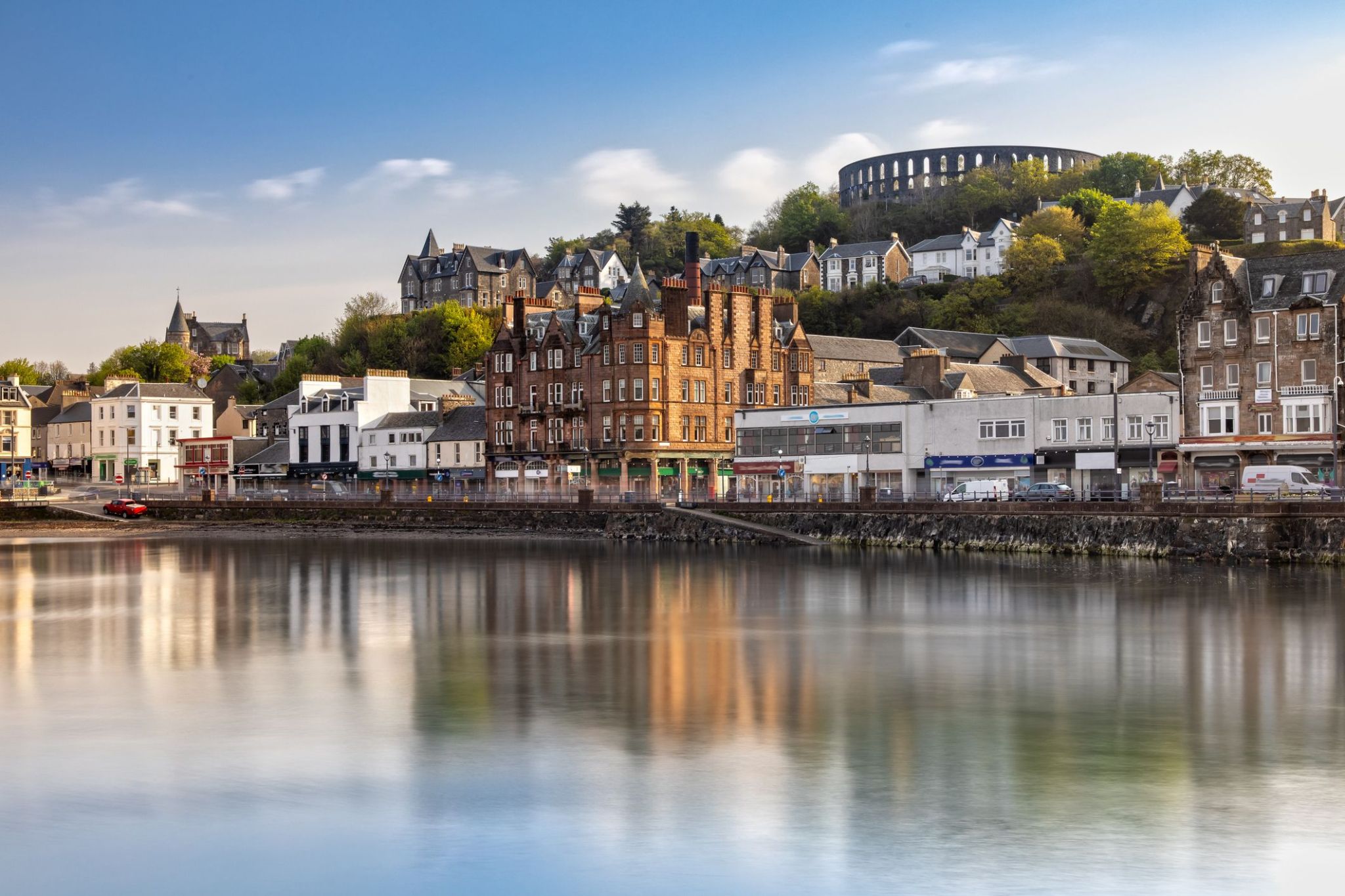
Գրինոքը Շոտլանդիայի քաղաք է, որը գտնվում է հարավ-արևմտյան ափին, Գլազգոյից 32 կիլոմետր արևմուտք: Գրինոքն հիմնադրվել է որպես նավահանգիստ, և նրա պատմական նշանակությունը կապված է նավաշինության և առևտրի զարգացման հետ: Շատ տարիներ շարունակ քաղաքը եղել է կարևոր ծովագնացության կենտրոն, իսկ այսօր այն շարունակում է ծառայել որպես կարևոր տրանսպորտային հանգույց՝ մեծ նավահանգստով և ժամանակակից ենթակառուցվածքով: Գրինոքը նաև հայտնի է իր պատմական շենքերով, ինչպիսիք են Գրինոքի մախլախամահակը, և դրա մերձակայքում գտնվում են նավատորմի թանգարանն ու բազմաթիվ հին պահեստներ, որոնք պահպանել են անցյալի մթնոլորտը:
Զբոսաշրջիկների համար Գրինոքը հետաքրքիր վայր է ծովափնյա զբոսանքների և պուրակներում քայլելու համար, ինչպես նաև հիանալի տեղ է Շոտլանդիայի ծովագնացության պատմությունը ուսումնասիրելու համար: Քաղաքը նաև հայտնի է որպես զբոսաշրջիկների համար իդեալական կետ, քանի որ դրա նավահանգիստը կապում է այն երկրի արևմտյան ափի ամենագեղեցիկ հատվածների հետ: Քաղաքի շրջակայքում կան բազմաթիվ բնական տեսարժան վայրեր՝ այդ թվում՝ հարևան կղզիներ և գեղեցիկ ավազափնյակներ, որտեղ կարելի է հանգստանալ և վայելել ծովի ու ափի գեղեցիկ տեսարանները:
Դուգլասը Մեն կղզու մայրաքաղաքն ու ամենամեծ քաղաքն է, որը գտնվում է Իռլանդական ծովում: Քաղաքը, որը հայտնի է իր հարուստ ծովային պատմությամբ, հայտնի է իր գեղեցիկ ափամերձ տեսարաններով և հարմարավետ մթնոլորտով: Դուգլասում կարելի է զբոսնել պատմական ափամերձ գծով, որտեղ գտնվում են հին շենքեր և ժամանակակից սրճարաններ, ինչպես նաև այցելել տեղական թանգարան, որը պատմում է կղզու ծովային մշակույթի և ավանդույթների մասին: Քաղաքը նաև հայտնի է իր ճարտարապետական հուշարձաններով, ինչպիսիք են ամրոցը և պատմական վիկտորիականական շենքերը, որոնք տալիս են նրան յուրօրինակ հմայք:
Դուգլասի շրջակայքում կան բացօթյա գործունեության համար հիանալի հնարավորություններ, այդ թվում՝ քայլարշավներ, ափամերձ զբոսանքներ և հեծանվային էքսկուրսիաներ: Մեն կղզին հայտնի է իր յուրահատուկ բնությամբ, և զբոսաշրջիկները կարող են վայելել դիտարժան սարերը, գեղեցիկ ծոցերն ու ավանդական գյուղերը: Այս Բրիտանիայի հատվածը գրավում է զբոսաշրջիկներին իր յուրահատուկ մշակույթով, հին ավանդույթներով և գեղեցիկ բնական տեսարաններով, ինչը այն դարձնում է հիանալի վայր՝ հանգիստ արձակուրդների և հետաքրքիր ճամփորդությունների համար:
Dublin is the capital of, and largest city in, Ireland. It is on the east coast of Ireland, in the province of Leinster, at the mouth of the River Liffey, and is bordered on the south by the Wicklow mountains. It has an urban area population of 1,173,179, while the population of the Dublin Region (formerly County Dublin), as of 2016, was 1,347,359, and the population of the Greater Dublin area was 1,904,806.
There is archaeological debate regarding precisely where Dublin was established by Celtic-speaking people in the 7th century AD. Later expanded as a Viking settlement, the Kingdom of Dublin, the city became Ireland's principal settlement following the Norman invasion. The city expanded rapidly from the 17th century and was briefly the second largest city in the British Empire before the Acts of Union in 1800. Following the partition of Ireland in 1922, Dublin became the capital of the Irish Free State, later renamed Ireland.
Dublin is a historical and contemporary centre for education, the arts, administration and industry. As of 2018 the city was listed by the Globalization and World Cities Research Network (GaWC) as a global city, with a ranking of "Alpha -", which places it amongst the top thirty cities in the world.
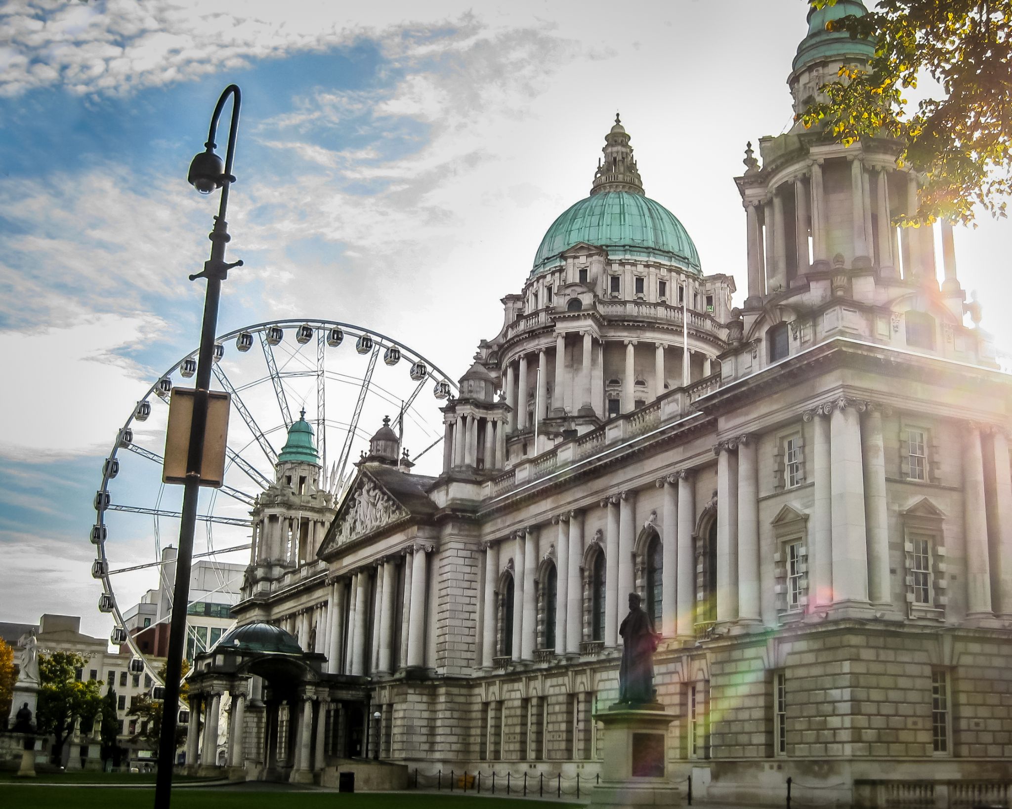
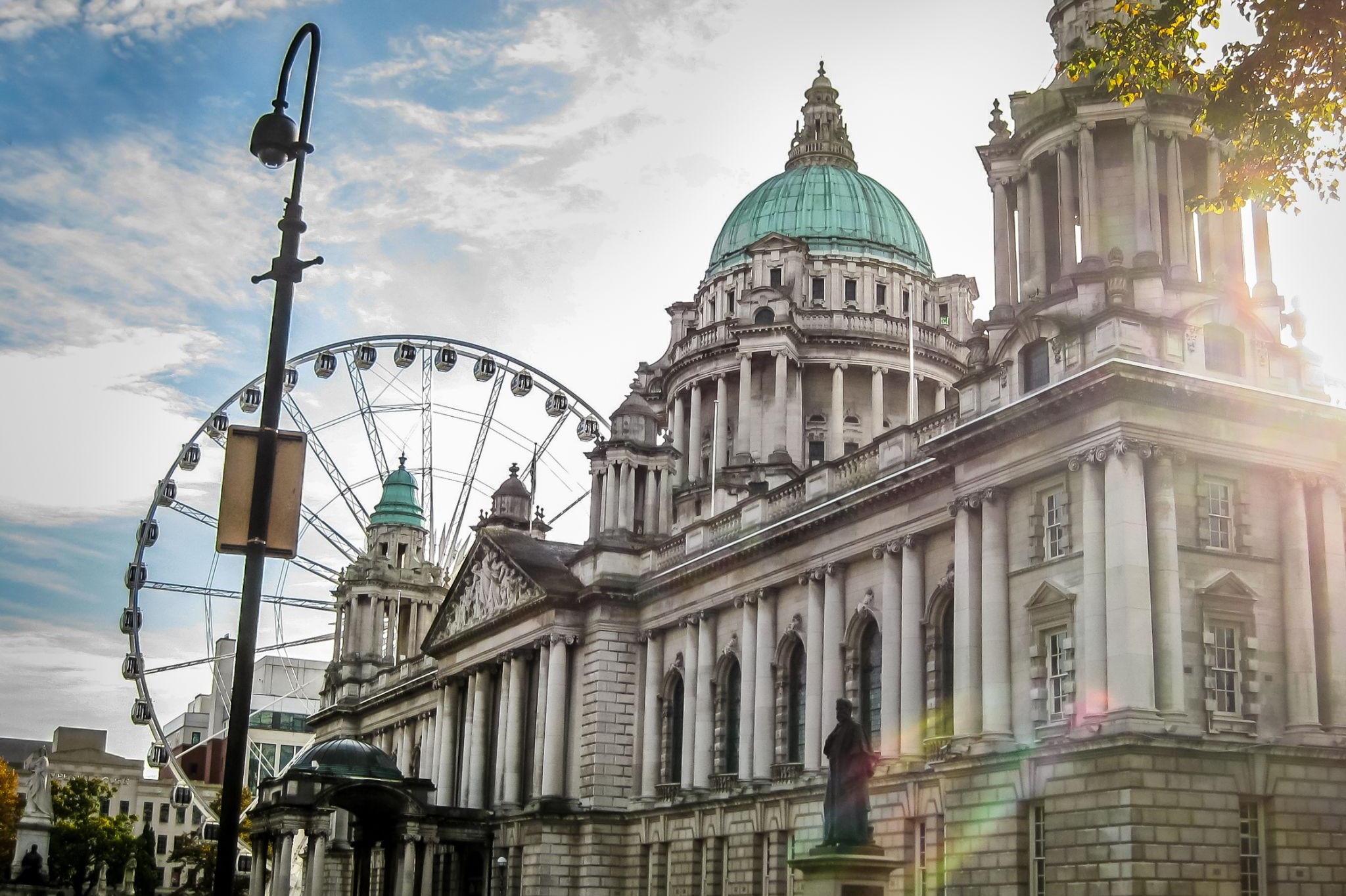
Belfast is a port city in the United Kingdom and the capital city of Northern Ireland, on the banks of the River Lagan on the east coast of Ireland. It is the largest city in Northern Ireland and second largest on the island of Ireland. It had a population of 333,871 in 2015.
By the early 1800s Belfast was a major port. It played a key role in the Industrial Revolution, becoming the biggest linen producer in the world, earning it the nickname "Linenopolis". By the time it was granted city status in 1888, it was a major centre of Irish linen production, tobacco-processing and rope-making. Shipbuilding was also a key industry; the Harland and Wolff shipyard, where the RMS Titanic was built, was the world's biggest shipyard. It also has a major aerospace and missiles industry. Industrialisation and the inward migration it brought made Belfast Ireland's biggest city and it became the capital of Northern Ireland following the Partition of Ireland in 1922. Its status as a global industrial centre ended in the decades after the Second World War.
Belfast suffered greatly in the Troubles, and in the 1970s and 1980s was one of the world's most dangerous cities. However, the city is now considered to be one of the safest within the United Kingdom. Throughout the 21st century, the city has seen a sustained period of calm, free from the intense political violence of former years and has benefitted from substantial economic and commercial growth. Belfast remains a centre for industry, as well as the arts, higher education, business, and law, and is the economic engine of Northern Ireland. Belfast is still a major port, with commercial and industrial docks dominating the Belfast Lough shoreline, including the Harland and Wolff shipyard. It is served by two airports: George Best Belfast City Airport, and Belfast International Airport 15 miles (24 km) west of the city. It is listed by the Globalization and World Cities Research Network (GaWC) as a Gamma global city.