| Cruise Region : Africa, Pacific cruises |
| Company : Oceania Cruises |
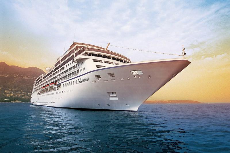
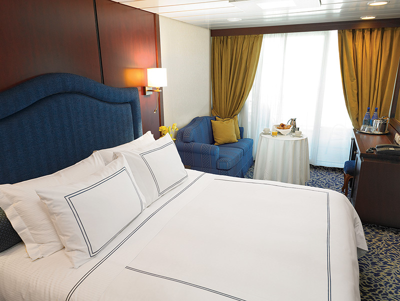
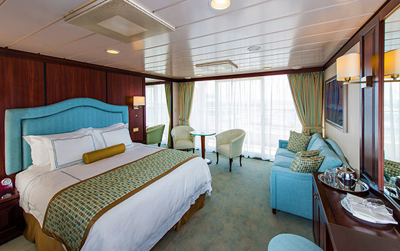
| Ship : Nautica |
| Journey Start : երկ 21 դեկ 2026 |
| Journey End : երք 05 հնվ 2027 |
| Count Nights : 15 nights |
| Day | Date | Port | Arrival | Departure |
|---|---|---|---|---|
| 1 | 21.12 երկ | Անորոշություն / Cameroon | 17:00 | |
| 2 | 22.12 երք | Օր ծովում / Sea | ||
| 3 | 23.12 չրք | Հանոյ (Hanoy) / Vietnam | 07:00 | 19:00 |
| 4 | 24.12 հնգ | Սանյա / China | 12:00 | 20:00 |
| 5 | 25.12 ուր | Դանանգ (Hue) / Vietnam | 07:00 | |
| 6 | 26.12 շբթ | Դանանգ (Hue) / Vietnam | 14:00 | |
| 7 | 27.12 կիր | Nha Trang / Vietnam | 10:00 | 18:00 |
| 8 | 28.12 երկ | Օր ծովում / Sea | ||
| 9 | 29.12 երք | Պսակ / Philippine Islands | 12:00 | 20:00 |
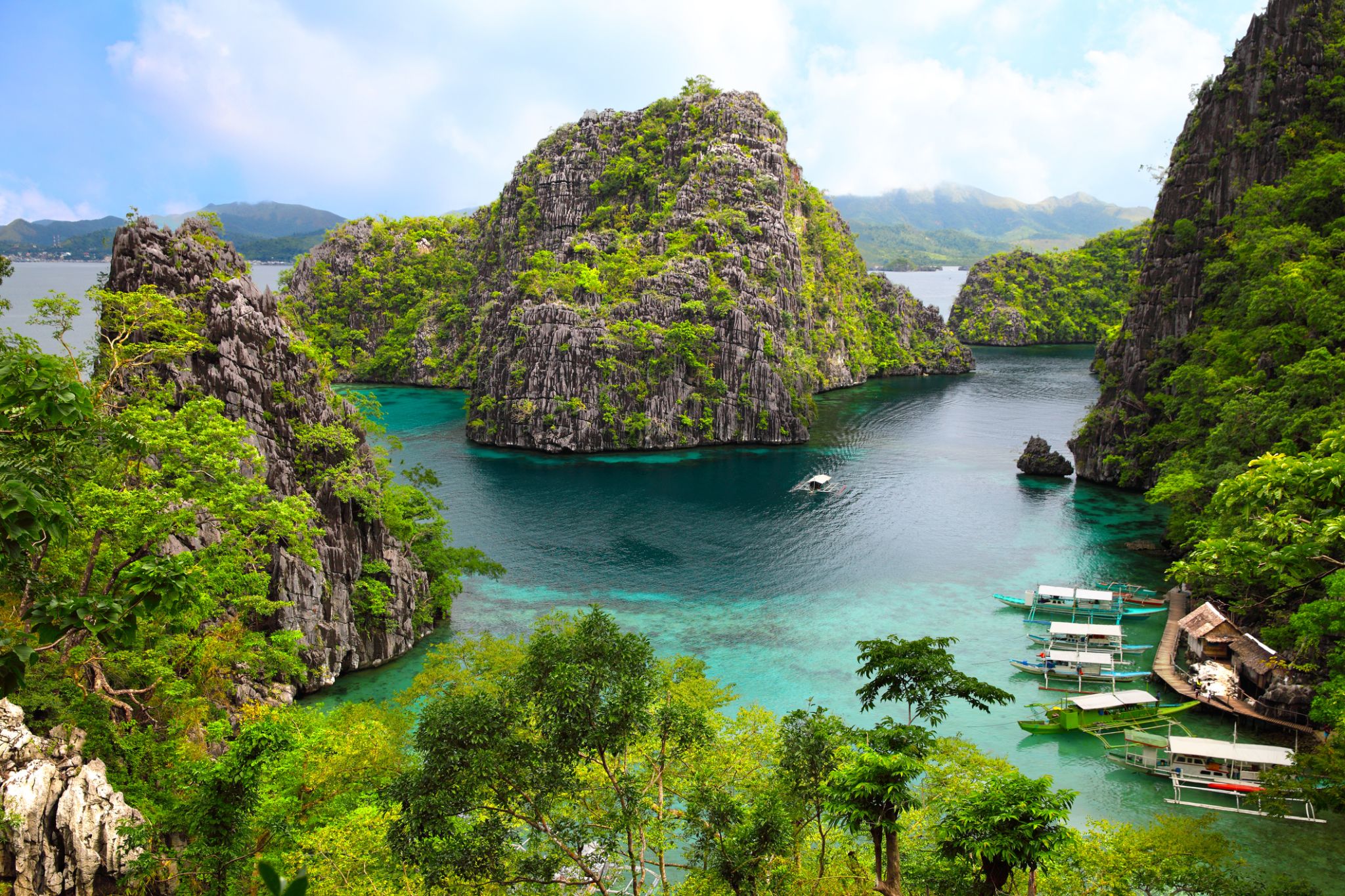
| 10 | 30.12 չրք | ԲՈՐԱԿԱՅ ԿՂԶԻ | 07:00 | 15:00 |
| 11 | 31.12 հնգ | Պուերտո Պրինսեզա / Philippine Islands | 07:00 | 15:00 |
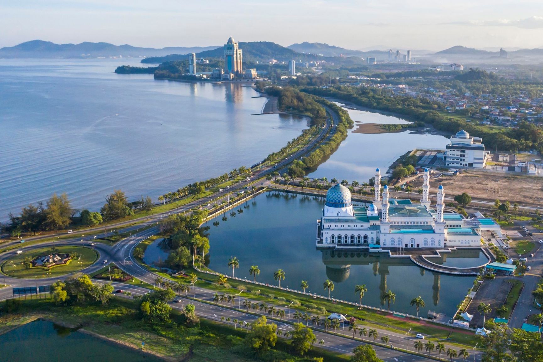
| 12 | 1.01 ուր | Կոտա Կինաբալու / Malaysia | 11:00 | 20:00 |
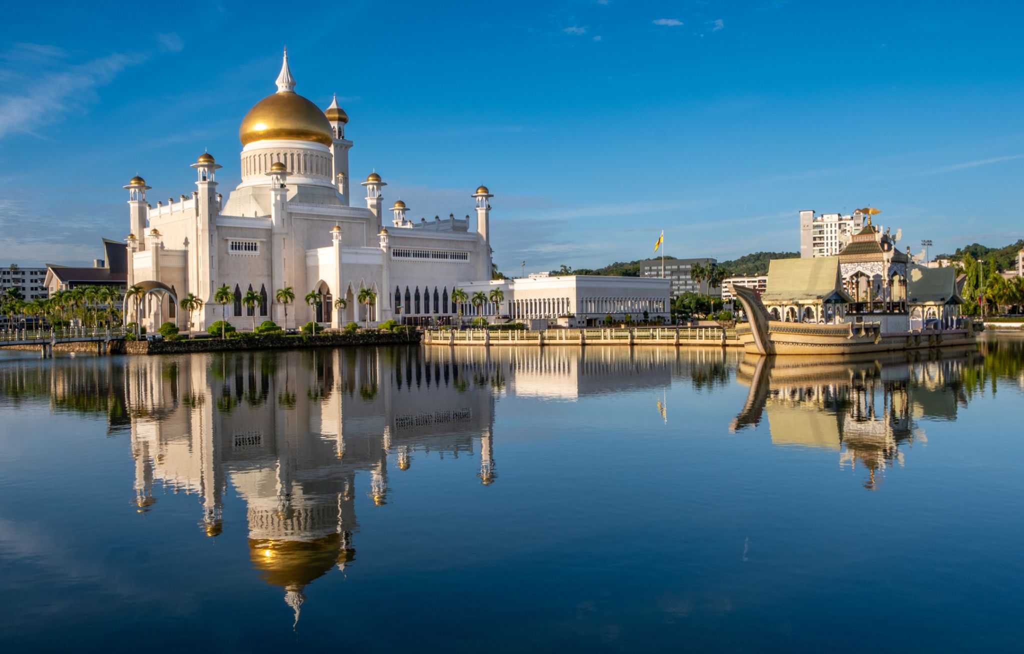
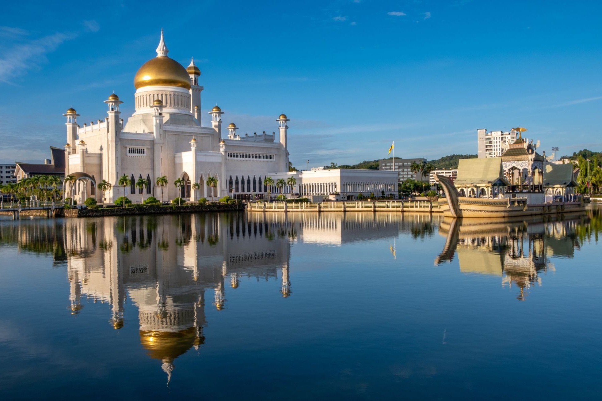
| 13 | 2.01 շբթ | Բանդար Սերի Բեգավան / Brunei | 07:00 | 15:00 |
| 14 | 3.01 կիր | Օր ծովում / Sea | ||
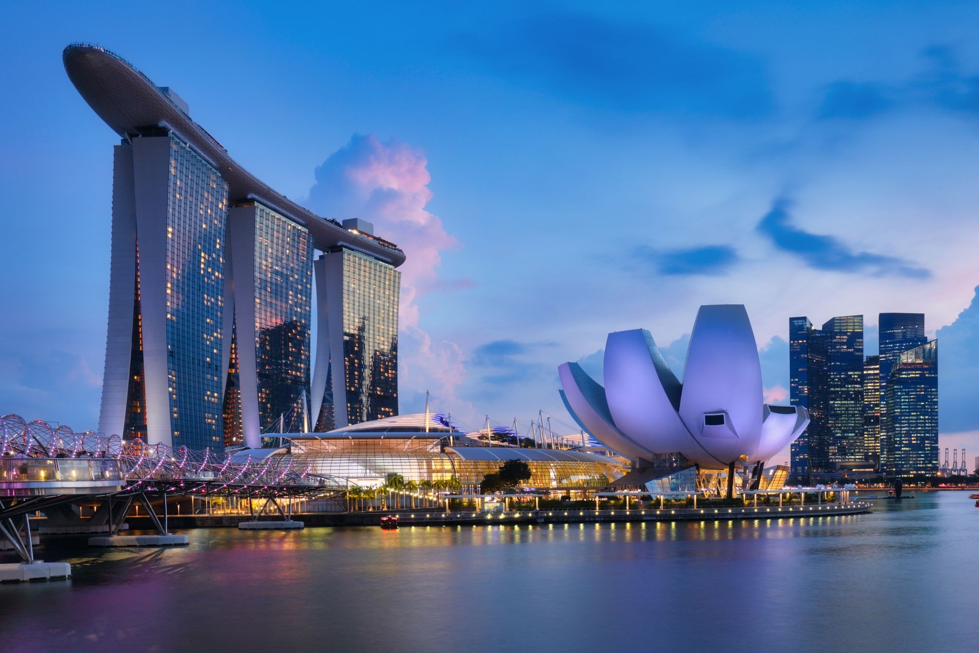
| 15 | 4.01 երկ | Սինգապուր / Singapore | 13:00 | |
| 16 | 5.01 երք | Սինգապուր / Singapore | 17:00 |
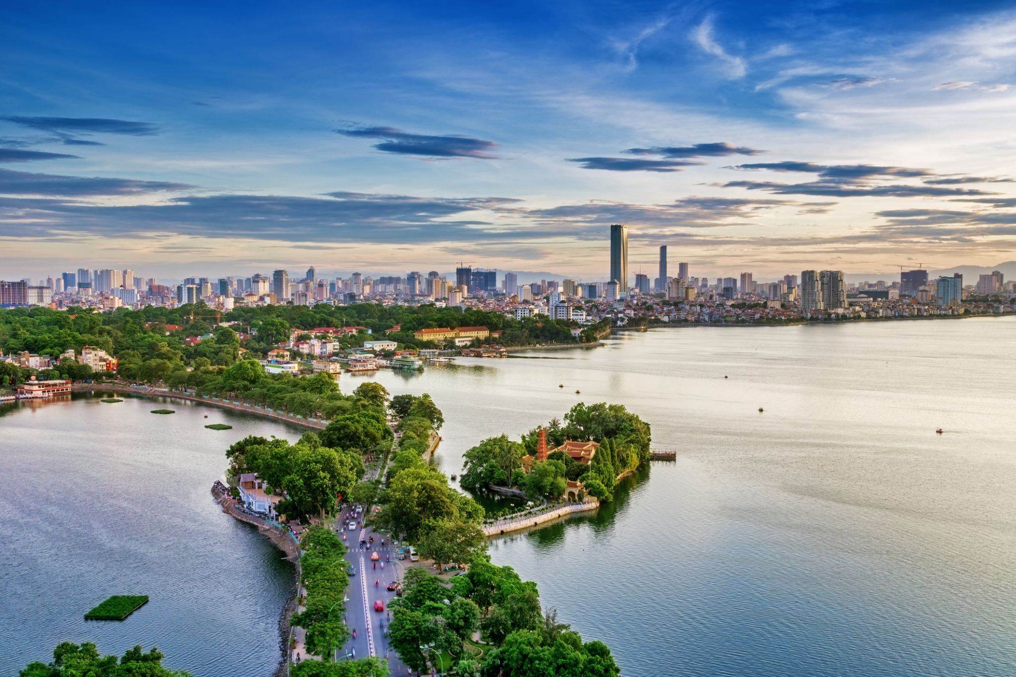
Հանոյը Վիետնամի մայրաքաղաքն է՝ հազարամյա պատմությամբ քաղաք, որն ավելի վաղ հայտնի էր որպես Թհանգ Լոնգ, ինչը թարգմանվում է որպես «Թռիչքի մեջ գտնվող վիշապի քաղաք»։ Չնայած բազմաթիվ պագոդաներին, ճարտարապետական հուշարձաններին և աշխույժ առևտրային թաղամասերին՝ այստեղ չկա զբոսաշրջիկների բազմություն, ինչը թույլ է տալիս վայելել քաղաքի հմայքը՝ առանց շտապելու կամ աղմուկի։
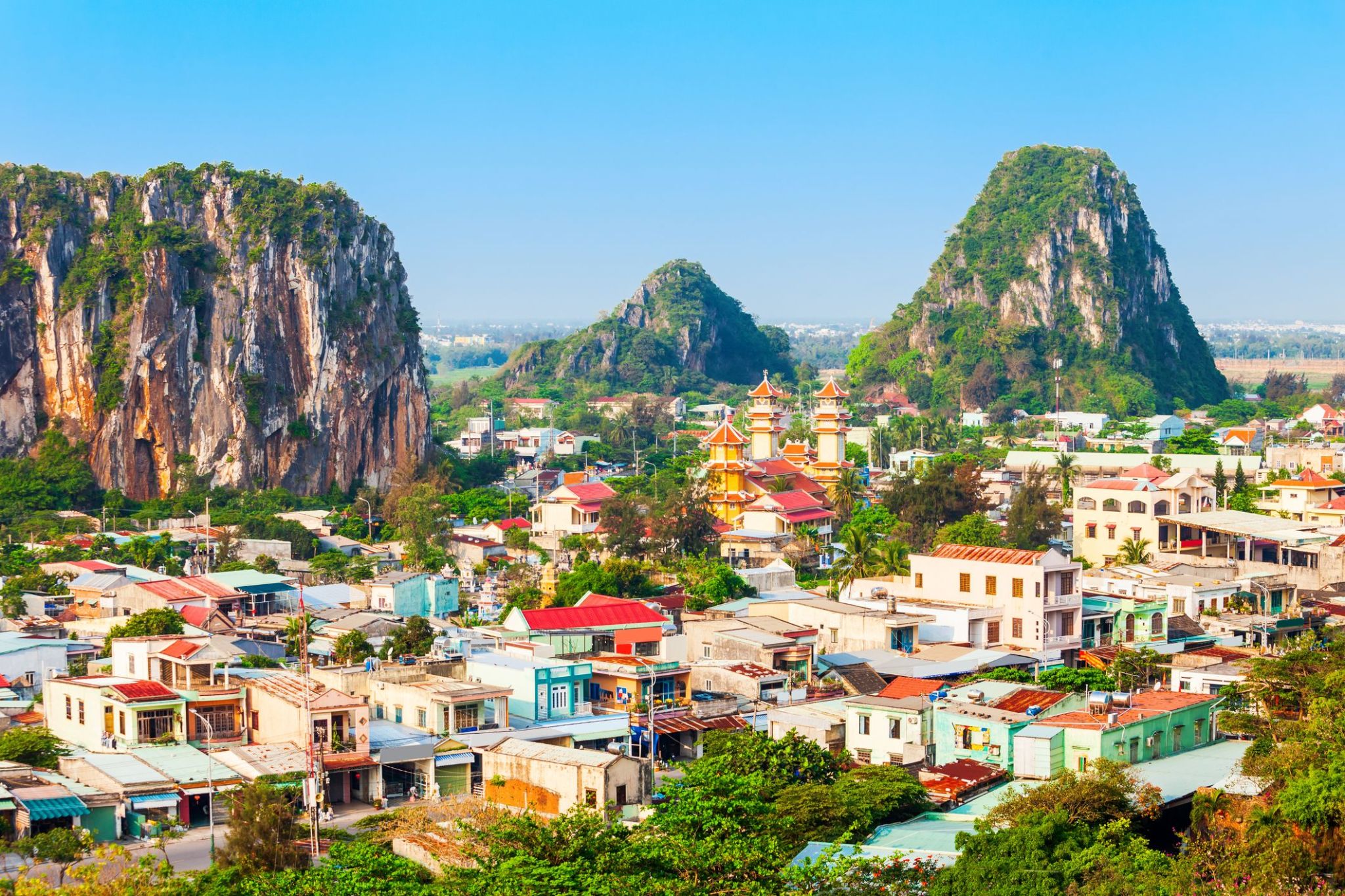
Da Nang is the fifth largest city in Vietnam after Ho Chi Minh City, Hanoi, Haiphong and Can Tho in terms of urbanization and economy. Located on the coast of the South China Sea at the mouth of the Han River, it is one of Vietnam's most important port cities. As one of the country's five direct-controlled municipalities, it is under the direct administration of the central government.
Da Nang is the commercial and educational centre of Central Vietnam, as well as being the largest city in the region. In addition to its well-sheltered, easily accessible port, Da Nang's location on the path of National Route 1A and the North–South Railway makes it a hub for transportation. It is located within 100 km (62 mi) of several UNESCO World Heritage Sites, including the Imperial City of Hue, the Old Town of Hoi An, and the My Son ruins. The city was previously known as Cửa Hàn during early Đại Việt settlement, and as Tourane (or Turon) during French colonial rule. Before 1997, the city was part of Quang Nam-Da Nang Province.
On 1 January 1997, Da Nang was separated from Quảng Nam Province to become one of four independent (centrally controlled) municipalities in Vietnam. Da Nang is listed as a first class city, and has a higher urbanization ratio than any of Vietnam's other provinces or centrally governed cities.
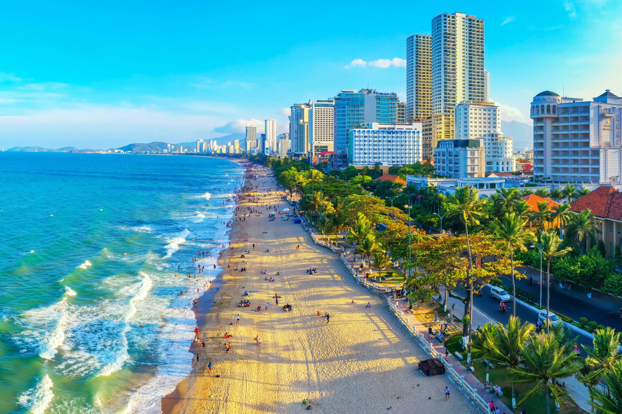
Nha Trang is a coastal city and capital of Khánh Hòa Province, on the South Central Coast of Vietnam. It is bounded on the north by Ninh Hoà district, on the south by Cam Ranh town and on the west by Diên Khánh District. The city has about 392,000 inhabitants, a number that is projected to increase to 560,000 by 2015 and 630,000 inhabitants by 2025. An area of 12.87 square kilometres (4.97 sq mi) of the western communes of Diên An and Diên Toàn is planned to be merged into Nha Trang which will make its new area 265.47 square kilometres (102.50 sq mi) based on the approval of the Prime Minister of Vietnam in September 2012.
Nha Trang is well known for its beaches and scuba diving and has developed into a popular destination for international tourists, attracting large numbers of backpackers, as well as more affluent travelers on the south-east Asia circuit; it is already very popular with Vietnamese tourists, with Nha Trang Bay widely considered as among the world's most beautiful bays. Tourists are welcomed to participate in the Sea Festival, held biennially. Nha Trang was the site of the Miss Universe 2008 Pageant on July 14, 2008 and Miss Earth 2010 was held on December 4, 2010. It was also the site for the April 14, 2015 season 8 finale of Face Off. Nha Trang was approved to host the 2016 Asian Beach Games.
Historically, the city was known as Kauthara under the Champa. The city is still home to the famous Po Nagar Tower built by the Champa. Being a coastal city, Nha Trang is a centre for marine science based at the Nha Trang Oceanography Institute. The Hon Mun marine protected area is one of four first marine protected areas in the world admitted by the IUCN.
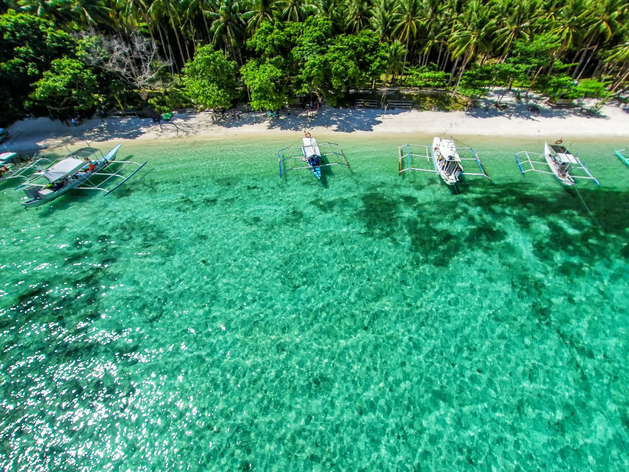
Պուերտո Պրինսեսան Ֆիլիպինների Պալավան կղզու վրա գտնվող քաղաք է, որը լայն ճանաչում ունի իր բնական հրաշքներից մեկի՝ Պուերտո Պրինսեսայի ստորգետնյա գետի շնորհիվ, որը ՅՈւՆԵՍԿՕ-ի համաշխարհային ժառանգության ցանկում է։ Այս ստորգետնյա քարանձավների և գետերի համակարգը, որը անցնում է կրաքարե ժայռերի միջով, գրավում է այցելուներին ամբողջ աշխարհից՝ նավակով գետի միջով անցնելու և ստալակտիտներ, ստալագմիտներ ու եզակի էկոհամակարգ տեսնելու հնարավորությամբ։ Քաղաքը նաև մեկնարկային կետ է Պալավանի տպավորիչ բնությունը ուսումնասիրելու համար՝ արևադարձային անտառներ, ափեր և արգելոցներ։
Բնական տեսարժան վայրերից բացի, Պուերտո Պրինսեսան հայտնի է իր մաքուր փողոցներով, հյուրընկալ մթնոլորտով և զարգացած զբոսաշրջային ենթակառուցվածքներով։ Այստեղ կարելի է վայելել թարմ ծովամթերք, այցելել գիշերային շուկաներ կամ շրջագայություններ կազմակերպել Հոնդա ծոցի կղզիներում։ Քաղաքը ակտիվորեն զարգացնում է էկոտուրիզմը՝ պահպանելով բնության և զարգացման հավասարակշռությունը։ Ուղևորների համար, ովքեր փնտրում են արկածներ, հանգիստ և մշակութային փորձառություն, Պուերտո Պրինսեսան դառնում է ավելի գրավիչ ուղղություն։
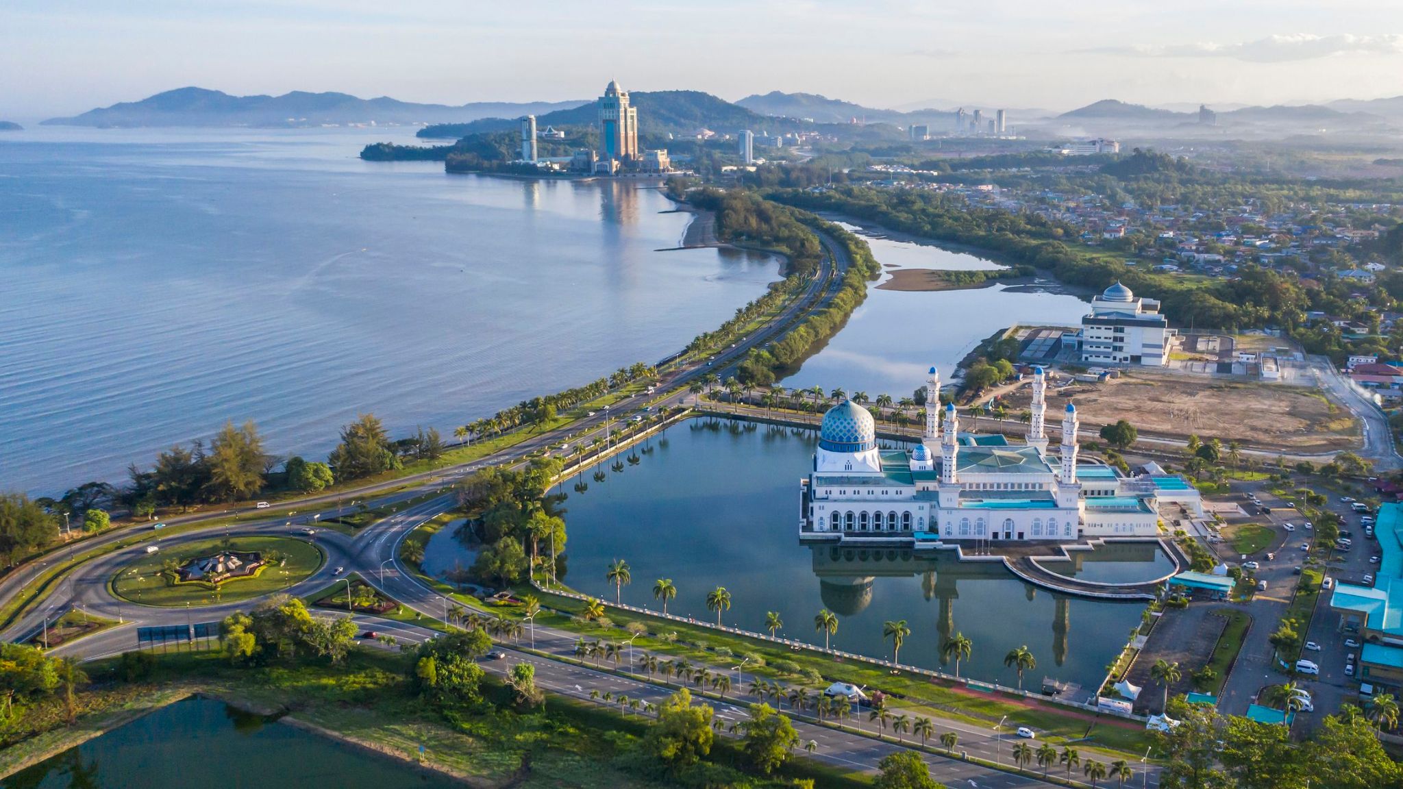
Kota Kinabalu , formerly known as Jesselton, is the state capital of Sabah, Malaysia and the capital of the Kota Kinabalu District. It is also the capital of the West Coast Division of Sabah. The city is located on the northwest coast of Borneo facing the South China Sea. The Tunku Abdul Rahman National Park lies to its west and Mount Kinabalu, which gave the city its name, is located to its east. Kota Kinabalu has a population of 452,058 according to the 2010 census; when the adjacent Penampang and Putatan districts are included, the metro area has a combined population of 628,725.
In the 15th century, the area of Kota Kinabalu was under the influence of Bruneian Empire. In the 19th century, the British North Borneo Company (BNBC) first set up a settlement near the Gaya Island. However, it was destroyed by fire in 1897 by a local leader named Mat Salleh. In July 1899, the place located opposite to the Gaya Island was identified as a suitable place for settlements. Development in the area was started soon after that; and the place was named "Api-api" before it was renamed after the vice-chairman of BNBC as "Jesselton". Jesselton became a major trading port in the area, and was connected to the North Borneo Railway. Jesselton was largely destroyed during World War II. The Japanese occupation of Jesselton provoked several local uprisings notably the Jesselton Revolt but they were eventually defeated by the Japanese. After the war, BNBC was unable to finance the high cost of reconstructions and the place was ceded to the British Crown Colony. The British Crown declared Jesselton as the new capital of North Borneo in 1946 and started to rebuild the town. After the formation of Malaysia, North Borneo was renamed as Sabah. In 1967, Jesselton was renamed as Kota Kinabalu, Kota being the Malay word for Fort and Kinabalu after the nearby Mount Kinabalu. Kota Kinabalu was granted city status in 2000.
Kota Kinabalu is often known as KK both in Malaysia and internationally. It is a major tourist destination and a popular gateway for travellers visiting Sabah and Borneo. Kinabalu Park is located about 90 kilometres from the city and there are many other tourist attractions in and around the city. Kota Kinabalu is also one of the major industrial and commercial centres of East Malaysia. These two factors combine to make Kota Kinabalu one of the fastest growing cities in Malaysia.