| Cruise Region : South America / Antarctica |
| Company : Oceania Cruises |
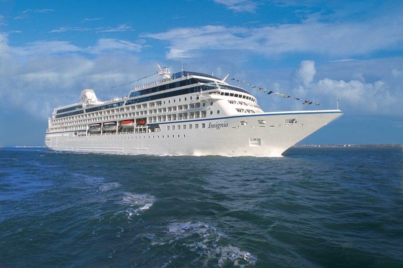
| Ship : Insignia |
| Journey Start : կիր 07 մրտ 2027 |
| Journey End : ուր 09 ապր 2027 |
| Count Nights : 33 nights |
| Day | Date | Port | Arrival | Departure |
|---|---|---|---|---|
| 1 | 7.03 կիր | Բուենոս Այրես / Argentina | 06:00 | 18:00 |
| 2 | 8.03 երկ | Մոնտեվիդեո / Uruguay | 08:00 | 20:00 |
| 3 | 9.03 երք | Պունտա դել Էստե / Uruguay | 07:00 | 16:00 |
| 4 | 10.03 չրք | Rio Grande - Rio Grande do Sul / Brazil | 11:00 | 20:00 |
| 5 | 11.03 հնգ | Օր ծովում / Sea | ||
| 6 | 12.03 ուր | Ֆլորիանոպոլիս / Brazil | 07:00 | 19:00 |
| 7 | 13.03 շբթ | Իտաժաի / Brazil | 07:00 | 17:00 |
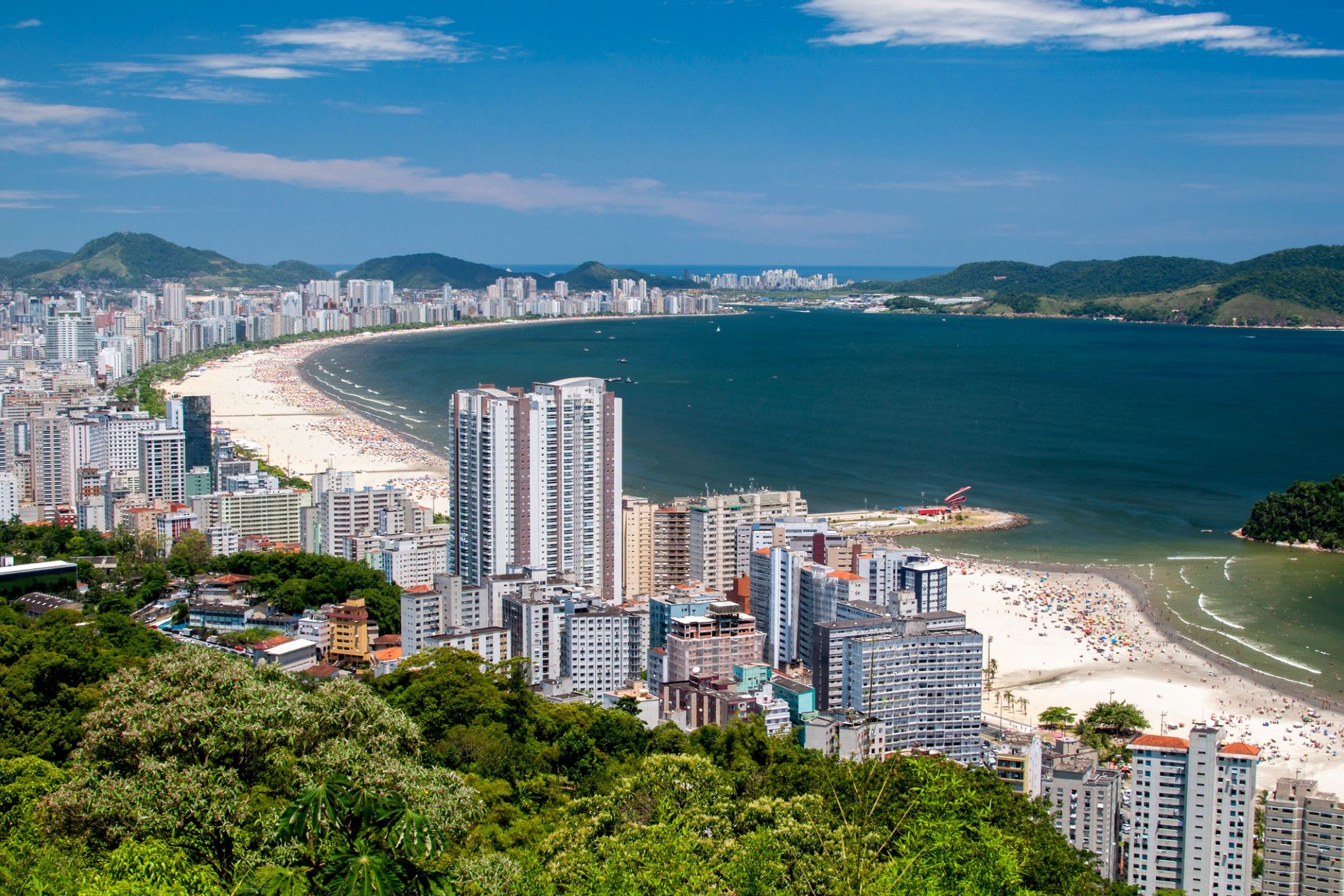
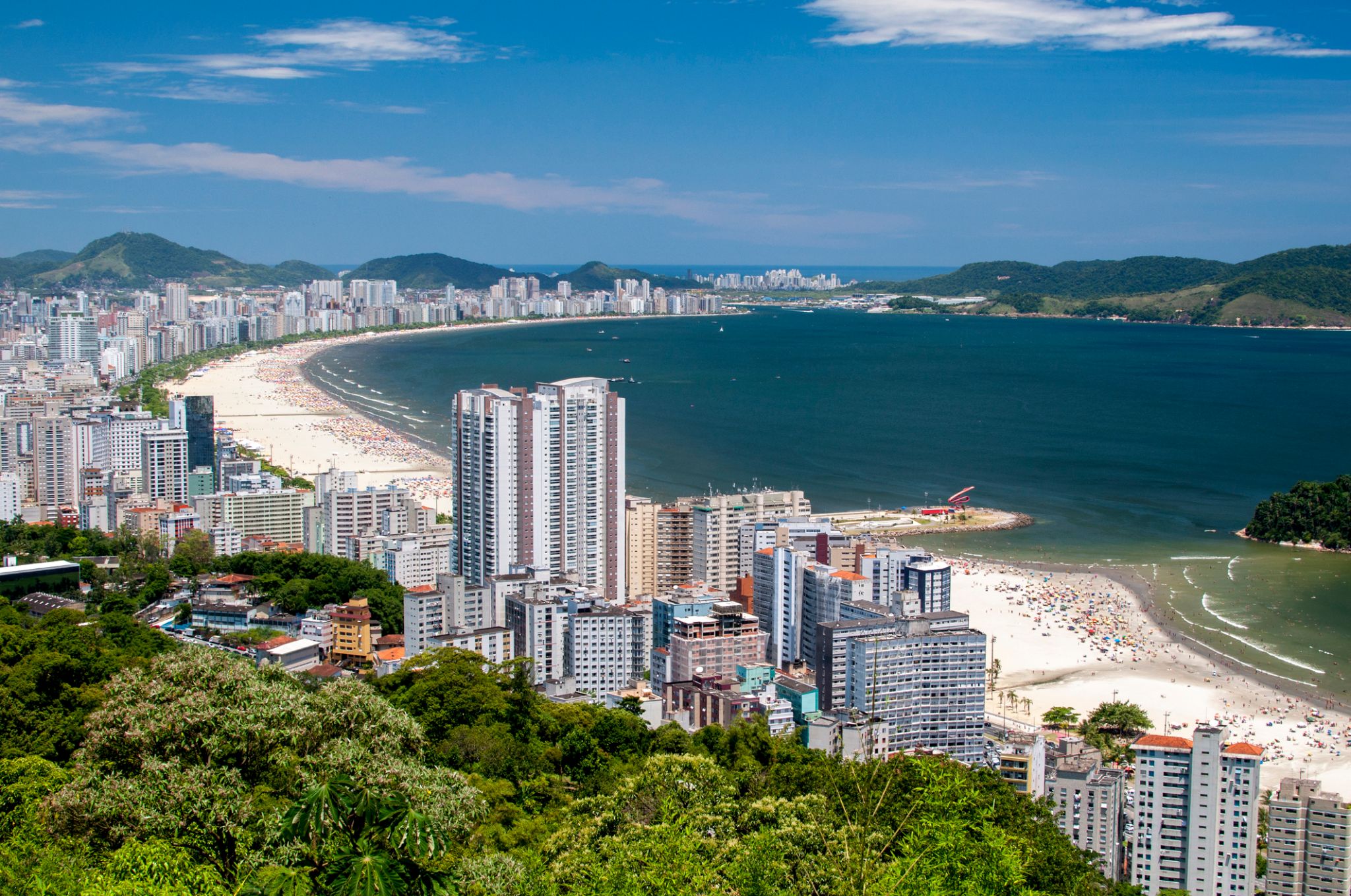
| 8 | 14.03 կիր | Սանտոս / Brazil | 09:00 | 18:00 |
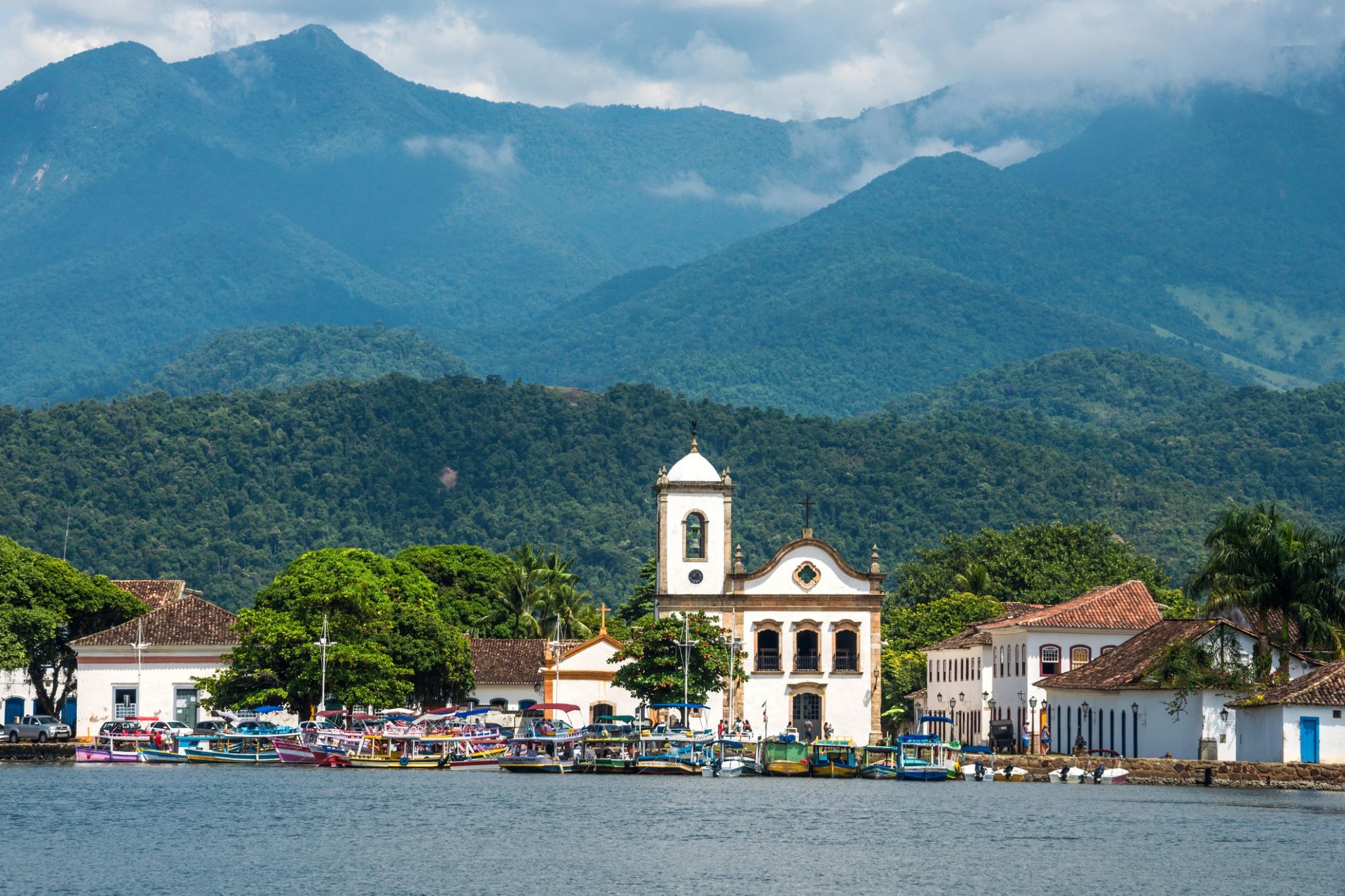
| 9 | 15.03 երկ | Պարատի / Brazil | 08:00 | 18:00 |
| 10 | 16.03 երք | Իլյա Գրանդե / Brazil | 08:00 | 18:00 |
| 11 | 17.03 չրք | Արմասաու դուս Բուզիուս / Brazil | 08:00 | 18:00 |
| 12 | 18.03 հնգ | Ռիո դե Ժանեյրո / Brazil | 08:00 | |
| 13 | 19.03 ուր | Ռիո դե Ժանեյրո / Brazil | 16:00 | |
| 14 | 20.03 շբթ | Օր ծովում / Sea | ||
| 15 | 21.03 կիր | Օր ծովում / Sea | ||
| 16 | 22.03 երկ | Օր ծովում / Sea | ||
| 17 | 23.03 երք | Օր ծովում / Sea | ||
| 18 | 24.03 չրք | Օր ծովում / Sea | ||
| 19 | 25.03 հնգ | Օր ծովում / Sea | ||
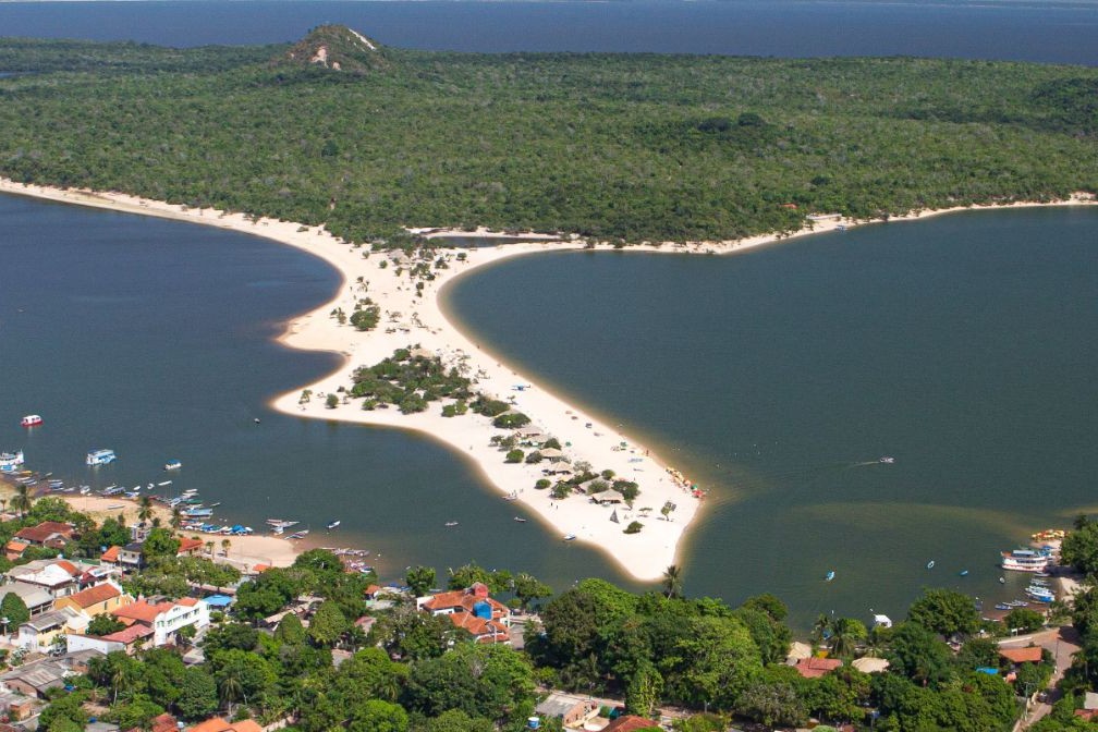
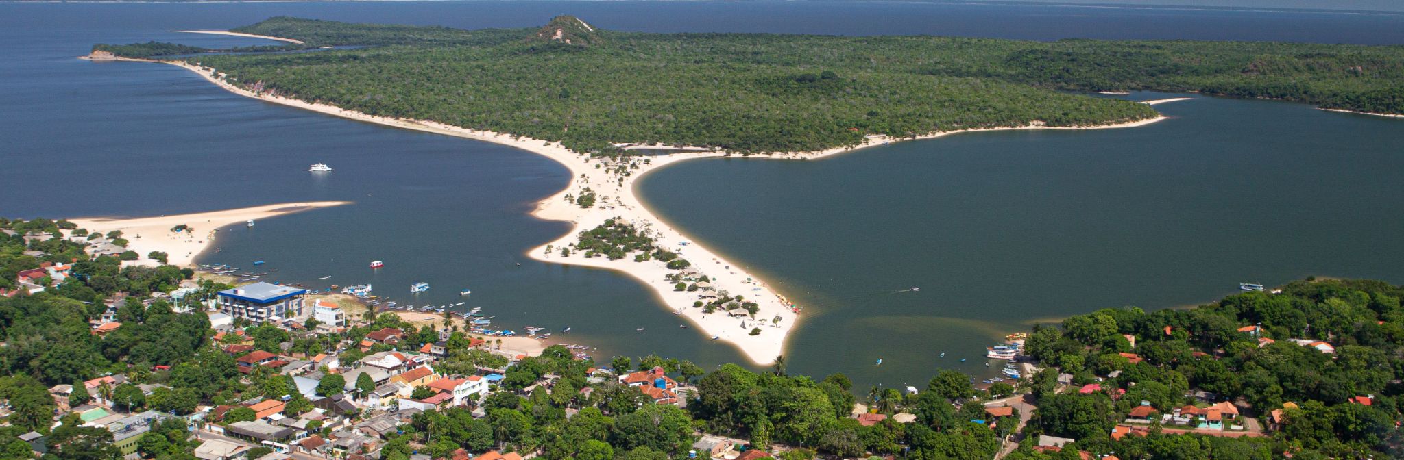
| 20 | 26.03 ուր | Alter do Chao / Brazil | 14:00 | 20:00 |
| 21 | 27.03 շբթ | Վալերիա գյուղի բերան / Brazil | 08:00 | 15:00 |
| 22 | 28.03 կիր | Մանաուս / Brazil | 09:00 | |
| 23 | 29.03 երկ | Մանաուս / Brazil | 18:00 | |
| 24 | 30.03 երք | Parintins Parintins / Brazil | 12:00 | 18:00 |
| 25 | 31.03 չրք | Սանտարեն / Brazil | 07:00 | 12:00 |
| 26 | 1.04 հնգ | Օր ծովում / Sea | ||
| 27 | 2.04 ուր | Օր ծովում / Sea | ||
| 28 | 3.04 շբթ | Օր ծովում / Sea | ||
| 29 | 4.04 կիր | Բրիջթաուն / Barbados | 07:00 | 15:00 |
| 30 | 5.04 երկ | Սուրբ Հովհաննես / Canada | 11:00 | 18:00 |
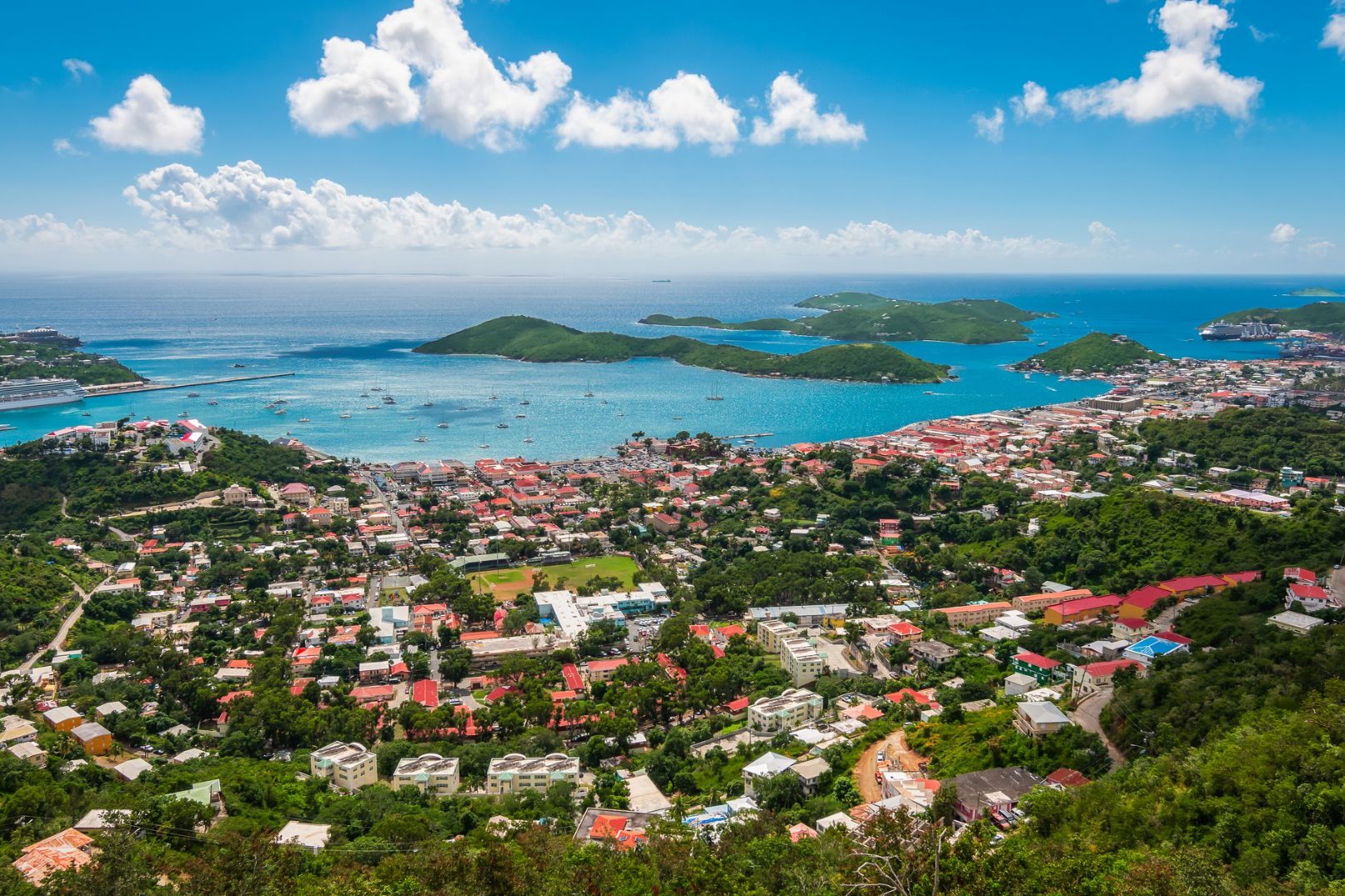
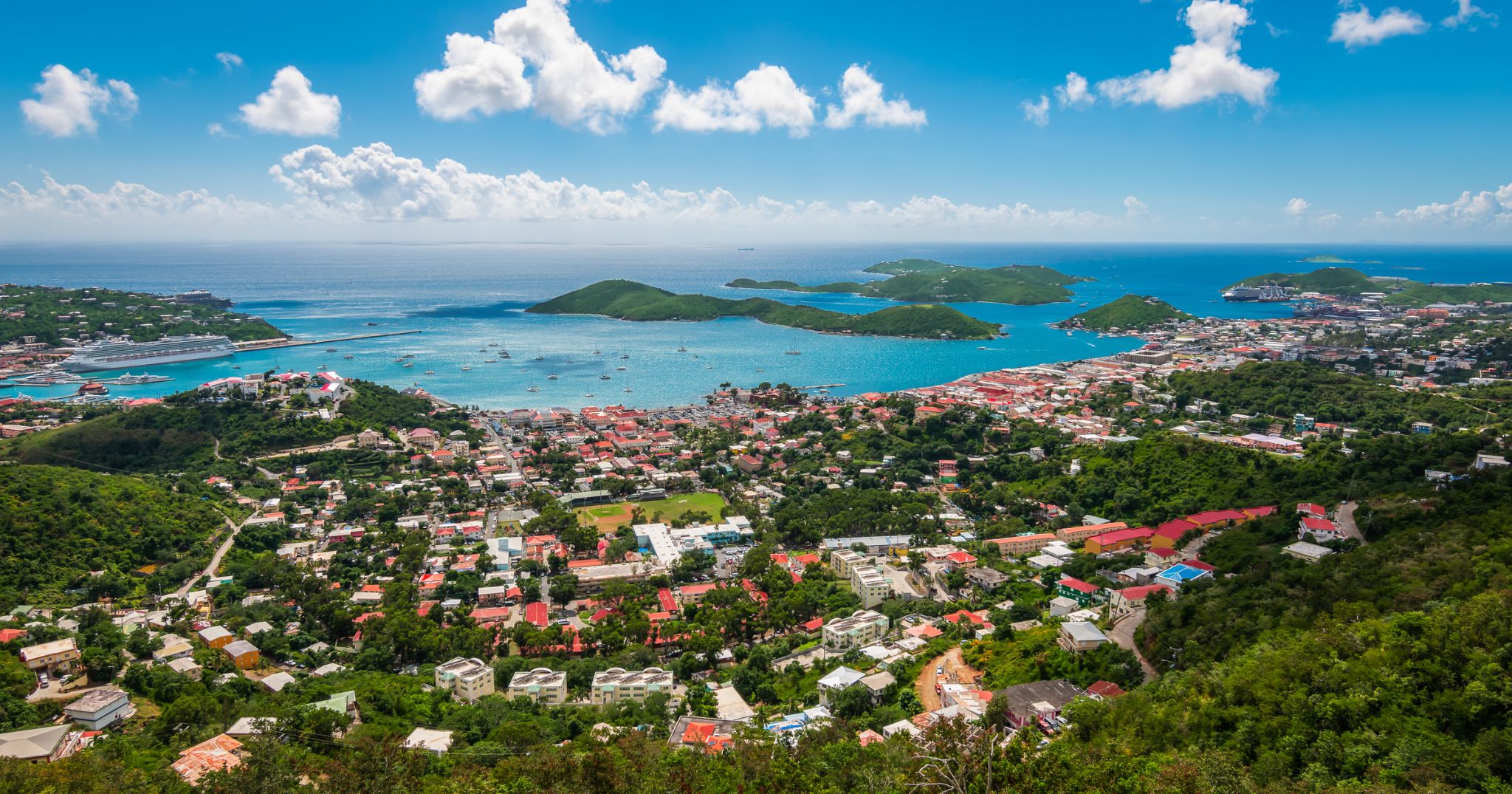
| 31 | 6.04 երք | Շառլոտ Ամալի, պ. Սուրբ Թովմաս / Virgin Islands | 07:00 | 17:00 |
| 32 | 7.04 չրք | Օր ծովում / Sea | ||
| 33 | 8.04 հնգ | Օր ծովում / Sea | ||
| 34 | 9.04 ուր | Մայամի / USA | 07:00 | 18:00 |

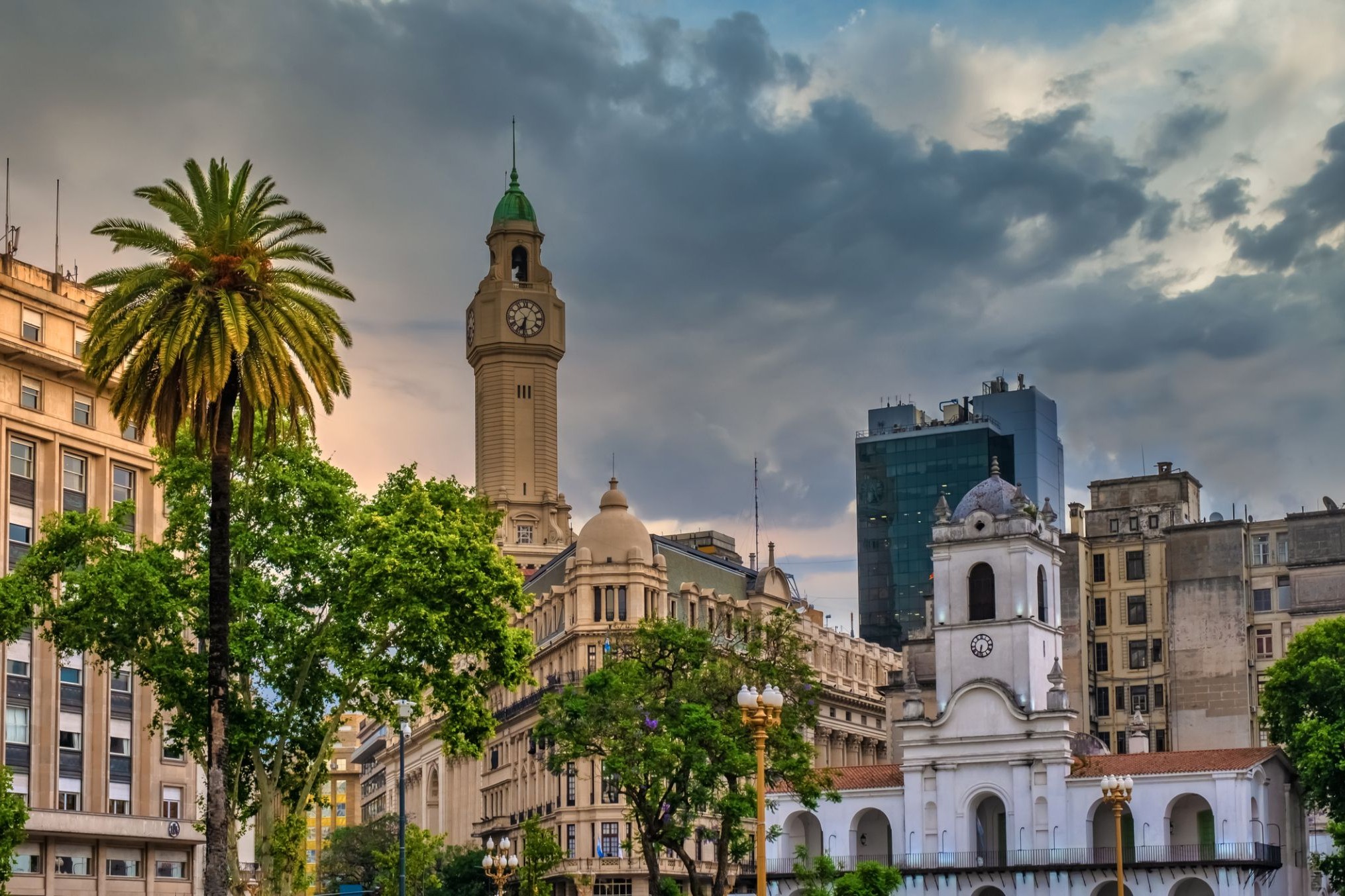
the capital city and chief port of Argentina, in the eastern central part of the country, on the Plata River; population 3,042,600 (est. 2008).
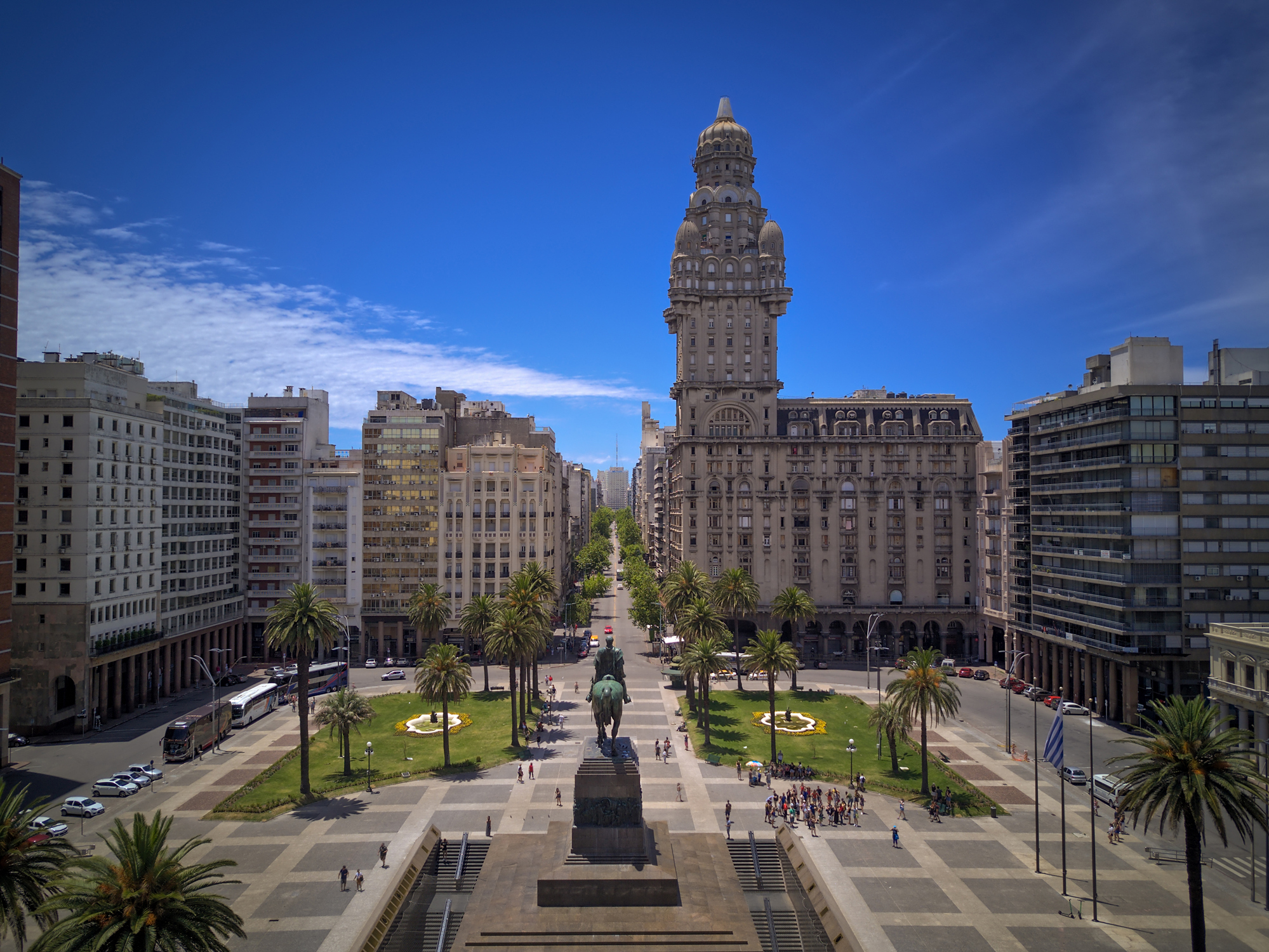
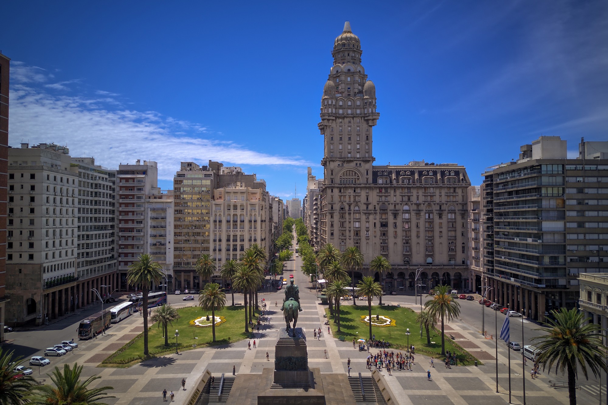
Montevideo is the capital and largest city of Uruguay. According to the 2011 census, the city proper has a population of 1,319,108 (about one-third of the country's total population) in an area of 201 square kilometres (78 sq mi). The southernmost capital city in the Americas, Montevideo is situated on the southern coast of the country, on the northeastern bank of the Río de la Plata.
The city was established in 1724 by a Spanish soldier, Bruno Mauricio de Zabala, as a strategic move amidst the Spanish-Portuguese dispute over the platine region. It was also under brief British rule in 1807. Montevideo is the seat of the administrative headquarters of Mercosur and ALADI, Latin America’s leading trade blocs, a position that entailed comparisons to the role of Brussels in Europe.
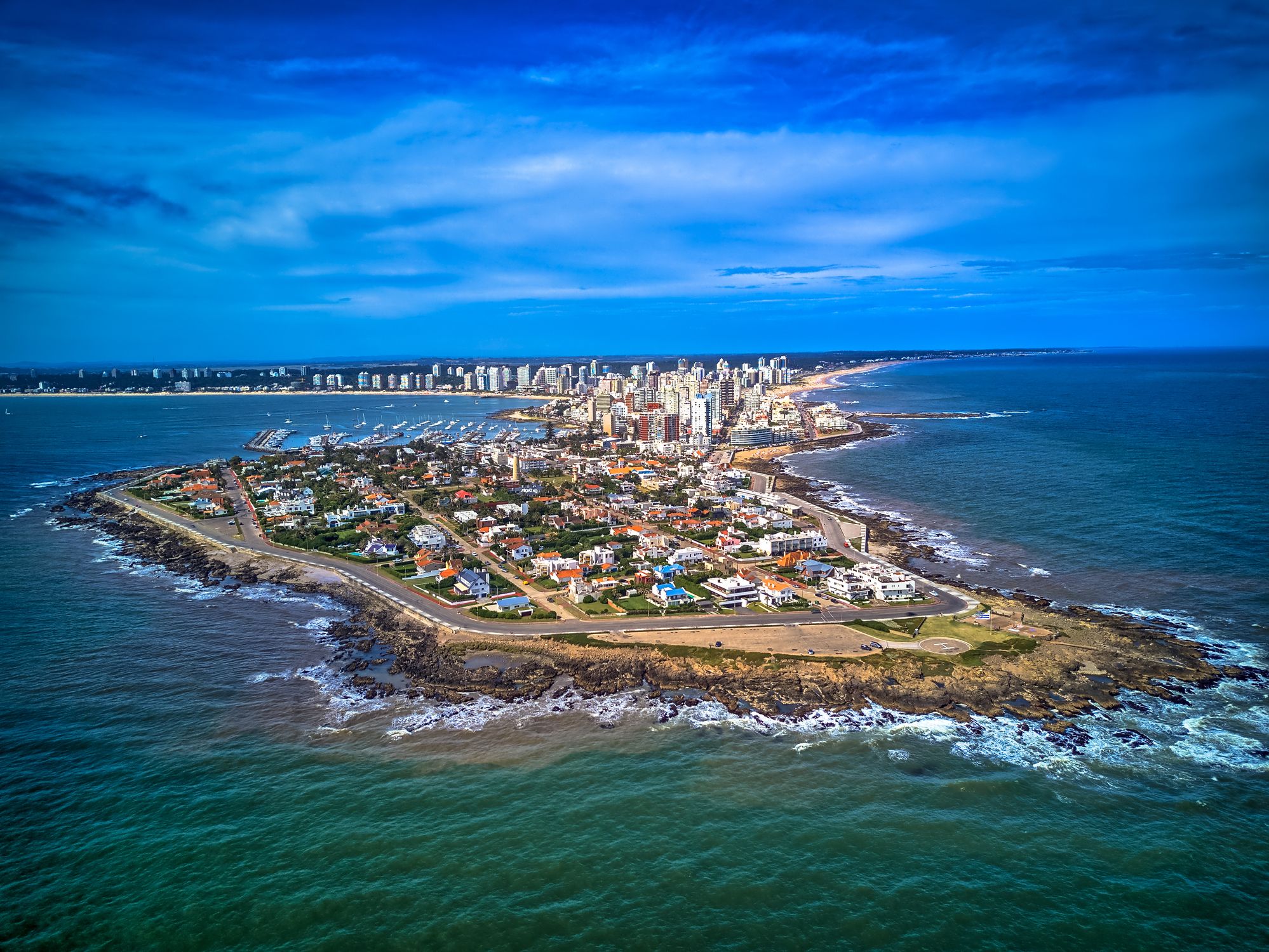
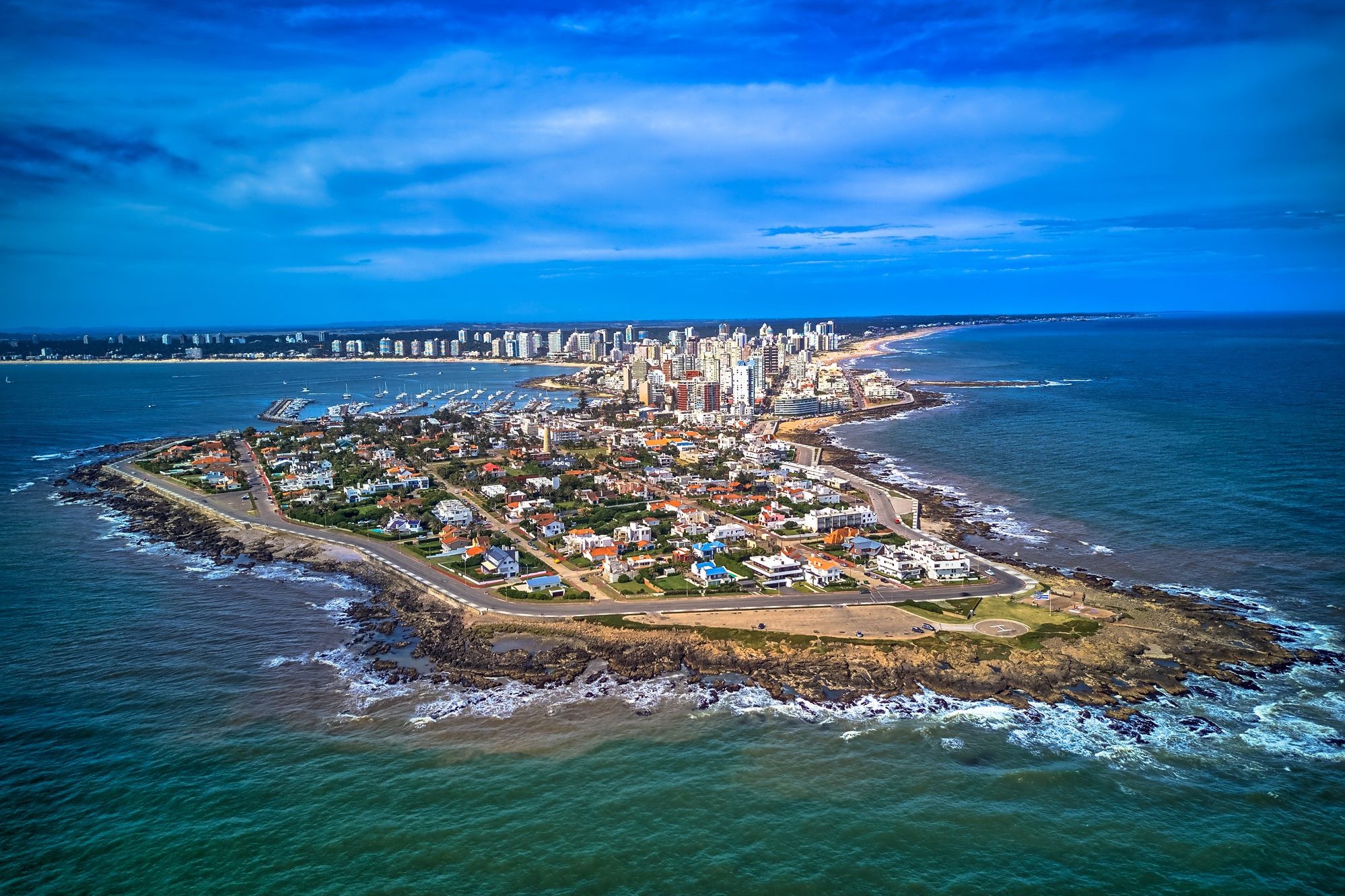
Պունտա դել Էստե — Ուրուգվայի ծովափնյա առողջարան Ատլանտիկի ափին
Պունտա դել Էստեն Հարավային Ամերիկայի ամենահայտնի առողջարաններից է, որը գտնվում է Ուրուգվայի հարավային ափին՝ այն տեղում, որտեղ Ատլանտյան օվկիանոսը միանում է Լա Պլատա էստուարի հետ։ Այս քաղաքը հայտնի է իր հակադրություններով. մեկ կողմից՝ շքեղ թաղամասեր, ժամանակակից երկնաքերեր, նավահանգիստներ և բարձրակարգ ռեստորաններ, իսկ մյուս կողմից՝ հանգիստ ավազոտ լողափեր, գեղատեսիլ ավազաթմբեր և ալիքներ, որոնք իդեալական են սերֆինգի համար։ Այն հաճախ անվանում են «Հարավային Ամերիկայի Մոնակո»՝ իր շքեղ ենթակառուցվածքների և համաշխարհային ճանաչում ունեցող հյուրերի շնորհիվ։
Բացի լողափերից՝ քաղաքը առաջարկում է մշակութային և բնական տեսարժան վայրեր՝ "La Mano" քանդակը, որը դարձել է քաղաքի խորհրդանիշը, Ralli ժամանակակից արվեստի թանգարանը, ինչպես նաև ափամերձ կղզիները՝ ծովառյուծներով։ Արժե այցելել նաև Լա Բարրա թաղամասը իր բոհեմյան մթնոլորտով կամ վայելել մայրամուտը Փունտա դել Էստեի փարոսի մոտ։ Ամառային սեզոնին (դեկտեմբեր–փետրվար) քաղաքը դառնում է աշխույժ կենտրոն՝ գրավելով զբոսաշրջիկներին ամբողջ աշխարհից։
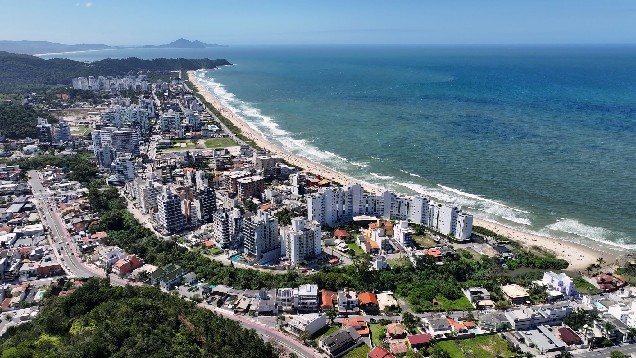
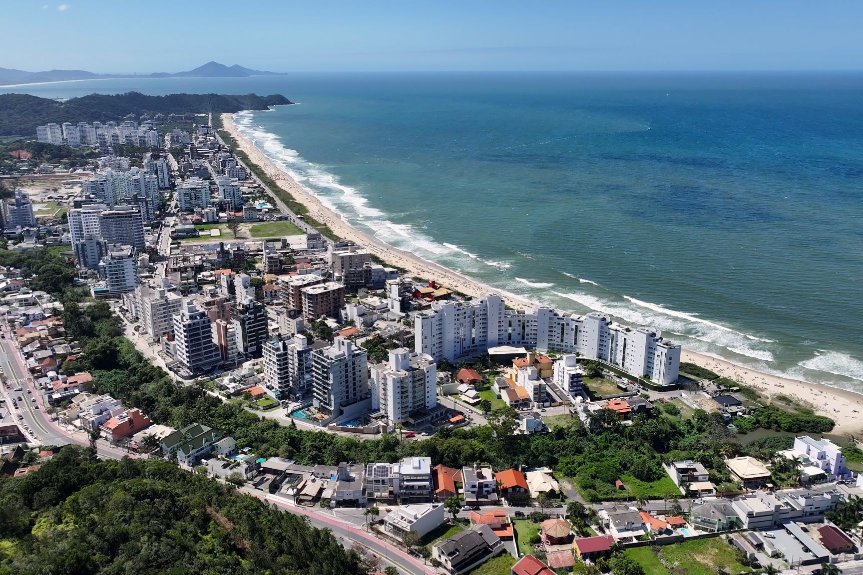
Իտաժաին Բրազիլիայի հարավում՝ Սանտա Կատարինա նահանգում գտնվող առափնյա քաղաք է, որը հայտնի է իր աշխույժ նավահանգստով և զարգացած ծովային ենթակառուցվածքներով։ Իտաժաիի նավահանգիստը համարվում է երկրի կարևորագույններից մեկը՝ մսի և գյուղատնտեսական արտադրանքի արտահանման ուղղությամբ։ Քաղաքը գրավում է ոչ միայն գործարար այցելուներին, այլև զբոսաշրջիկներին՝ իր մեջ համադրելով արդյունաբերական տեսարաններն ու բնական գեղեցկությունը։ Քայլելով ափամերձ գծով՝ կարելի է տեսնել հսկա բեռնանավեր Ատլանտյան օվկիանոսի ֆոնին և համտեսել թարմ ծովամթերք տեղական ռեստորաններում։
Չնայած իր տնտեսական նշանակությանը՝ Իտաժաին առաջարկում է հանգիստ լողափեր, կանաչ զբոսայգիներ և մշակութային միջոցառումներ։ Ամենահայտնի միջոցառումներից մեկը Festa do Mare-ն է՝ նավաստիների տոն, որն ուղեկցվում է շքերթներով, համերգներով և ձկնային ուտեստներով։ Քաղաքի մոտակայքում է գտնվում Balneário Camboriú հանգստավայրը՝ Բրազիլիայի ամենահայտնի լողափային ուղղություններից մեկը։ Իտաժաին միավորում է ծովը, մշակույթը և հարավային Բրազիլիայի դինամիկ կյանքը՝ դարձնելով այն իդեալական վայր ինչպես կարճ կանգառի, այնպես էլ հանգիստ շրջայցերի համար։

Բրազիլիայի ափամերձ սմարաղդյա ալիքների մեջ թաքնված է Ilha Grande կղզին, որն իր անխաթար բնությամբ ու իրական արկածախնդրության ոգով կախարդում է այցելուներին։ Ռիո դե Ժանեյրոյի նահանգում գտնվող այս կղզին երբևէ ծառայել է որպես բանտ և բորոտների գաղութ, իսկ այսօր այն դարձել է կատարյալ վայր քաղաքային աղմուկից փախչելու համար։ Այստեղ ավտոմեքենաներ չկան՝ փոխարենը՝ արահետներ, որոնք անցնում են ջունգլիներով՝ տանում դեպի սպիտակ ավազով լողափեր, բյուրեղյա պարզություն ունեցող ծովալճակներ և անտառի խորքերում թաքնված ջրվեժներ։
Ուղևորները կարող են բացահայտել ավելի քան 100 լողափ՝ ներառյալ աշխարհում ամենագեղեցիկներից մեկը համարվող Լոպես Մենդեսը։ Նավակներով շրջագայությունները դեպի լքված բանտեր, ջրասուզակություն՝ նավաբեկության վայրերում և արշավները Ատլանտյան անտառով առաջարկում են բազմաթիվ արկածներ։ Ilha Grande-ը պարզապես հանգստի վայր չէ, այլ կենդանի թանգարան՝ լի բնությամբ և պատմությամբ, որտեղ յուրաքանչյուր քայլը նոր բացահայտում է։
Արմասաու դուս Բուզիուսը, հաճախ պարզապես Բուզիուս անվամբ, հանգստյան քաղաք է և համայնք Բրազիլիայի Ռիո դե Ժանեյրո նահանգում։ 2012 թվականին բնակչությունը կազմել է 23,463 մարդ, իսկ տարածքը՝ 69 կմ²։ Այսօր Բուզիուսը հայտնի հանգստավայր է, հատկապես բրազիլացիների և արգենտինացիների շրջանում։
20-րդ դարի սկզբում Բուզիուսը գրեթե անհայտ ձկնորսական գյուղ էր։ Այսպես մնաց մինչև 1964 թվականը, երբ ֆրանսիացի դերասանուհի Բրիջիթ Բարդոն այցելեց Բուզիուս։ Այդ պահից սկսած, Բուզիուսը դարձավ Ռիո դե Ժանեյրոյի բարձր հասարակության սիրելի վայրը, ովքեր ցանկանում էին փախչել քաղաքի աղմուկից և վայելել թերակղզու առաջարկած ավելի քան 23 լողափերը։ Քաղաքը վերածվեց միջազգային զբոսաշրջային ուղղության։
Այսօր թերակղզին առաջարկում է հանգստություն, անմիջական կապ բնության հետ և գեղատեսիլ տեսարաններ։ Արևմտյան ափի լողափերը ունեն հանգիստ, պարզ ջրեր, մինչդեռ արևելյան ափի լողափերը, որոնք բաց են դեպի բաց ծովը, ավելի վայրի են և գրավում են սերֆինգի և ջրային սպորտերի սիրահարներին։ Քաղաքի ամենահայտնի լողափերից են Ազեդան, Ֆերրադուրան, Ժոաո Ֆերնանդեսը և Արմասաուն։ Երեկոյան Բուզիուսի գլխավոր փողոցը՝ Ռուա դաս Պեդրասը, առաջարկում է ակտիվ գիշերային կյանք և խանութների ու ռեստորանների լայն ընտրանի։

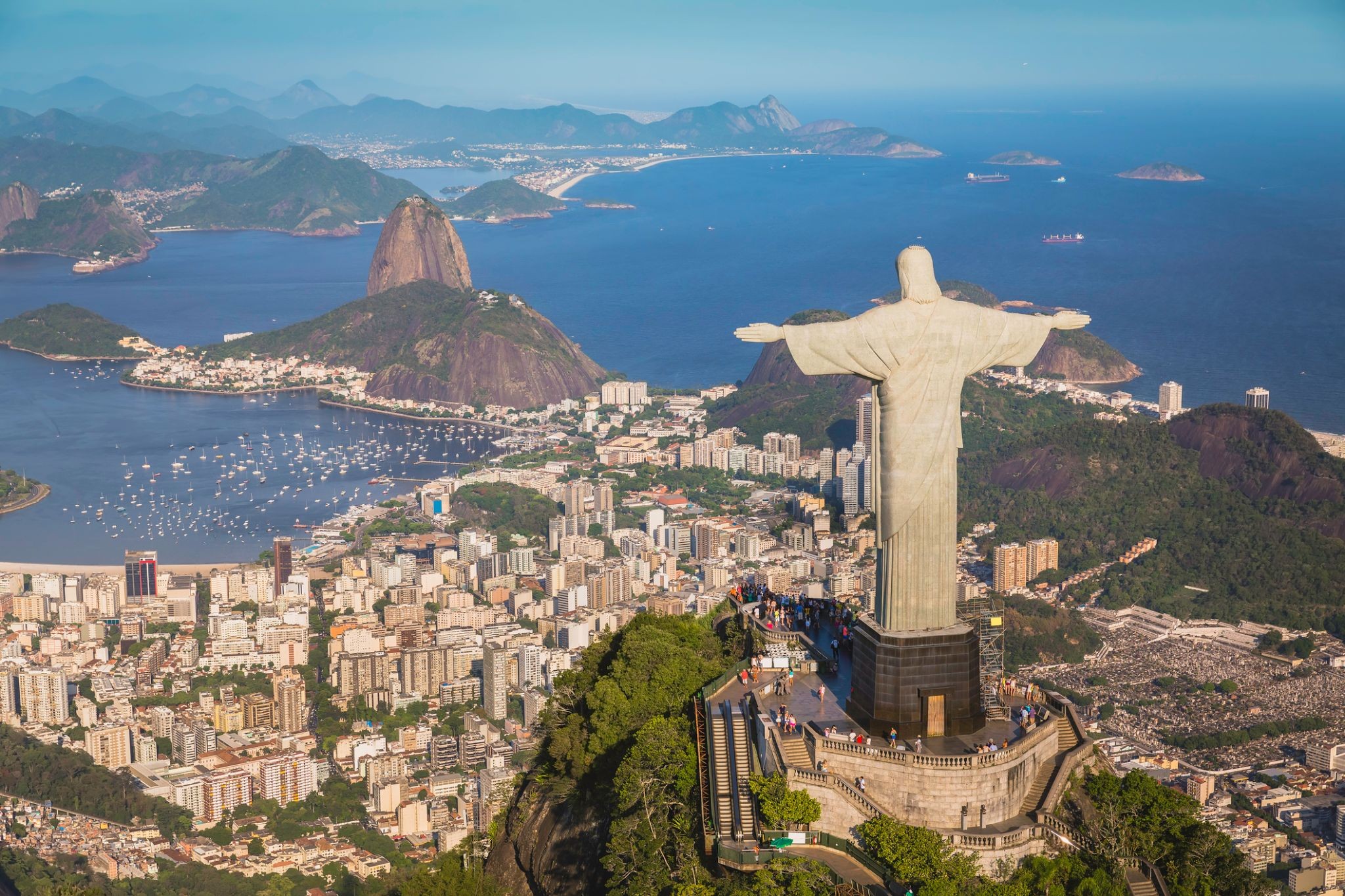
Rio de Janeiro is the second-most populous municipality in Brazil and the sixth-most populous in the Americas. The metropolis is anchor to the Rio de Janeiro metropolitan area, the second-most populous metropolitan area in Brazil and sixth-most populous in the Americas. Rio de Janeiro is the capital of the state of Rio de Janeiro, Brazil's third-most populous state. Part of the city has been designated as a World Heritage Site, named "Rio de Janeiro: CariocaLandscapes between the Mountain and the Sea", by UNESCO on 1 July 2012 as a Cultural Landscape.
Founded in 1565 by the Portuguese, the city was initially the seat of the Captaincy of Rio de Janeiro, a domain of the Portuguese Empire. Later, in 1763, it became the capital of the State of Brazil, a state of the Portuguese Empire. In 1808, when the Portuguese Royal Court transferred itself from Portugal to Brazil, Rio de Janeiro became the chosen seat of the court of Queen Maria I of Portugal, who subsequently, in 1815, under the leadership of her son, the Prince Regent, and future King João VI of Portugal, raised Brazil to the dignity of a kingdom, within the United Kingdom of Portugal, Brazil, and Algarves. Rio stayed the capital of the pluricontinental Lusitanian monarchy until 1822, when the War of Brazilian Independence began. This is one of the few instances in history that the capital of a colonising country officially shifted to a city in one of its colonies. Rio de Janeiro subsequently served as the capital of the independent monarchy, the Empire of Brazil, until 1889, and then the capital of a republican Brazil until 1960 when the capital was transferred to Brasília.
Manaus, previously known as Manaós before 1939 and formerly Barra do Rio Negro, is the capital city of the state of Amazonas in the North Region of Brazil. It is situated near the confluence of the Negro and Solimões rivers. With a population of more than 2 million, it is the most populous city of both the Brazilian state of Amazonas and the Amazon rainforest.
The city was founded in 1669 as the Fort of São José do Rio Negro. It was elevated to a town in 1832 with the name of "Manaus", an altered spelling of the indigenous Manaós peoples, and legally transformed into a city on October 24, 1848, with the name of Cidade da Barra do Rio Negro, Portuguese for "The City of the Margins of the Black River". On September 4, 1856 it returned to its original name.
Manaus is located in the middle of the Amazon rainforest, and access to the city is primarily by boat or airplane. This isolation helped preserve both the natural environment as well as the culture of the city. The culture of Manaus, more than in any other urban area of Brazil, preserves the habits of Native Brazilian tribes. The city is the main access point for visiting the fauna and flora of the Brazilian Amazon. Few places in the world afford such a variety of plants, birds, insects, and fishes.
It was known at the beginning of the century, as "Heart of the Amazon" and "City of the Forest". Currently its main economic engine is the Industrial Park of Manaus, a Free Economic Zone. The city has a free port and an international airport. Its manufactures include electronics, chemical products, and soap; there are distilling and ship construction industries. Manaus also exports Brazil nuts, rubber, jute and rosewood oil. It has a cathedral, opera house, zoologicaland botanical gardens, an ecopark and regional and native peoples museums.
With a population of 2,145,444 people in 2018, Manaus is the most populous city in the Brazilian Amazon area and the 7th most populous in the country. It is located on the north bank of the Negro River, 18 km (11 mi) above the meeting of the rivers where the Negro merges with the Solimões, to form the Amazon proper. Manaus is 1,400 km (900 mi) inland from the Atlantic Ocean. It is the hub of tourism for the rivers, the jungle lodges and the river cruises.
The Solimões and Negro rivers meet just east of Manaus and join to form the Amazon River (using the Brazilian definition of the river; elsewhere, Solimões is considered the upper part of the Amazon). Rubber made it the richest city in South America during the late 1800s. Rubber also helped Manaus earn its nickname, the "Paris of the Tropics". Many wealthy European families settled in Manaus and brought their love for sophisticated European art, architectureand culture with them. Manaus is also a duty-free zone, which has encouraged development in the region.
Parintins is a municipality in the far east of the Amazonas state, Brazil. It is part of a microregion also named Parintins. The population for the entire municipality was 109,150 (2005) and its area is 5,952 km². The city is located on Tupinambarana island in the Amazon River. Parintins is known for a popular folklore festival held there each June called Boi-Bumbá.

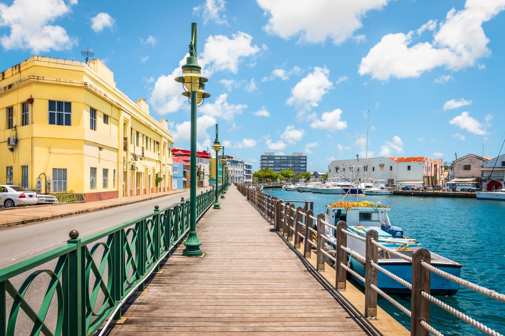
Բրիջթաունը Բարբադոսի մայրաքաղաքն ու ամենամեծ քաղաքն է։ Նախկինում հայտնի էր որպես Սեն Մայքլի քաղաք, իսկ այժմյան Մեծ Բրիջթաունի տարածքը գտնվում է Սեն Մայքլ ծխում։ Տեղացիները երբեմն անվանում են այն «Քաղաք», սակայն առավել հաճախ պարզապես «Թաուն»։ 2014 թվականի տվյալներով մետրոպոլիտենային շրջանի բնակչությունը կազմում էր մոտավորապես 110,000։
Բրիջթաունի նավահանգիստը գտնվում է Քարլայլի ծոցի ափին (13.106° հս․ լ, 59.632° ար․ երկ․)՝ կղզու հարավ-արևմտյան մասում։ Մեծ Բրիջթաունի որոշ հատվածներ (որոնք պայմանականորեն սահմանվում են ABC մայրուղով) մոտ են հարևան Քրայսթ Չերչ և Սենթ Ջեյմս ծխերի սահմաններին։ Բարբադոսի Գրանտլի Ադամս միջազգային օդանավակայանը գտնվում է քաղաքի կենտրոնից 16 կմ դեպի հարավ-արևելք և ունի ամենօրյա թռիչքներ դեպի Միացյալ Թագավորություն, ԱՄՆ, Կանադա և Կարիբյան տարածաշրջան։ Այժմ քաղաքը չունի տեղական ինքնակառավարման մարմին, սակայն հանդիսանում է ազգային խորհրդարանի ընտրատարածք։ 1950-60-ականների Բրիտանական Արևմտյան Հնդկաստանի կարճաժամկետ դաշնության ժամանակ Բրիջթաունը համարվում էր դաշնային մայրաքաղաքի հնարավոր թեկնածու քաղաքներից մեկը։
Քաղաքի ներկայիս վայրը հիմնադրվել է անգլիացի վերաբնակիչների կողմից 1628 թվականին։ Մինչ այդ Սըր Ուիլյամ Կուրթենի ղեկավարությամբ բնակեցում եղել է Սենթ Ջեյմս Թաունում։ Բրիջթաունը Կարիբյան տարածաշրջանի կարևոր զբոսաշրջային ուղղություններից մեկն է, ինչպես նաև ֆինանսական, տեղեկատվական, համաժողովային կենտրոն և նավային զբոսաշրջության հանգույց։ 2011 թվականի հունիսի 25-ին «Պատմական Բրիջթաունը և դրա կայազորը» ընդգրկվել է ՅՈւՆԵՍԿՕ-ի Համաշխարհային ժառանգության ցանկում։

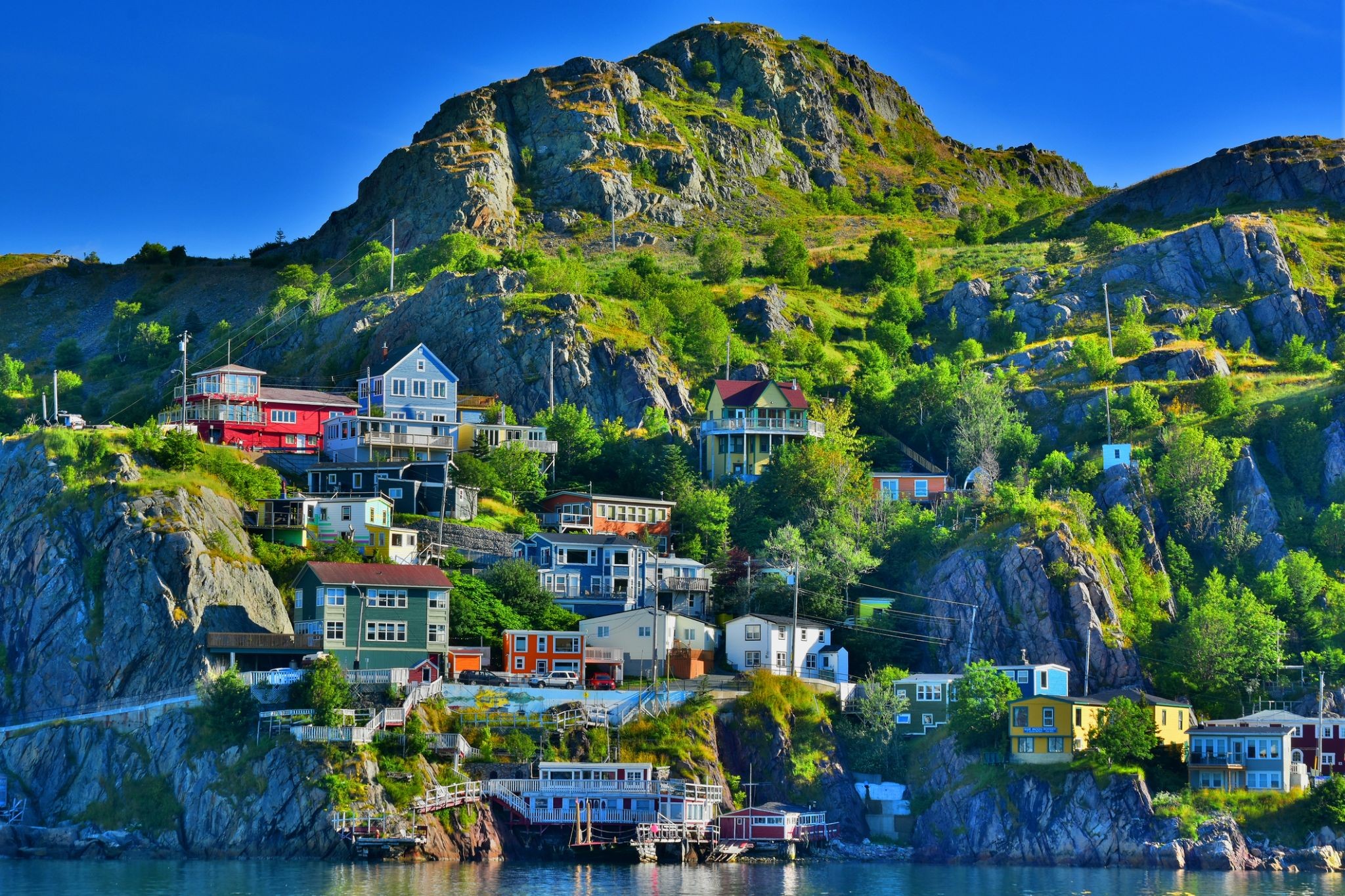
St. John's is the capital and largest city of the Canadian province of Newfoundland and Labrador. It is on the eastern tip of the Avalon Peninsula on the large Canadian island, Newfoundland. The city spans 446.04 square kilometres (172.22 sq mi) and is North America's easternmost city.
Its name has been attributed to the Nativity of John the Baptist, when John Cabot was believed to have sailed into the harbour in 1497 and to a Basque fishing town with the same name. Existing on maps as early as 1519, it is the oldest city in North America. It was officially incorporated as a city in 1888. With a metropolitan population of approximately 219,207 (as of July 1, 2017), the St. John's Metropolitan Area is Canada's 20th largest metropolitan area and the second largest Census Metropolitan Area (CMA) in Atlantic Canada, after Halifax.
The city has a rich history, having played a role in the French and Indian War, the American Revolutionary War, and the War of 1812. Italian inventor Guglielmo Marconi received the first transatlantic wireless signal in St. John's. Its history and culture have made it into an important tourist destination.
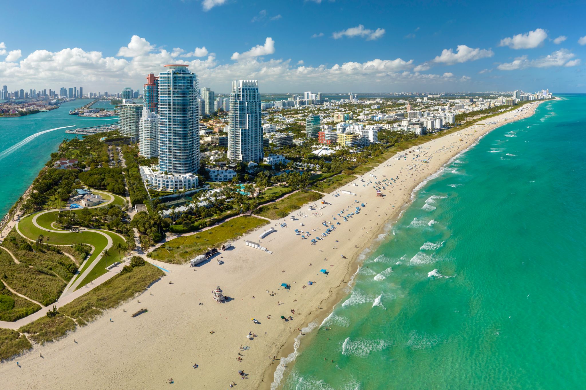
Miami, officially the City of Miami, is the cultural, economic and financial center of South Florida. Miami is the seat of Miami-Dade County, the most populous county in Florida. The city covers an area of about 56.6 square miles (147 km2), between the Everglades to the west and Biscayne Bay on the east; with a 2017 estimated population of 463,347, Miami is the sixth most densely populated major city in the United States. The Miami metropolitan area is home to 6.1 million people and the seventh-largest metropolitan area in the nation. Miami's metro area is the second-most populous metropolis in the southeastern United States and fourth-largest urban area in the U.S.
Miami is a major center, and a leader in finance, commerce, culture, media, entertainment, the arts, and international trade. The Miami Metropolitan Area is by far the largest urban economy in Florida and the 12th largest in the United States with a GDP of $344.9 billion as of 2017. In 2012, Miami was classified as an "Alpha−" level world city in the World Cities Study Group's inventory. In 2010, Miami ranked seventh in the United States and 33rd among global cities in terms of business activity, human capital, information exchange, cultural experience, and political engagement. In 2008, Forbes magazine ranked Miami "America's Cleanest City", for its year-round good air quality, vast green spaces, clean drinking water, clean streets, and citywide recycling programs. According to a 2009 UBS study of 73 world cities, Miami was ranked as the richest city in the United States, and the world's seventh-richest city in terms of purchasing power. Miami is nicknamed the "Capital of Latin America" and is the largest city with a Cuban-American plurality.
Greater Downtown Miami has one of the largest concentrations of international banks in the United States, and is home to many large national and international companies. The Civic Center is a major center for hospitals, research institutes, medical centers, and biotechnology industries. For more than two decades, the Port of Miami, known as the "Cruise Capital of the World", has been the number one cruise passenger port in the world. It accommodates some of the world's largest cruise ships and operations, and is the busiest port in both passenger traffic and cruise lines. Metropolitan Miami is also a major tourism hub in the southeastern U.S. for international visitors, ranking number two in the country after New York City.